
Discover LIDAR Topography
One of the modern surveying techniques used by Acero Estudio, a surveying company, is LIDAR [...]

BIM + IoT for Real-Time Building Management
As we’ve mentioned in various articles on our website, the BIM methodology is not only [...]

Skills a BIM Consultant Must Have
The spread of BIM methodology in construction is a reality; however, in this process of [...]

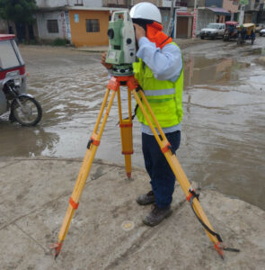
Acero Estudio, the Best Surveying Company in Peru
If you’re looking for a surveying company, you’ve come to the right place. Acero Estudio [...]

Why Are More and More Public Tenders Requiring BIM?
BIM is here to stay. If in the past companies or individuals demanded blueprints of [...]

Discover Our Solutions and Services for the Mining Industry
Mining sector is very important pillar in the Peruvian economy. As construction consultants, in Acero [...]

How BIM Auditing Reduces the Digital Debt of Your Model
The aspects and benefits covered by a BIM audit were discussed in our article (BIM [...]

BIM Audit for Projects
A BIM audit is highly recommended for large-scale and high-investment construction projects, as it provides [...]

Topography and Geodesy in Mega Projects: The New Central Highway
The New Central Highway of Peru is one of the most ambitious infrastructure projects in [...]
The Role of Topography in Urban Planning
While it’s true that many cities grow in a disorganized manner, smart urban planning helps [...]
