Photogrammetry, as part of the surveying services offered by Acero Estudio, a company specialized in topography and geodesy, is the technique that uses photography to obtain measurements and create accurate three-dimensional models of areas.
By capturing multiple samples (photos) of a specific area, it is possible to accurately determine its dimensions and shape. It’s important to note that this technology is developed in conjunction with various software packages, allowing us to achieve optimal results in terms of measurements and modeling.
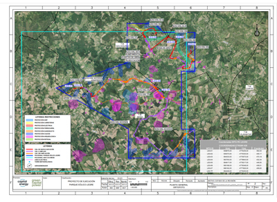
Photogrammetry Use Case
To connect two small cities, a municipality needed to carry out a topographic survey over a vast area with difficult-to-access zones, making traditional measurement methods costly and impractical. Photogrammetry with drones was chosen instead, planning flights with high-resolution cameras and establishing ground control points.
After processing the images with specialized software, a Digital Terrain Model and a high-precision orthophoto were obtained. This data allowed engineers and architects to efficiently plan the construction, saving time and money compared to traditional methods.
Uses and Applications
- Widely used in topographic surveys and cartography to generate detailed maps.
- Helps document and digitally recreate ancient structures in 3D.
- In construction projects, it assists in monitoring progress and resource usage.
Contact us to learn more about our photogrammetry services.
