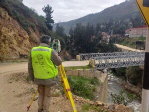
Uses and Characteristics of the Total Station in Surveying
The total station is an essential tool in surveying due to its versatility and ease [...]
Errors in topography, what they are and what we do to avoid them
In topography, as in any other human activity, failures and errors can arise due to [...]

Benefits of Outsourcing BIM Modeling
You are already familiar with the benefits of the BIM methodology and our BIM consulting [...]

Activities and Responsibilities of a BIM Consultant
The BIM methodology is now a requirement and standard in the construction and architecture industry. [...]

Our Drone Services
Drones have become essential tools in the construction and architecture sectors. Their ability to perform [...]

Export AutoCAD Drawings to BIM with Precision
In the engineering and architecture sector, precision is paramount, and the use of CAD and [...]
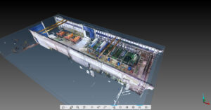
Accelerate Your Projects with 3D Scan to BIM
The integration of 3D Scan to BIM technologies allows us to quickly and accurately create [...]
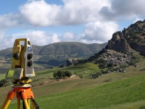
Importance of Control Points in Surveying and Geodesy
Control points in surveying and geodesy are crucial as they serve as references that enhance [...]

Advantages of Digital Twins for Construction and Architecture
A digital twin is a computerized representation of a real object, project, or construction that [...]

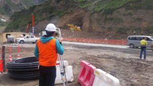
Examples of Projects Where Topography is Vital
Topography is essential and highly recommended for any construction project, from a house to the [...]
