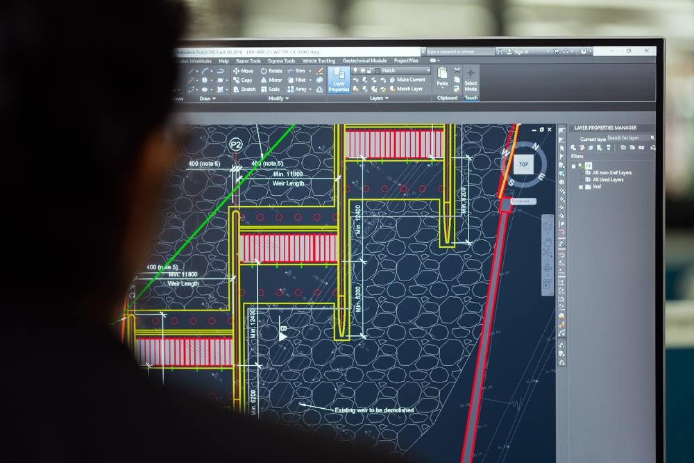
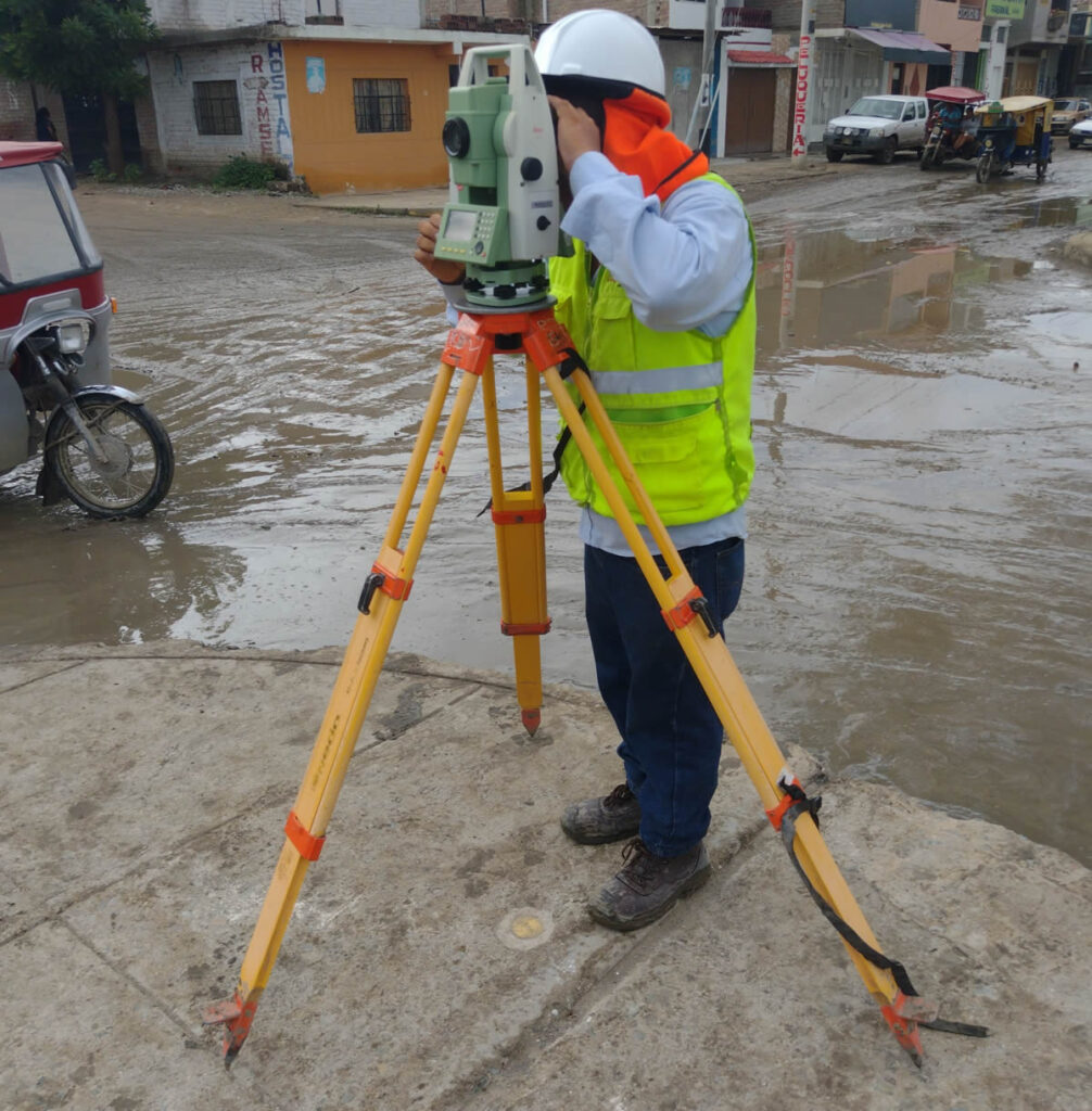
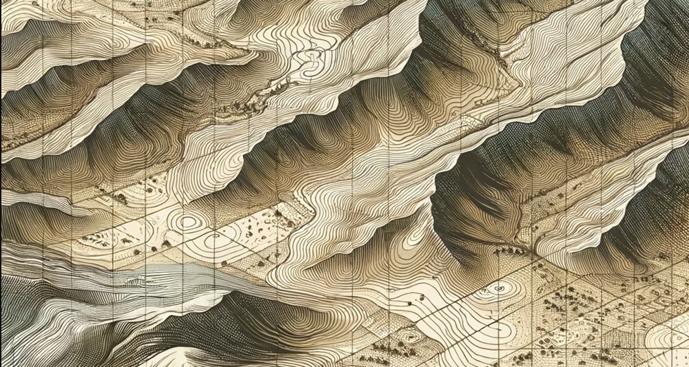
Is it possible to carry out surveying with drones?

is it possible to carry out surveying with drones

In recent years, drone surveying has gained prominence among surveying services due to its efficiency and accuracy. Various prestigious brands offer drones, equipped with specialized sensors and mapping technology, these tools facilitate the collection of detailed topographic data as well as data that can later be compared with already prepared plans or used to carry out other types of studies. This approach has proven valuable in topographic surveying, providing crucial information on elevations, slopes, and geographic features.

In addition to topographic surveying, drones are capable of generating three-dimensional models of the terrain. This 3D modeling capability not only makes it easier to visualize topography, but also improves analysis and understanding of the geographic environment.

Another notable application is surface change control. By carrying out periodic flights, drones make it possible to monitor alterations in the terrain over time, such as erosion, construction or any relevant modification.

In the field of project planning and design, topographic data obtained from drones is essential. Detailed information streamlines the decision-making process and contributes to efficiency in construction, engineering and agricultural projects.

Additionally, precision agriculture benefits greatly from drone surveying. These devices can perform elevation maps and analyze crop health, providing valuable data to optimize agricultural practices.

The most commonly used sensors in surveying drones include RGB cameras, multispectral cameras, LIDAR (Light Detection and Ranging) and ultrasound sensors.

Drone surveying offers significant advantages, such as reduced time and costs compared to traditional surveying methods. Additionally, the ability to obtain real-time data and flexibility in flight planning make this technology increasingly popular in various fields.

Contact us and request more information about our drone topography and aerial photogrammetry services, we are at your service.

Topography in the Wind Generation Industry

topografia para centrales de generacion-electrica

The growing concern for clean electricity generation sources means that wind energy generation continues to experience significant growth. For these reasons, the construction and installation of wind energy projects are works of great importance both for the investments they represent as well as for the benefits they bring to the cities they supply.

Obviously when it comes to wind, wind power plants must be installed in places where there is a deep understanding of the terrain. In this context, topography, together with advanced technologies such as aerial photogrammetry, BIM and 3D laser scanning, play a fundamental role in optimizing the installation of wind farms.

Efficient Design Depends on Accurate Data

Topography provides us with detailed information about the shape of the land, elevations, slopes and geological characteristics. Integrating this information with techniques such as photogrammetry allows for the creation of accurate three-dimensional models of the site, facilitating the design of efficient wind farms. The combination of topographic data and 3D models ensures a complete understanding of the environment, resulting in an optimized design of the turbine layout and its height to maximize wind capture.

Identification of Obstacles and Risks

3D laser scanning has become an essential tool for identifying potential obstacles in the terrain, such as buildings, vegetation and geological structures. This level of detail not only helps avoid problems during the construction phase, but also minimizes operational risks throughout the life of the wind farm. Anticipating and mitigating potential challenges contributes to the long-term safety and profitability of the project.

Project Planning and Management

The implementation of BIM in wind energy projects allows for comprehensive and efficient information management. From the design phase to construction and operation, BIM facilitates collaboration between different disciplines, improving coordination and reducing errors. Topography, when integrated into BIM models, offers a holistic vision of the project, improving decision making and optimizing resources.

Likewise, with the integration of 3D laser scanning and BIM (ask about our BIM consulting service) we can integrate simulations into the generated model that help us anticipate potential risks that affect the performance of the wind farm, such as the construction of surrounding buildings, etc.

In summary Acero Estudio‘s specialized focus on geography, architecture and construction analysis technologies allows your company to benefit from the integration of advanced technologies that will reduce risks, improve the economics of the project and guarantee its sustainability.

Drones in Infrastructure: State of the Art and Future Perspectives

dron sobrevolando un puente y realizando vigilancia aérea

While it is true that we often see drones as fun tools, in the last decade their use has amplified our capabilities in various areas. As drone specialists, at Acero Estudio we want to show how this important tool plays a vital role in infrastructure inspection today.

Aerial Photogrammetry: Capturing precise details from above

One of the most significant drone-driven advancements in infrastructure inspection is drone photogrammetry. This technique uses high-resolution cameras mounted on drones to capture detailed images from different angles, allowing the creation of accurate three-dimensional models of existing structures and facilitating the planning of new construction.

Large construction companies use aerial photogrammetry to evaluate the condition of bridges, roads and buildings, identifying possible structural problems early. Additionally, the ability to generate detailed models facilitates informed decision making during the design phase and reduces costs associated with manual inspections.

Monitoring and Surveillance of Works: Guaranteeing Safety and Efficiency

Drones equipped with thermal cameras and advanced sensors can closely monitor construction progress, identify potential safety risks, and provide real-time data to management teams.

Developed countries, such as the United States and China, have integrated drone systems to monitor large-scale construction projects, such as highway expansion and the construction of new facilities. This constant surveillance not only improves workplace safety, but also contributes to overall project efficiency by identifying and addressing issues in a timely manner. In the past, if you wanted to observe a work from the air, it was necessary to hire the service of a helicopter or light plane, but today, thanks to drones, this possibility is within our reach.

Infrastructure and its Impact on the Lives of Populations

Infrastructure plays a fundamental role in the quality of life of populations. From roads and bridges that facilitate transportation to water and energy supply facilities that sustain communities, these structures directly impact the well-being of society.

Large construction companies are using drones to inspect and maintain their critical infrastructure. For example, regular drone inspection of bridges not only ensures their structural integrity, but minimizes closure times and reduces traffic disruptions.

Future Perspectives: Automation and Collaboration with AI

As technology advances, the future prospects for drone infrastructure inspection become even more exciting. The integration of artificial intelligence (AI) will allow drones to analyze data autonomously, identifying patterns and anomalies without human intervention.

Fully automating infrastructure inspection using drones will not only improve efficiency, but also reduce the costs and risks associated with manual work in potentially hazardous environments. This points the way toward a more proactive and predictive approach to critical infrastructure maintenance.

As we move into the future, the collaboration between drone technology and artificial intelligence promises an exciting horizon for global infrastructure development and maintenance.

How 3D Laser Scanning Revolutionized Architecture Projects

modelo de edificio historico generado por el láser escaner 3d

The continuous advancement of technology has radically transformed the way in which architectural projects are planned and carried out. One of the most important technological advances in recent times is without a doubt the 3D laser scanner.

This important tool improves efficiency in digital modeling efforts but also redefines precision in the design and construction of structures in critical areas that previously required intensive use of personnel.

Use of the 3D Scanner in the Renovation of Historical Heritage

3D laser scanning plays an important role in the renovation of historic buildings, where preservation of the original architecture is essential. The use of this important tool allows the machine to capture details not visible to the naked eye, helping to generate an exact model of the architectural elements.

Urban planification

The demographics of cities and their growth mean that urban planning faces new, increasingly complex challenges. In these cases, precision and space optimization are essential. 3D laser scanning together with other techniques such as photogrammetry with drones and techniques such as Scan to BIM (learn about our BIM Consulting service) has proven to be very useful.

The ability to capture three-dimensional information in real time speeds up decision-making and contributes to a more efficient and functional urban design.

Building Construction

In the construction sector where labor is intensive, companies seek to improve efficiency without affecting labor aspects; That is why the use of techniques such as the 3D laser scanner together with the BIM methodology are mandatory to achieve efficiency and speed.

3D laser scanning not only allows a quick, objective and detailed inspection of the works but, combined with various software, offers the early detection of possible structural problems, guaranteeing exceptional safety standards.

escaneo laser 3d de gran calidad
In addition to the indicated benefits, our equipment allows you to achieve high-quality scanning for your projects.

Interior design

For interior design projects, the 3D laser scanner paves the way for unrestricted creativity. This feature allows designers to accurately visualize their ideas with better aesthetic and practical functional results.

Now that you know more clearly the advantages and benefits of the 3D laser scanner, do not hesitate to contact us, our sales team will provide you with the best information to achieve spectacular results in your project. We are at your service.

Construction Monitoring: The importance of continuous topography

importancia de la topografia continua
  • Introduction
  • Continuous Surveying Case in Action
  • Benefits of Continuous Surveying in Permanent Constructions
  • Types of Construction that Require Continuous Topographic Monitoring
  • Conclusions: The Crucial Need for Continuous Surveying in Construction Sites

1. Introduction

Construction monitoring is an essential facet in the construction and development of projects and continuous surveying is a tool that often makes the difference between the success and failure of a construction or engineering project. This article will explore the importance of having surveying services on an ongoing basis throughout the entire project, examining its benefits and highlighting the types of construction that crucially require this service.

2. Practical Case of Continuous Surveying in Action

There are cases in which a large-scale construction project requires great topographical efforts continuously throughout the construction process; This process is called continuous surveying. If initial surveying provides the foundation, continuous surveying ensures that the infrastructure will remain stable and safe throughout the construction process.

Thanks to the advancement and technology of our work, we can provide sensors that will accurately constantly monitor soil deformations, guaranteeing structural integrity and providing adequate data to take corrective actions before a structural collapse occurs.

3. Benefits of Continuous Surveying

Continuous surveying goes beyond simple initial measurement. It provides constant monitoring of the work, detecting any unexpected changes, which provides higher levels of security and optimizes resources by preventing problems before they worsen.

4. Types of Construction that Require Continuous Topographic Monitoring

Not all constructions demand the same level of topographic monitoring. Those of a permanent nature, such as bridges, skyscrapers, tunnels, dams and critical infrastructure projects, benefit significantly from continuous topography. The long-term stability of these structures requires constant attention to ground conditions and possible changes. Topographical surveying is no longer enough.

5. The Crucial Need for Continuous Surveying in Construction Sites

Continuous topographic monitoring stands as a fundamental pillar in risk management and effective planning, ensuring that each construction is a lasting testament to human skill. Ultimately, continuous surveying is not only a safety measure, but a wise investment for the present and future of engineering and construction.

Practical uses of photogrammetry in sustainable ecosystem management

la Fotogrametría en la Gestión Sostenible de Ecosistemas Amenazados

such as reserve parks, forests and jungles. In a world where illegal logging, deforestation and urban sprawl prey on and threaten the integrity of our natural environments, photogrammetry emerges as an essential tooPhotogrammetry with drones, a technique that combines measurement, topography and image capture, has become a fundamental ally in the conservation of threatened ecosystemsl to monitor, conserve and restore the health of our ecosystems.

Let’s learn about the practical uses of photogrammetry in the sustainability of vulnerable natural environments.

1. Monitoring Changes in Forest Cover

Aerial photogrammetry offers detailed monitoring of forest cover, identifying significant changes in vegetation. For this, it is important that diverse captures are made over time, which will provide us with information to combat illegal logging and deforestation, since it provides precise data on forest loss and early detection of illegal activities.

2. Biodiversity Assessment

3D models from images generated by photogrammetry software facilitate the assessment of biodiversity. This allows scientists and conservationists to understand the composition and structure of ecosystems, identifying key species and areas of biological importance.

3. Ecological Restoration Planning

Ecosystems can not only be conserved but regenerated and for this it is important to know their composition, identifying degraded areas and establishing effective strategies for the restoration of natural habitats.

4. Monitoring Erosion and Landscape Changes

Images captured using photogrammetric techniques are useful for monitoring soil erosion and landscape changes. This is essential to prevent soil degradation and adopt land use practices that maintain healthy ecosystems.

5. Rapid Response to Natural Disasters

In situations of natural disasters, carrying out photogrammetry work helps us to know the magnitude of the damage, recognize the most affected areas and establish with exact and first-hand information necessary activities for rescue or damage minimization.

6. Education and Environmental Awareness

Maps and still image captures are still used in schools and universities. Photogrammetry could go further because using 3D models it provides us with images, videos and simulated tours with real data that will allow students to increase their awareness and knowledge through modern and interactive information.

7. Applications in the Management of Natural Reserves

Natural reserves can also benefit from the modernity provided by this important technique, as has been evidenced in Chile where the Isluga Volcano National Park, Nevado Tres Cruces National Park, in the Antofagasta Region has benefited from photogrammetric studies that provide rangers with information important about the presence of activities that generate risks to the flora and fauna of the protected area.

For these reasons, do not hesitate to contact Acero Estudio, a company specialized in aerial photogrammetry with drones; we are at your service.

What software is used in drone photogrammetry?

ingeniero realizando fotogrametria aerea con drones

Drone photogrammetry is a technique that has gained a lot of popularity in various industries to perform precise mapping and measurements from the air. The process involves capturing aerial images and then processing them to create 3D models, maps and other representations. Here is a list of some of the most used software in drone photogrammetry:

Pix4Dmapper: It is one of the most popular software for processing aerial images captured by drones. It offers powerful algorithms to transform images into digital models and accurate maps.

Agisoft Metashape: It is known for its ability to efficiently process digital images and generate 3D spatial data, including terrain elevation models and orthomosaics.

DroneDeploy: Offers a cloud-based solution that allows users to not only capture images but also process them online to create 3D maps and models. It is designed to be easy to use and accessible to those who are not experts in photogrammetry.

Autodesk ReCap: This software uses photogrammetry to convert photographs and laser scans into detailed 3D models. It integrates well with other Autodesk products, making it popular in construction and engineering.

Bentley ContextCapture: Allows users to create high-fidelity 3D models from ordinary images, which can be especially useful for urban mapping and infrastructure projects.

3DF Zephyr: It is a software that reconstructs 3D models from photos automatically and is aimed at both beginners and advanced users due to its ease of use and comprehensive feature set.

OpenDroneMap (ODM): It is an open source solution for processing drone data. Provides tools to process aerial images and generate maps, 3D models and more.

Global Mapper: Although not exclusively for photogrammetry, it offers a wide range of spatial data processing tools, including drone photogrammetry.

Skyline Photomesh: Another robust software that transforms photos into 3D meshes, surfaces, and complete city models.

SimActive Correlator3D: Specifically designed for processing aerial images captured by drones, this software is used in cartography, construction and mining.

When selecting the right software for drone photogrammetry, factors such as ease of use, project specifics, compatibility with other analysis and design software, and the level of technical support available should be considered. Additionally, accuracy, processing power, and customization options are also crucial aspects to consider.

The importance of Topography in the Construction of Industrial Plants

The design and construction of an industrial plant is a project of great magnitude and great importance for the companies that carry it out. Due to the risks involved, the size of the investment and the uses it will have; A work like this requires millimeter precision and careful planning to avoid serious errors or future risks for people and investment.

Reducing risks is where topography becomes an indispensable ally to detail every centimeter of the land. Knowledge of these characteristics will allow us to develop a construction adapted to its environment, safe with respect to potential natural disasters and also efficient in terms of taking advantage of the benefits of the area.

In this short article we will learn how when carrying out a topographic survey we not only provide efficiency but also reduce risks in the construction of industrial plants.

In industrial construction, risks range from ground instability to errors in the alignment of heavy machinery that can result in accidents or structural defects. Surveying identifies potential problems before they become real dangers. By revealing variations in terrain, potential flood zones, or subsurface inconsistencies, surveyors enable construction teams to proactively anticipate and mitigate these risks.

Before the first brick is placed, the topography will provide us with a faithful and exact representation of the terrain. Using advanced technologies such as 3D laser scanning and aerial drone photogrammetry (to create digital models), engineers and architects design with precise knowledge of site characteristics, resulting in more efficient use of resources. and an optimization of the plant design that translates into significant savings.

Modern surveying, with its precision, plays a vital role in cost estimation. By providing accurate data, you help avoid wastage of materials and human resources. The ability to accurately plan the required quantities of materials and labor required for each phase of the project prevents cost overruns and reduces the need for costly adjustments in the future.

Once construction begins, Acero Estudio’s topography services play a vital role allowing:

  • Constant comparison of current site conditions with design plans
  • Identifying and correcting ground deviations in real time
  • Keeping the project on its planned trajectory and within safety parameters

In addition to these important improvements, topography can help us:

  • Locate the best areas for the installation of tanks and cisterns
  • Maximize land use
  • Locate the most appropriate areas for merchandise maintenance
  • Locate the most optimal areas for logistics areas

The success of the construction of an industrial plant or warehouse is a very important factor that is achieved through various knowledge and professionals. The discipline of topography is one of these knowledge that, when integrated with construction capabilities, provides security and responsible risk management.

Ask more about our surveying services, we will be happy to assist you.

Our 3D Laser Scanning Process using the Faro Focus Laser

cloud of dots generated with 3d laser scanner

When it comes to preserving and analyzing a historic building, the 3D laser scanning process has become an indispensable tool. Using the FARO Focus 3D laser scanner, our method focuses on creating an accurate and detailed point cloud that serves as a digital record of the current state of any historic building.

The process begins with strategic site planning. We determine the best scan points to maximize coverage and minimize obstructions. Thanks to the FARO Focus’s ability to reach up to 350 meters, we can cover wide areas from strategic positions, resulting in more complete coverage with fewer equipment movements.

Contact Acero Estudio and know more about our services.

The 3D Laser Scanner: Capturing the world in a point cloud

El Escáner Láser 3D La captura del mundo en nube de puntos

The 3D laser scanner, one of Acero Estudio’s services, has a remarkable capacity to generate precise and detailed point clouds, playing an essential role in a wide range of applications in construction and architecture. Let’s learn about the features of the 3D laser scanner, its advantages and the reason for its nickname, the “point cloud scanner.”

What is the 3D Laser Scanner?

The 3D laser scanner is a device that uses a laser to emit pulses of light that hit the surfaces of objects and structures in their environment. By measuring the return time of light to the scanner, the device precisely calculates the distance between it and objects, collecting this data in the form of thousands or even millions of three-dimensional points, in a process called “laser scanning.”

Benefits

One of the main advantages of this technology lies in its ability to capture extremely precise details of objects and environments. Each point in the point cloud represents a specific location in space, enabling a highly detailed representation of the scanned object.

The 3D laser scanner can generate point clouds at impressive speed, allowing efficient scanning of large areas or complex structures in a short period of time, increasing efficiency in large projects.

Unlike conventional measurement techniques, 3D laser scanning is non-intrusive and does not require physical contact with the scanned objects, making it particularly useful in applications where preserving the integrity of the structure is essential.

It can be used in a variety of applications. In construction to capture buildings and land, and in architecture to document and represent constructions, among many other applications.

Why has it been called “Point Cloud Scanner”?

It is due to the nature of the data it offers. These three-dimensional points make up a “cloud” in space, analogous to a constellation of stars in the night sky. This point cloud houses detailed information about the shape and location of objects, serving as a basis for the creation of high-precision three-dimensional digital models.

Now that you understand the benefits of the 3D laser scanner, including its exceptional accuracy, capture speed, application versatility, and ability to work in hazardous environments, we invite you to contact us to request a quote for our services. We are at your disposal to provide you with the best solution.