Advantages of Drone Surveying for Infrastructure Projects

drones en topografia de infraestructura

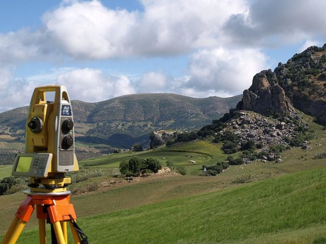
When we begin an infrastructure project, we know that obtaining reliable terrain data is the foundation of a successful design. Traditional land surveying requires survey crews to move continuously across large areas while transporting total stations, GNSS equipment, and other instruments. This process increases fieldwork time, demands greater logistical coordination, and delays the delivery of critical information. For highways, industrial plants, transmission lines, mining operations, and urban developments, these limitations directly impact project schedules and operational efficiency.

We Plan Automated Flight Missions to Survey Large Areas Faster

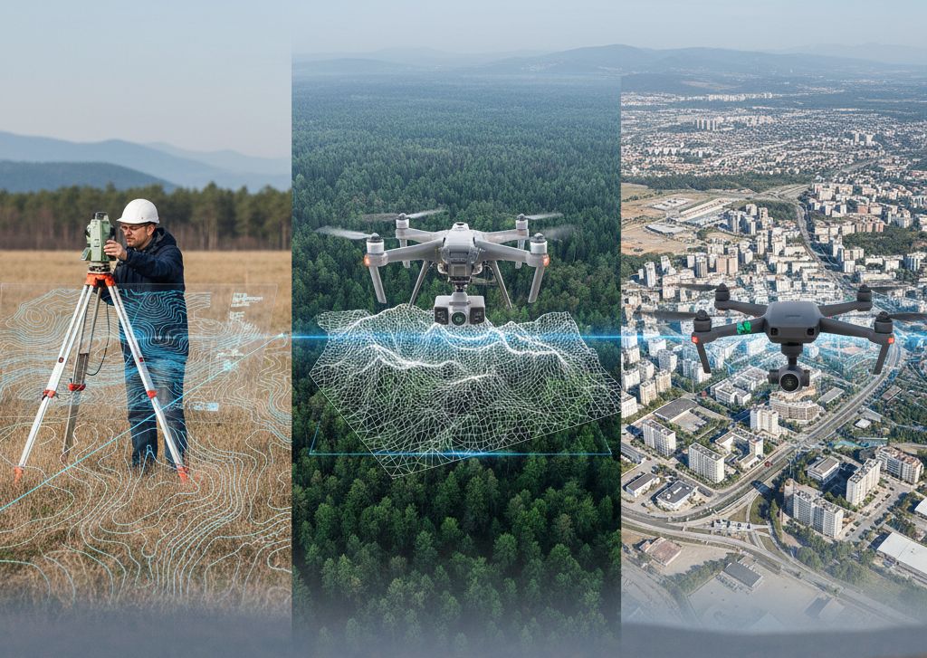
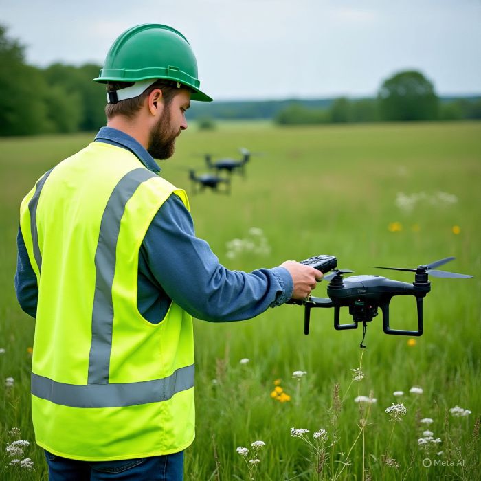
At Acero Estudio, we use drone technology to optimize every topographic survey. Before each mission, we program precise flight paths that ensure complete coverage of the project area while maintaining consistent data collection. This methodology eliminates unnecessary field movements, reduces survey time, and allows us to capture extensive areas efficiently without compromising data quality. As a result, engineering teams receive accurate information sooner and can move forward with design, planning, and project execution without delays.

We Process Digital Data with Specialized Software for Maximum Accuracy

After every flight, we download all captured information in digital format and process it using specialized software to generate orthomosaics, digital terrain models, contour lines, and high-density point clouds. This digital workflow delivers consistent results, integrates seamlessly with CAD, BIM, and GIS platforms, and accelerates the production of technical deliverables. Our clients receive precise and reliable data that supports engineering analysis, construction planning, and infrastructure development from the earliest project stages.

At Acero Estudio, we provide advanced surveying solutions for infrastructure, industrial, mining, and construction projects. Our services include topographic surveying, LiDAR surveying, and drone photogrammetry, all performed with state-of-the-art technology and rigorous quality standards. We focus every survey on accuracy and precision because we understand that every successful engineering project begins with dependable geospatial information.

What Is Topography and What Is It Used for?

What Is Topography and What Is It Used for

Topography is a fundamental discipline in engineering, architecture, and construction. Its main purpose is to study and represent the surface of a terrain, including its dimensions, shape, elevation, and both natural and artificial features. Through topography, it becomes possible to plan projects, design infrastructure, and execute construction work with precision.

Today, topographic studies are essential for the development of roads, buildings, bridges, urban developments, and large infrastructure projects. Specialized companies such as
Acero Estudio provide professional solutions through their topography services, using modern technologies to obtain precise terrain data before any project begins.

Definition of Topography

Topography is the science responsible for measuring, describing, and representing a portion of the Earth’s surface through maps or plans. To achieve this, different surveying techniques and specialized equipment are used to determine positions, distances, elevations, and coordinates of points on the terrain.

In simple terms, topography converts the physical reality of a terrain into graphical and numerical information that engineers, architects, and planners can use to design and develop projects.

What Is Topography in Engineering?

In engineering, topography provides the base information required for designing civil works. Before building a road, a structure, or any infrastructure project, it is necessary to understand the exact characteristics of the terrain.

Topographic studies help identify:

  • Terrain relief and slope
  • Reference point locations
  • Elevations and level differences
  • Natural elements such as rivers or vegetation
  • Existing structures

This information is collected through processes such as a topographic survey, which involves measuring different points on the terrain to generate accurate maps and digital models.

Brief History of Topography

Topography is one of the oldest technical disciplines in human history. Its origins date back to ancient civilizations such as the Egyptians and Romans, who used land measurement techniques to construct irrigation systems, temples, and infrastructure.

Over time, topographic tools evolved from manual measurement methods to advanced instruments such as total stations, geodetic GPS, drones, and 3D laser scanners. Today, these technologies allow professionals to obtain extremely precise terrain data and generate detailed three-dimensional models.

What Is Topography Used For?

Topography has many applications across various industries, but its most significant role lies in engineering and construction projects. Without topographic studies, it would be extremely difficult to properly plan and execute construction works.

Construction Project Planning

Before any construction project begins, it is essential to understand the characteristics of the terrain where the project will take place. Topography helps analyze land shape, slopes, and ground conditions to determine project feasibility.

Infrastructure Design

Topographic maps and plans serve as the foundation for designing roads, buildings, bridges, dams, drainage systems, and transportation infrastructure. These data allow engineers to calculate levels, slopes, and alignments accurately.

Construction Layout and Control

During the construction phase, topography is used to transfer the design from plans to the real-world terrain. This process, known as construction layout or staking, ensures that the project is built in the correct location and according to the design specifications.

Examples of Topography in Real Projects

Topography plays a key role in many engineering and urban development projects. Some common examples include:

Road Construction

When designing roads, engineers must analyze terrain relief, identify slopes, and determine the optimal route to ensure safety and efficient transportation.

Urban Development

Urban planning projects rely on topographic studies to define street layouts, land parcels, drainage systems, and utility networks.

Building Construction

In building projects, topography helps determine ground leveling, foundation placement, and the correct positioning of structures.

Hydraulic Infrastructure

Dams, canals, and drainage systems depend on accurate topographic data to manage water flow and prevent flooding issues.

Difference Between Topography and Geodesy

Although topography and geodesy are closely related disciplines, they focus on different scales and objectives.

Topography

Topography focuses on studying and representing relatively small portions of the Earth’s surface, such as land parcels, construction sites, or local terrain areas. In these cases, the curvature of the Earth is generally considered negligible.

Geodesy

Geodesy studies the shape and dimensions of the Earth on a much larger scale. It is used to establish global coordinate systems, perform continental measurements, and develop positioning systems such as GPS.

The Importance of Topography Today

Today, topography is an indispensable tool for modern engineering and infrastructure development. Thanks to technologies such as drones, laser scanning, and GPS systems, it is now possible to obtain highly accurate terrain information quickly and efficiently.

Having access to a professional topography service helps reduce risks, optimize project design, and ensure that construction works are executed correctly from the earliest stages.

If you need professional topographic studies for your project, you can explore the specialized services offered by Acero Estudio, where advanced technical solutions are available for terrain analysis and surveying.


Geomatics: When to Use Each Survey and Why

geomatica-cuando-utilizar-cada-estudio-y-por-que

Geomatics integrates a set of technologies and methodologies focused on capturing, analyzing, and interpreting geospatial information. Thanks to technological advancements, it is now possible to obtain highly accurate terrain data, optimizing the planning, design, and execution of engineering, infrastructure, and land management projects.

However, not all geomatics techniques are suitable for every project. The choice between topography, LIDAR, or photogrammetry depends on factors such as terrain type, required accuracy, budget, and environmental conditions. Below, we explore when to use each method and why.

Topography

Topography is one of the most traditional and essential techniques within geomatics. Its purpose is to accurately measure and represent the physical characteristics of a terrain, including elevations, slopes, boundaries, and existing features.

It is ideal for:

  • Open and accessible land areas.
  • Construction and urban development projects.
  • Property boundary surveys.
  • Civil works requiring high precision at specific points.

The accuracy of the survey depends on the project scale and the expertise of the professional in charge. If you are looking for a topography service, it is essential to work with modern equipment and updated methodologies.

Today, drone-based topography is also available, allowing faster data collection and improved efficiency in hard-to-reach areas.

LIDAR

LIDAR (Light Detection and Ranging) uses laser pulses to measure distances and generate highly accurate digital terrain models. This technology can penetrate vegetation, making it especially valuable in complex environments.

It is recommended when:

  • The terrain has dense vegetation.
  • A high-resolution digital elevation model is required.
  • Environmental or forestry studies are being conducted.
  • The area has limited ground accessibility.

A professional LIDAR service provides precise data even in areas where conventional topography would be limited or more time-consuming.

Photogrammetry

Photogrammetry relies on aerial or satellite imagery to generate maps, orthomosaics, and three-dimensional terrain models. It is particularly efficient for covering large areas in a short period of time.

It is recommended for:

  • Urban planning projects.
  • Large-scale territorial studies.
  • Construction monitoring.
  • Detailed cartography of extensive regions.

Drone photogrammetry has revolutionized this technique, enabling the capture of high-resolution images quickly and cost-effectively compared to traditional methods.

How to Choose the Right Technique

Selecting the appropriate geomatics technique should be based on:

  • The nature and accessibility of the terrain.
  • The level of accuracy required.
  • The available budget.
  • The specific objectives of the survey.

In many cases, combining topography, LIDAR, and photogrammetry delivers more comprehensive and accurate results, optimizing decision-making and reducing risks in later project stages.

Conclusion

Each technique within geomatics offers specific advantages and applications. Understanding when to use each one ensures efficient results, cost reduction, and improved strategic planning for any project.

If you need expert guidance to determine the most suitable survey method, feel free to contact us for professional advice tailored to your project’s needs.

How our BIM Service helps you achieve a more feasible project

how our bim service helps you achieve a more feasible project

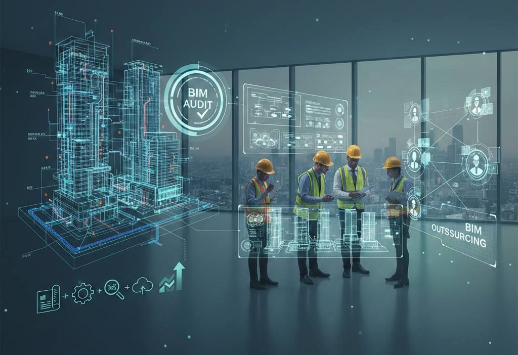
Efficiency and feasibility are key factors for the success of any project. Through our bim services, we provide comprehensive solutions that optimize resources, reduce errors, and improve coordination among all stakeholders. Our approach ensures greater control, accuracy, and profitability at every stage of development.

BIM Modeling: Accuracy and Coordination from the Start

BIM modeling is the foundation of an efficient project. It involves the creation of intelligent digital models that integrate geometric and technical information into a single collaborative environment.

Through BIM modeling, it is possible to detect clashes before construction begins, enhance coordination between disciplines (architecture, structure, and MEP), and optimize execution timelines. This results in fewer reworks, reduced material waste, and more reliable planning.

BIM Audit: Quality Control and Standards Compliance

Our BIM audit service evaluates the quality and compliance of BIM models and processes within a project.

Through detailed technical reviews, we verify that models meet established standards, required Levels of Development (LOD), and client objectives. This ensures information consistency, minimizes risks, and guarantees that the project progresses under clearly defined guidelines.

BIM Consulting: Strategy and Process Optimization

Our bim consulting services focus on implementing and optimizing BIM methodology within your organization or project.

We analyze your current workflows, define implementation strategies, establish standards, and train teams to ensure efficient BIM adoption. The result is a more structured management process, increased productivity, and better data-driven decision-making.

BIM Outsourcing: Flexibility and Operational Cost Reduction

Our bim outsourcing service allows you to delegate specialized tasks to an expert team without expanding your internal structure.

This solution is ideal for companies seeking to maintain high technical standards while avoiding increased fixed costs. By outsourcing processes such as modeling, coordination, or BIM documentation, you gain flexibility, access to specialized professionals, and more efficient execution, ultimately improving project profitability and enabling your internal team to focus on strategic activities.

An Integrated Approach for More Feasible Projects

The integration of modeling, auditing, consulting, and outsourcing creates a collaborative ecosystem that drives efficiency in every phase of the project. From planning to construction, our services are designed to reduce risks, optimize resources, and maximize results.

If you are looking to improve quality, profitability, and project control, our BIM solutions provide the strategic advantage needed to achieve a more efficient and truly feasible development.

How Topography Is Vital for Mega Projects: The Case of the New Central Highway in Peru

importancia de la topografia para las megaobras

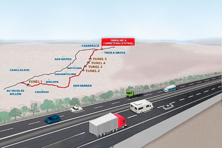
Topographic studies are essential for the construction of large-scale transportation infrastructures that require detailed information and cutting-edge technology. Topographic surveys, geodesy, and other related services help ensure the proper execution of each stage of a project. An emblematic example is the New Central Highway of Peru, one of the most ambitious infrastructure works in recent times, where topographic and geodetic studies are critical.

A Large-Scale Project to Connect Peru

The New Central Highway will require an investment of more than S/ 24 billion and will extend 185 km, including 33 km of tunnels and 19 km of viaducts. This mega project aims to reduce travel time between the coast and the country’s central region from six hours to just two and a half, strategically linking the regions of Lima and Junín.

For a project of this magnitude, precise topographic information is indispensable. Every meter of land must be accurately surveyed, modeled, and georeferenced so that the design, engineering, and construction phases can be executed without deviations or cost overruns.

Topography and Geodesy: The Technical Foundation of the Project

In this type of project, topography forms the technical backbone, as it allows for the accurate understanding of the terrain’s physical characteristics: contour lines, slopes, geographical features, and surface details. Geodesy, on the other hand, provides the necessary spatial reference to ensure the absolute and relative position of each point within a global coordinate system.

The combination of these disciplines enables:

  • Generation of high-precision digital terrain models.
  • Definition of road alignments and axes that optimize layouts and reduce earthworks.
  • Accurate positioning of complex structures such as tunnels and viaducts.
  • Deformation control and progress monitoring during construction.
  • Reduction of technical and economic risks, avoiding staking errors and delays.

Our Contribution to Large-Scale Infrastructure Projects

With decades of experience in topographic and geodetic surveys for complex infrastructure projects in both Peru and Spain, Acero Estudio deploys specialized teams and advanced technology such as:

  • 3D laser scanning services to capture geometries through dense point clouds in seconds.
  • Drone photogrammetry to cover large areas quickly and with high accuracy.
  • LIDAR systems capable of penetrating vegetation to obtain precise terrain information even in forested or hard-to-access areas.
  • High-precision GNSS equipment and total stations, ensuring exact geodetic references.

In addition, our technical team processes and delivers data in formats compatible with engineering and BIM software, facilitating direct integration into design and construction workflows.

Building the Future with Precision

Mega projects demand decisions based on reliable data and the support of an experienced surveying company. If you are developing a large-scale project, contact us. Our specialized team is ready to support you from the planning stage through execution, ensuring accurate and dependable results at every step.

Use of LIDAR in topography for mining

lidar en topografia para mineria

Modern mining, which processes hundreds of tons each day, requires precise and reliable information to ensure safety, optimize resources, and plan large-scale operations. Thanks to the use of advanced laser sensors that can be integrated into drones, LIDAR captures millions of 3D points and generates detailed digital terrain models.

Large-Scale Topographic Surveys

One of the greatest benefits of LIDAR in mining is the ability to carry out topographic surveys of vast areas in a short time. In the past, a team of surveyors working with traditional instruments was necessary, but today LIDAR technology provides up-to-date information to plan new explorations, optimize access, and design open pits quickly through:

  • Point collection with drones
  • Data processing with specialized software
  • Generation of topographic maps and delivery to stakeholders
  • Volume and Material Management

LIDAR’s accuracy in data collection allows mining companies to calculate extraction volumes after just one workday, enabling ore grade calculations and income projections that are essential for operational and financial planning.

Slope Monitoring and Operational Safety

Another critical aspect for operational stability in mining is verifying slope stability. LIDAR technology enables the creation of geotechnical models that identify deformations, movements, and landslide risks. This contributes to safer operational management while reducing personnel exposure to hazardous areas.

3D Digital Models for Mine Planning

Beyond detailed terrain capture, LIDAR also generates 3D digital models that support mining planning. These models make it possible to simulate scenarios, analyze alternatives, and optimize the design of pits, access roads, and more.

  • Key Benefits of LIDAR in Mining
  • Higher accuracy compared to traditional surveying methods
  • Time and cost savings in data capture
  • Improved worker safety, by reducing the need to enter hazardous zones
  • Comprehensive and up-to-date information, useful for exploration, exploitation, and mine closure

LIDAR in mining is now one of the most valuable technologies for improving efficiency, safety, and sustainability in operations. From volume control to geotechnical risk prevention, its applications offer a competitive advantage to companies seeking to optimize processes and ensure precision at every stage of a project.

If you want to learn more about our LIDAR services, contact us. We are Acero Estudio, a surveying company specialized in LIDAR, drone photogrammetry, and 3D laser scanning. We are at your service.

BIM Modeling: What Is It?

modelo bim

BIM modeling is a 3D development process that basically consists of creating a digital model of a construction project. Unlike traditional drawings or computer-aided design, a BIM model brings together all the project information in a single environment, allowing for better planning, error detection before construction, and coordination of all teams involved.

What methods of BIM model generation are there?

There are different methods to generate a BIM model, depending on the available data and the stage of the project:

From CAD drawings

If the project has 2D drawings, it is possible to transform them into a 3D model enriched with information, allowing the evolution from a basic design to a complete BIM model.

From a 3D laser scanner

Using scanning technology, millions of points are captured that represent the built reality with millimetric precision. This point cloud serves as the basis to generate the BIM model, making it ideal for remodeling or expansion projects.

Other methods

BIM models can also be created from aerial photographs taken by drones, existing models from other design platforms, or even manually collected information, as long as it can be structured in a BIM environment.

How do we feed a BIM model?

The value of BIM models lies not only in their initial creation but also in how they are continuously enriched with information by the various professionals involved in the project. Let’s see how different disciplines feed, update, and refine the models:

  • The architect incorporates design aspects, space distribution, and finishes.
  • The structural engineer adds data on materials, resistance, and structural behavior.
  • The MEP engineer provides information about electrical, plumbing, HVAC, and security systems.
  • The cost specialist integrates budgets, schedules, and financial analysis.
  • In this way, the model becomes a digital meeting point where all disciplines converge, ensuring consistency and facilitating decision-making.

How far does the BIM model go?

The scope of the BIM methodology goes beyond the design or construction stage. Once the project is completed, the model can continue to be used during the operation and maintenance of the infrastructure, since it contains information about materials, installed equipment, warranties, technical manuals, and maintenance schedules. It can even be useful in future stages of remodeling, expansion, or controlled demolition, thus covering the complete life cycle of the asset.

As you can see, a 3D BIM model is not just a design tool but an integral system that supports an infrastructure from its conception to its final use, ensuring efficiency, accuracy, and value at every stage.

If you want to learn more about our BIM consulting services, do not hesitate to contact us. And if you already have a developed model, we can help you evaluate it with our BIM auditing service for projects.

In Acero Estudio we are at your service to turn your ideas into 3D models.

Discover LIDAR Topography

topografia lidar

One of the modern surveying techniques used by Acero Estudio, a surveying company, is LIDAR (Light Detection and Ranging). This method is supported by laser technology that employs sensors capable of generating topographic mappings to measure, with high precision, the distances between an emitter and the Earth’s surface. With these laser pulses, it is possible to generate a point cloud, which can later be transformed into an accurate topographic map of a study area.

LIDAR technology has several benefits compared to traditional surveying methods, such as:

  1. Conducting topographic surveys at high speed
  2. Providing high accuracy thanks to its laser system
  3. Ensuring safe data collection through the use of UAVs
  4. Capturing information from areas with dense vegetation without intervening in the terrain
  5. Generating an accurate point cloud

What is LIDAR used for?

LIDAR technology has become one of the most effective tools in engineering, construction, and land-use planning, as it allows for obtaining topographic information of large surfaces in reduced time frames and with a higher level of accuracy than traditional methods.

In practice, LIDAR surveying is applied in infrastructure projects, road works, hydrological studies, urban planning, archaeology, and environmental monitoring, among others. Its main value lies in its precision, speed, and versatility, as it provides high-resolution data that can be processed in specialized software to generate digital elevation models, contour lines, volumetric analyses, and simulations.

Thanks to this capability, LIDAR technology is a strategic resource to optimize decision-making in projects that require accurate, fast, and reliable geospatial information.

If you would like to learn more about our services in surveying, drone surveying, photogrammetry, or LIDAR surveying, contact us today.

BIM + IoT for Real-Time Building Management

bim and iot for lifecycle management

As we’ve mentioned in various articles on our website, the BIM methodology is not only present during the planning and execution phases of projects – it goes beyond construction and can positively impact building management through simulations, component lifecycle control, and expansion projections.

One of the technologies currently being integrated with BIM is the Internet of Things (IoT), which in turn will make BIM an even more powerful tool for real-time building maintenance and management.

From Construction to Lifecycle Management

Integrating IoT sensors allows the digital model to evolve from a static representation into a living digital twin, powered by real-time data. This opens the door to more efficient asset management, predictive maintenance, and resource savings.

aplicaciones de la topografia en ingenieria civil

How Does BIM + IoT Integration Work?

The Internet of Things operates through sensors that can provide data on foot traffic within the building, elevator usage, air quality, structural vibration during seismic events, and more.

All this centralized information enables us to identify risk zones, mandatory maintenance elements, and over time, develop real statistics and data that facilitate preventive and timely maintenance through a centralized system functioning as a brain.

This not only results in cost savings in terms of maintenance management and failure prevention, but also reduces downtime caused by repairs.

Where Can BIM + IoT Be Applied?

  • Corporate buildings
  • Hospitals
  • Industrial plants
  • Public projects

The Future: Toward Complete Digital Twins

The convergence of BIM + IoT is the first step toward adopting digital twins—virtual replicas that simulate the behavior of a building and allow for full lifecycle management, from planning to decommissioning.

In this scenario, buildings will no longer be conceived merely as physical spaces, but as intelligent, self-sustaining ecosystems, where each sensor feeds a database that helps improve efficiency, reduce costs, and ensure people’s safety.

As we can see once again, the possibilities of BIM methodology are vast and open the door to new ideas. If your company is interested in developing BIM projects, at Acero Estudio we provide experienced BIM consulting services specializing in implementation, BIM modeling, and BIM auditing for projects and constructions.

Contact us today – we’re here to help.

Skills a BIM Consultant Must Have

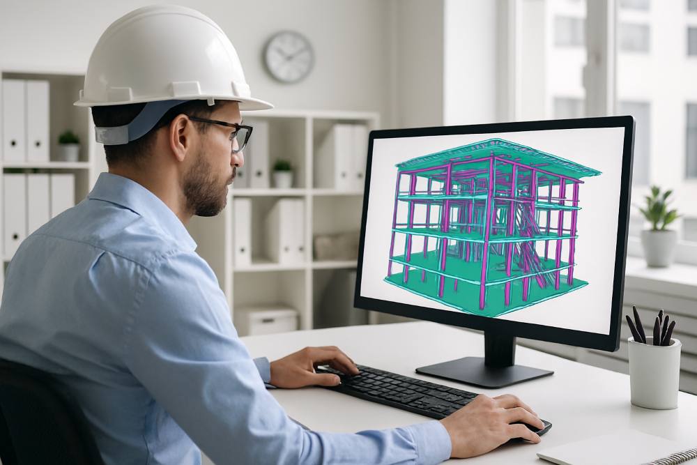
ingeniero consultor bim de acero estudio trabajando en un modelo bim

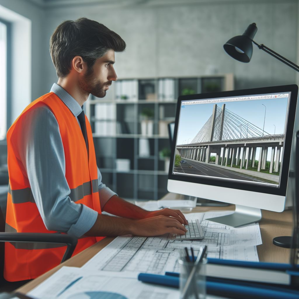
The spread of BIM methodology in construction is a reality; however, in this process of BIM modeling evolution, there are still several gaps that hinder standardized implementation. To close these gaps and reduce the digital debt, BIM consultants play a crucial role, as they are responsible for ensuring that BIM models are accurate, efficient, and effective.

To unlock the full potential of BIM models, further minimize risks, and optimize time, a professional BIM consultant must possess a set of key skills, such as:

On-Site Experience

A BIM consultant with construction site experience is essential to fully realize the potential of the methodology. Consultants who have real on-site knowledge can better understand the needs and challenges of the sector. They also know the capabilities of the construction team, which allows them to create, edit, and audit models effectively. The goal is for these models to be practical and realistic, helping reduce the complexities of project execution.

Attention to Detail

Want to know if a BIM consultant is good? Evaluate how attentive and detail-oriented they are. Systems are important, but without proper human supervision, they lack the reliability that correct monitoring can provide. As BIM consultants, we can analyze BIM models and detect errors or inconsistencies that may affect project quality. The ability to observe and analyze BIM models is crucial to ensure accuracy and reliability.

Software Expertise (Revit or Other BIM Tools)

Proficiency in BIM software is essential for a BIM consultant. They must know how to operate programs that allow them to make edits, assess libraries, run simulations, and perform key functions such as clash detection, among others.

Application of Practical Logic

Logic is fundamental for a BIM consultant. They must be able to analyze complex problems, propose and develop logical, feasible, and cost-efficient solutions. This requires a deep understanding of BIM methodology and the software tools used, as well as knowledge of construction capabilities, budget scopes, and more.

Curiosity

Curiosity is an important skill for a BIM consultant. They must be willing to continuously learn and improve, as BIM technology and best practices are constantly evolving, with new features appearing regularly that can strengthen performance in different sectors. Curiosity allows BIM consultants to stay updated and offer innovative solutions to their clients.

Unlocking the Full Potential of Your BIM Models

By combining these skills, a BIM consultant can develop, improve, or audit BIM models that are accurate, efficient, and realistic. With these abilities, construction projects benefit from reduced costs, improved project quality, and increased client satisfaction.

Do You Need an Expert BIM Consultant?

If you are looking for a BIM consultant who can help you unlock the full potential of your BIM models, we are Acero Estudio, a company specialized in BIM Consulting and BIM Auditing. Our team of BIM experts can help you enhance the quality and efficiency of your 3D models, integrating them effectively into your projects with the goal of reducing costs, minimizing risks, and maintaining greater control of every stage, from construction to maintenance.

Contact us today, we are at your service.

Acero Estudio

Privacy Overview

This website uses cookies so that we can provide you with the best user experience possible. Cookie information is stored in your browser and performs functions such as recognising you when you return to our website and helping our team to understand which sections of the website you find most interesting and useful.