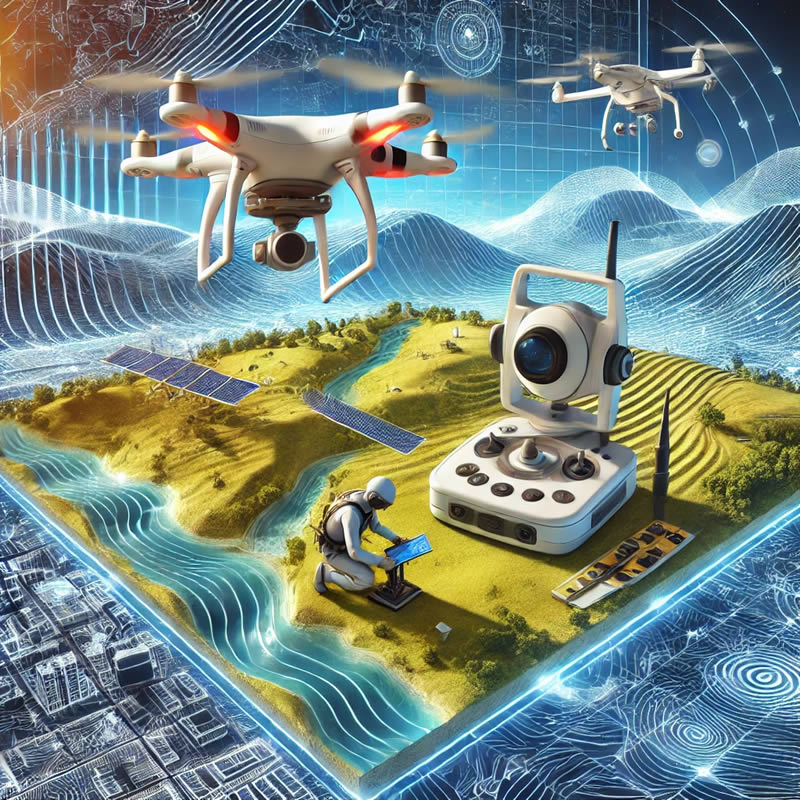
The importance of Topography in the Construction of Industrial Plants

The design and construction of an industrial plant is a project of great magnitude and great importance for the companies that carry it out. Due to the risks involved, the size of the investment and the uses it will have; A work like this requires millimeter precision and careful planning to avoid serious errors or future risks for people and investment.

Reducing risks is where topography becomes an indispensable ally to detail every centimeter of the land. Knowledge of these characteristics will allow us to develop a construction adapted to its environment, safe with respect to potential natural disasters and also efficient in terms of taking advantage of the benefits of the area.

In this short article we will learn how when carrying out a topographic survey we not only provide efficiency but also reduce risks in the construction of industrial plants.

In industrial construction, risks range from ground instability to errors in the alignment of heavy machinery that can result in accidents or structural defects. Surveying identifies potential problems before they become real dangers. By revealing variations in terrain, potential flood zones, or subsurface inconsistencies, surveyors enable construction teams to proactively anticipate and mitigate these risks.

Before the first brick is placed, the topography will provide us with a faithful and exact representation of the terrain. Using advanced technologies such as 3D laser scanning and aerial drone photogrammetry (to create digital models), engineers and architects design with precise knowledge of site characteristics, resulting in more efficient use of resources. and an optimization of the plant design that translates into significant savings.

Modern surveying, with its precision, plays a vital role in cost estimation. By providing accurate data, you help avoid wastage of materials and human resources. The ability to accurately plan the required quantities of materials and labor required for each phase of the project prevents cost overruns and reduces the need for costly adjustments in the future.

Once construction begins, Acero Estudio’s topography services play a vital role allowing:

  • Constant comparison of current site conditions with design plans
  • Identifying and correcting ground deviations in real time
  • Keeping the project on its planned trajectory and within safety parameters

In addition to these important improvements, topography can help us:

  • Locate the best areas for the installation of tanks and cisterns
  • Maximize land use
  • Locate the most appropriate areas for merchandise maintenance
  • Locate the most optimal areas for logistics areas

The success of the construction of an industrial plant or warehouse is a very important factor that is achieved through various knowledge and professionals. The discipline of topography is one of these knowledge that, when integrated with construction capabilities, provides security and responsible risk management.

Ask more about our surveying services, we will be happy to assist you.

Our 3D Laser Scanning Process using the Faro Focus Laser

cloud of dots generated with 3d laser scanner

When it comes to preserving and analyzing a historic building, the 3D laser scanning process has become an indispensable tool. Using the FARO Focus 3D laser scanner, our method focuses on creating an accurate and detailed point cloud that serves as a digital record of the current state of any historic building.

The process begins with strategic site planning. We determine the best scan points to maximize coverage and minimize obstructions. Thanks to the FARO Focus’s ability to reach up to 350 meters, we can cover wide areas from strategic positions, resulting in more complete coverage with fewer equipment movements.

Contact Acero Estudio and know more about our services.

The 3D Laser Scanner: Capturing the world in a point cloud

El Escáner Láser 3D La captura del mundo en nube de puntos

The 3D laser scanner, one of Acero Estudio’s services, has a remarkable capacity to generate precise and detailed point clouds, playing an essential role in a wide range of applications in construction and architecture. Let’s learn about the features of the 3D laser scanner, its advantages and the reason for its nickname, the “point cloud scanner.”

What is the 3D Laser Scanner?

The 3D laser scanner is a device that uses a laser to emit pulses of light that hit the surfaces of objects and structures in their environment. By measuring the return time of light to the scanner, the device precisely calculates the distance between it and objects, collecting this data in the form of thousands or even millions of three-dimensional points, in a process called “laser scanning.”

Benefits

One of the main advantages of this technology lies in its ability to capture extremely precise details of objects and environments. Each point in the point cloud represents a specific location in space, enabling a highly detailed representation of the scanned object.

The 3D laser scanner can generate point clouds at impressive speed, allowing efficient scanning of large areas or complex structures in a short period of time, increasing efficiency in large projects.

Unlike conventional measurement techniques, 3D laser scanning is non-intrusive and does not require physical contact with the scanned objects, making it particularly useful in applications where preserving the integrity of the structure is essential.

It can be used in a variety of applications. In construction to capture buildings and land, and in architecture to document and represent constructions, among many other applications.

Why has it been called “Point Cloud Scanner”?

It is due to the nature of the data it offers. These three-dimensional points make up a “cloud” in space, analogous to a constellation of stars in the night sky. This point cloud houses detailed information about the shape and location of objects, serving as a basis for the creation of high-precision three-dimensional digital models.

Now that you understand the benefits of the 3D laser scanner, including its exceptional accuracy, capture speed, application versatility, and ability to work in hazardous environments, we invite you to contact us to request a quote for our services. We are at your disposal to provide you with the best solution.

Aerial Photogrammetry: Capturing the World from Above

capturing world from above with drones

In this article, we will learn how the process of photogrammetry with drones, also known as aerial photogrammetry, works, a very important activity to generate models of large areas using drones with photography and georeferencing tools.

PROJECT OBJECTIVE DEFINITION PLANNING

Before starting the photo taking process, it is a priority to clearly define the objectives of the project. This involves determining what information needs to be obtained, such as creating a topographic map, monitoring the growth of an urban area, or surveying urban growth for planning purposes.

In this phase, the appropriate equipment and platforms for the project and the types of drones, cameras, necessary flight altitude, sensors that will be used to capture the images, etc. are selected.

FLIGHT PLAN ESTABLISHMENT

The flight route is planned that allows the necessary images to be captured. This involves determining flight altitude, speed, image overlay and number of passes over the area of interest.

Safety priority in aerial photogrammetry. Flight restrictions, airspace, weather, and other factors that may affect mission safety must be considered.

IMAGE CAPTURE PROCESS

During the flight, several series of high-resolution aerial images of the area of interest are taken. These images are taken from different angles and positions to ensure complete coverage.

Georeferences are generated for each image, which is the addition of precise geographic coordinates. This is achieved using global positioning systems (GPS) on board the aircraft and reference markers on the ground.

ORTHORECTIFICATION

This process serves to correct distortions due to the tilt and curvature of the Earth. Allows images to be overlaid correctly and used for accurate measurements.

Images are paired to create coherent 3D models and mosaics. Common reference points are used on the overlay images to align them correctly.

Digital models of the terrain will then be generated from the captured images. These models represent the elevation and topography of the Earth’s surface.

ANALYSIS AND MEASUREMENT

This phase can include the creation of topographic maps, the identification of changes in vegetation, the analysis of floods, among others.

The results of aerial photogrammetry are applied depending on the objectives of the project. For example, topographic maps are used in urban planning and civil engineering, while detecting changes in vegetation is essential in precision agriculture.

DELIVERY OF RESULTS

Aerial photogrammetry results are presented in a clear and accessible manner for interested parties. This can include maps, reports and 3D visualizations that help you understand and make decisions based on the data captured.

From urban planning to natural resource management, aerial photogrammetry continues to play an essential role in capturing and analyzing geospatial information. Contact Acero Estudio specialists in drone fleet services.

The Total Station in Surveying: An Essential Instrument for Accurate Measurements

total station

One of the most essential and versatile tools used in surveying services is the total station. In this article, we will explore in detail what a total station is and how it is used in surveying.

A total station is an advanced surveying instrument that combines several essential functions in a single device. Unlike traditional surveying instruments such as theodolite and scope, the total station is an all-in-one tool that allows surveyors to make accurate measurements of horizontal and vertical angles, as well as distances, heights and elevations. These measurements are made with remarkable precision, making it an indispensable tool in the field of modern surveying.

Components of a Total Station

Total stations consist of several key components:

  • Theodolite: The theodolite incorporated in a total station is responsible for measuring horizontal and vertical angles with great precision. It allows surveyors to point to specific points on the ground and determine directions and elevations accurately.
  • Distancemeter: Total stations are equipped with a distancemeter that uses laser or electronic technology to measure distances between the total station and the point of interest. This allows obtaining precise coordinates.
  • Spirit Level: A spirit level built into the total station ensures that the instrument is perfectly level, which is essential for accurate angle and elevation measurements.
    Screen or viewer: The total station generally has a screen or viewer where the collected data, such as angles, distances and coordinates, are displayed. Some modern total stations even have touch screens for a friendlier user interface.

Use of the Total Station in Topography

Total stations are used in a wide variety of surveying applications, including:

  • Topographic Surveys: To measure the elevation, distance and direction of points on the Earth’s surface, allowing the creation of detailed topographic maps.
  • Construction project control: In the planning and execution of construction projects, such as buildings, roads and bridges, to ensure that structures are built according to specifications.
  • Property surveying and demarcation: To determine property boundaries and create accurate cadastral plans.
  • Monitoring of deformations and changes: In geodetic studies to measure the deformation of structures or the movement of the ground over time.
  • Geology and geophysics: In geological studies to determine the stratigraphy of the subsoil and in geophysical studies to investigate the properties of the terrain.

Advantages of Total Stations

Using a total station offers several advantages, such as:

  • Greater precision: Allows highly precise measurements of angles, distances and elevations.
  • Efficiency: Simplifies the measurement process by combining multiple functions in a single instrument.
  • Speed: Facilitates obtaining data quickly and efficiently.
  • Data Storage: Many modern total stations can store and transfer data electronically, simplifying further processing of the information.

The total station is an essential tool in the field of modern surveying. Its ability to make accurate measurements of angles, distances and elevations with efficiency and ease makes it an invaluable instrument in a variety of applications, from creating detailed topographic maps to planning and executing construction projects.

Its incorporation of cutting-edge technology has transformed the way surveying measurements are made and has significantly improved the accuracy of the results.

Benefits of Aerial Photogrammetry in Infrastructure Construction

drone aerial photogrametry

Aerial photogrammetry also known as drone photogrammetry. This technique, which uses aerial and ground images to obtain precise measurements and three-dimensional models, offers a number of key benefits for the planning and execution of public infrastructure projects.

grafico obtenido con la tecnica de fotogrametria con drones
Graphic obtained through the aerial photogrammetry technique with drones.
  1. Precision and Accuracy: One of the greatest benefits of photogrammetry in public infrastructure construction is its ability to provide precise and accurate measurements. High-resolution aerial and ground images capture minute details of the terrain and existing structures. This allows engineers and architects to work with reliable data to make critical decisions in project design and execution.
  2. Reduction in Project Costs and Time: Photogrammetry significantly speeds up the topographic survey process and data capture. Compared to traditional manual measurement techniques or total stations, photogrammetry saves considerable time and resources. This results in reduced project costs and faster completion of public works.
  3. Improved Planning and Design: Photogrammetry provides a comprehensive and detailed view of the construction environment. Engineers and designers can use three-dimensional models to analyze the terrain, identify potential challenges, and optimize the placement of infrastructure. This leads to a more efficient design and the minimization of unforeseen problems during construction.
  4. Progress Monitoring and Control: During project execution, photogrammetry can be used for progress monitoring and control. By comparing images before and after the works, it is possible to evaluate the progress and quality of the work. This facilitates timely decision-making and allows deviations to be corrected before they become costly problems.
  5. Safety and Risk Reduction: Photogrammetry also contributes to improving safety in public works. By providing detailed information about terrain and site conditions, construction teams can identify and mitigate potential risks. Additionally, accurate planning reduces the likelihood of accidents and mishaps.
  6. Complete Project Documentation: Photogrammetry creates complete project documentation that includes images, 3D models, and detailed measurements. This is invaluable for future references, maintenance and possible infrastructure expansions. It also facilitates communication with stakeholders and reporting to regulatory authorities.
  7. Improved Decision Making: By having accurate and updated data in real time, project managers and authorities can make informed and strategic decisions. This is especially important in public infrastructure projects, where the financial and social implications are significant.
  8. Minimizing Environmental Impact: The ability to accurately assess terrain and environmental conditions allows project planners to minimize environmental impact. This includes protecting sensitive areas and implementing measures to reduce the ecological footprint of the building.

This technology has proven to be a valuable tool for engineers and architects working on public infrastructure projects, contributing to the creation of more efficient, sustainable and safe infrastructure for communities around the world. Contact Acero Estudio and request more information about our aerial photogrammetry service with the use of drones.

Warehouse refurbishment and 3D laser scanning

warehouse almacen o nave industrial

With our experience in 3D laser scanning service we provide our client with the necessary information for the ideal location of their new warehouse facilities to store online purchase/delivery products.

Our mission was to provide precise information to evaluate how they could, with their means and facilities, allow the workflow of goods – for heavy vehicle access and general loading or unloading.

We help determine if a retrofit for this warehouse location could meet your requirements and generate the graphical information necessary to visualize existing conditions and solutions.

We carry out the survey of the 2D levels with a detailed study of the exterior, using a total station with global satellite navigation systems. Followed by taking 3D laser scanner data to generate a cloud of internal and external points of the place. Lastly, we performed 3D modeling where the collected data was analyzed to generate exact geometric shapes.

As a result, our client was able to make decisions quickly and accurately, resulting in notable savings in costs and time.

Another important point valued by the client was being able to verify both compliance with security requirements and evaluate the scope of actions and work flows.

Consult about our services. Our team can help you manage your projects optimally and at a higher level with the use of cutting-edge technological tools.

Remember that at Acero Estudio, a company specialized in 3D laser scanning, it provides various services dedicated to reducing construction, engineering or architectural risks such as:

Contact us and request a quote for our services, we are here to assist you.

We work in Peru to rebuild El Niño floods and prevent new ones

estudios de topografia,

Acero Estudio works in Peru to reconstruct El Niño floods and prevent new ones

The intense rains and river overflows caused the destruction of homes, bridges and roads, generating a large number of people affected and displaced. In addition, there were human losses and basic services such as the supply of drinking water and electricity were affected. Agricultural infrastructure also suffered considerable damage, affecting food production and the local economy, especially for the northern region.

The Authority for Reconstruction with Changes (ARCC) developed the Comprehensive Plan for Reconstruction with Changes (PIRCC) to restore all physical infrastructure damaged and destroyed by the El Niño Coastal Phenomenon.

survey activities to prevent floodings in northern of peru

Acero Estudio collaborates in several reconstruction projects

From our headquarters in Peru we are developing the Topography Studies for the preparation of the project “Storm drainage of the city of Sullana”.

Additionally, within the study’s activities, we are carrying out field and office work on Geo-reference, Polygonals, Polygonal Leveling and Photogrammetry with Drones.

At Acero Estudio, a company specialized in topography services, we have a notable presence in Latin America (LATAM), as a consolidated company in the sector. With more than 25 years of experience and knowledge in the field of 3D Laser Scanning, BIM Consulting, CAD outsourcing service, Topography and Digital Twin, we have managed to establish a solid network of clients and strategic allies in various countries in the region through innovative products. and solutions,

Many thanks to our client TYPSA for the trust placed in us for the execution of the topography work.

fotogrametria y cartografia de la ciudad de sullana

Contact us and request more information about our topography, BIM consulting, LIDAR and cartography services; We are here to serve you.

Advantages of using drones in construction

use of drones in construction sector

Advantages of using drones in construction

The use of drones for construction management has been growing exponentially in recent years. They offer many advantages in terms of tracking, surveillance and location inspection with good, faster and more accurate results.

Below, we present some of the main advantages provided by the use of drones in the construction sector.

Vista de profesional con el dron para la realización de la topografía del terreno
Drones provide various benefits for construction, engineering and architecture

1. Precise mapping

Most of the time, manual data collection and map generation are labor-intensive and time-consuming tasks. Drones can speed up this process by 60-70%. They provide high resolution photos, video capture and data through a LiDAR sensor or through the drone photogrammetry technique.

The LiDAR sensor transmits a laser beam and measures its reflection. Very useful for mapping, especially in topography when there are difficulties in accessing technicians. Construction drone surveying not only simplifies mapping, but also facilitates 3D modeling and analysis.

2. Minimum risk

Drones can replace people in the process of ensuring safety when accessing certain places. By integrating the drone with the monitoring device, real-time information is obtained and problems in certain areas can be instantly identified.

Therefore, the risk of accidents involving people and heavy equipment can be reduced during inspections in areas prone to hazards and risks.

3. Monitoring productivity and responsibility in the field

Drones used in construction make it possible to monitor team productivity. They can also check whether the equipment is installed or not. Therefore, they can easily identify the issue that is causing the project to run slowly. Easy and effective management.

4. Greater effectiveness in Marketing

Photos and videos are the best options to show the project. Until the emergence of drones a few years ago, certain operations could only be carried out with a helicopter to take photos and videos.

The high cost of a helicopter flight has no comparison with the accessibility in economic terms of a drone flight. The costs related to obtaining photos and videos are not parallel to their quality, flexibility, time and safety compared to the drone. These solve the same difficulties effectively.

Thanks to this technology, marketing efforts gain more with high-quality images. You can capture gorgeous projects from different angles in a relatively short time. The company can satisfy stakeholders with progress they can see visually.

Conclusion

The application of drones for construction management provides various benefits regarding safety, costs and time. Drones increase project efficiency with rapid data collection, mapping, and analysis. Furthermore, the information obtained can provide additional advantages if it is integrated with specific computer applications for construction, as it automates management tasks with access to real-time data.

The future of drones in construction will not stop. These benefits are just a few examples. As the technology develops, drones are expected to help construction companies in a wider area.

Also remember that at Acero Estudio we provide various services dedicated to reducing construction risks such as:

Contact us and request a quote for our services, we are here to assist you.

Optimize costs using geospatial 3D scanning and drone technology: precise volumetric analysis.

Acero Estudio’s team participated with its experience in data capture using the 3D laser scanner, GPS, Total Station and drones in this unusual project to provide a quick response and collaborate in the development process of a Due Diligence, whose purpose was to assess the acquisition of an industrial plant.

Our client was immersed in the process of urgently acquiring the property and needed reliable information about its spatial features to determine the quantities and value of the collected material.

Using our experience in handling various measurement scenarios, our team provided innovative technological solutions and accurate results.

The work was done in record time. Our challenge was to provide a solution that could accurately measure the volume of the material to later estimate transportation costs to another facility.

The procedure consisted of carrying out a 3D geospatial study and applying analytical methods to terrestrial or geographic data sets. The first step was to configure the control network with the total station and the GPS receiver.

The data collected from the 3D scanner and drone was processed using logging and photogrammetry software, quickly generating a 3D spatial representation of the facilities and material reserves. Finally, the spatial data was analyzed to calculate the volume of each individual reserve and plan the logistics of its relocation.

The result of the procedure was highly efficient. The time invested was less than estimated and this brought significant gains in all aspects. Without a doubt, an example of how the combination of technologies contributes to the fulfillment of our projects and the objectives of our clients.

Remember that at Acero Estudio, a company specialized in 3D laser scanning, it provides various services dedicated to reducing construction, engineering or architectural risks such as:

Contact us and request a quote for our services, we are here to assist you.