Can Earthquakes Affect the Topography of an Area?

how the earthquakes affect topography

One of the most interesting questions we have received from our Peruvian clients in recent times is whether an earthquake can affect the topography of an area. This is an unusual but important question, especially since countries like Peru are located in a high seismic activity zone known as the “Pacific Ring of Fire.”

The answer is a resounding YES. Seismic movements directly impact topography and soil characteristics due to various phenomena that affect the terrain. These include:

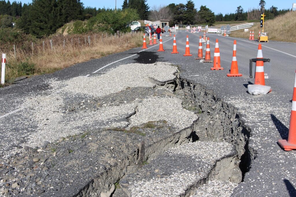
Ground Movement and Rupture

Earthquakes can cause movement and displacement of the Earth’s surface due to waves generated by the friction of tectonic plates. These displacements can damage rigid structures such as buildings and bridges.

Formation of Scarps

Scarps are abrupt rock formations that appear to rise from the terrain due to seismic movement. These can form suddenly or along a fault line, serving as visible evidence of crustal deformation. Over millions of years, scarps can evolve into mountain ranges.

Liquefaction

In soils affected by moisture or with the presence of water, a phenomenon known as liquefaction can occur. This causes the ground to lose its consistency, leading to the total collapse of structures.

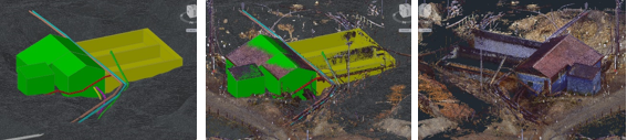
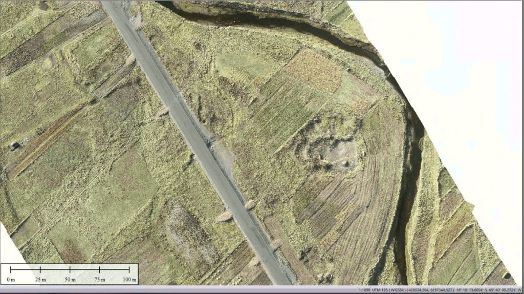
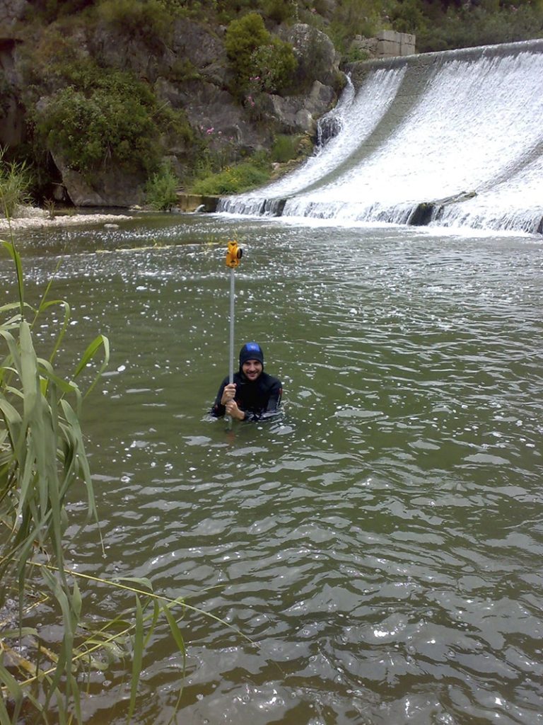
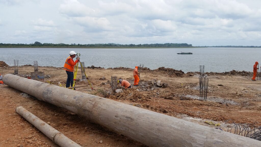
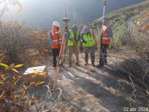
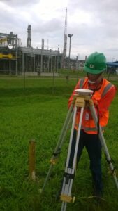
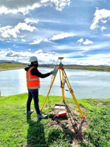
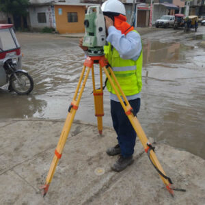
As you can see, earthquakes have a real impact on the ground and, consequently, on the topography of land, valleys, and mountainous areas. If you want to learn more about topography and how we can help you reduce construction risks in your projects (even in seismic zones), feel free to contact us and inquire about our topographic survey services.

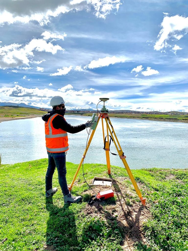
Acero Estudio, as a company specializing in advanced topographic studies, is always at your service.

Is it advisable to conduct topographic surveys during construction?

torre de pisa inclinada por falta de estudios topograficos

Regarding topography, it is often believed that this study is only necessary at the beginning of construction work; however, this view does not fully reflect the true purpose of a topographic survey.

It is essential to consider that these studies, in addition to providing a precise view of the terrain’s characteristics, can help us identify changes in the alignment of structures as they settle, ensuring the correct placement of structures and helping to prevent issues that may arise from discrepancies in elevation, alignment, and terrain configuration. Without this detailed information, construction can face significant risks that impact both the safety and functionality of the structure.

importancia de la topografia continua
Key reasons to conduct topographic surveys during construction:

  1. Precision control and alignment: Surveys help verify that all elements of the construction are correctly aligned, preventing deviations in walls, columns, and foundations.
  2. Minimizing structural risks: Detecting anomalies in the terrain, such as sinking or landslides, allows for preventive actions and plan adjustments to ensure structural stability.
  3. Efficiency in material usage: Knowing the precise terrain profile enables optimization of the required material quantities, reducing waste and additional costs.
  4. Mitigating legal issues and conflicts: Accurate surveys ensure that construction is carried out in the correct location and within property boundaries, avoiding property disputes and legal issues.

construccion y topografia
Historical Case: The Leaning Tower of Pisa

A famous example of the consequences of inadequate planning and lack of detailed topographic and geotechnical studies is the Leaning Tower of Pisa in Italy. Construction of this tower began in 1173, and due to the lack of thorough terrain studies, the tower’s foundations were insufficient to support its weight on soft, uneven ground. This caused the tower to begin leaning during its construction, creating a significant risk of collapse.

With today’s advances in topography, the leaning and structural problems of the Tower of Pisa would have been detected much earlier, allowing for design or foundational adjustments to prevent the tilt. Today, this tower remains an example of the importance of conducting topographic and geotechnical studies, not only at the beginning but at every stage of a construction project, to ensure the stability and safety of buildings.

torre de pisa inclinada por falta de estudios topograficos

Types of Objectives in Topographic Surveys

Topographic studies, also known as topographic surveys, are a fundamental tool in engineering, construction, architecture, and urban planning due to the valuable information they provide about the terrain.

There are various types of topographic surveys, each with specific objectives adapted to the needs of your project. Below, we describe the main types of topographic studies, each with its respective objectives.

  1. Geodetic Surveys

Geodetic surveys are essential for precise topographic mapping. Their objective is to create a framework of reference points with exact coordinates through the use of global navigation satellite systems (GNSS).

These surveys are crucial for large-scale projects, such as road and highway infrastructure, coastal city construction, and more. They provide reliable data to locate structures and other elements in relation to a global coordinate system.

geodesia

  1. Plane Surveys

A plane survey allows for detailed measurements within specific areas. It is widely used for limited areas and coordinate delineation projects as it does not account for the Earth’s curvature. Traditional tools like theodolites and levels are used to measure distances, angles, and elevations, ensuring precision in local projects.

  1. Airborne Surveys

With the help of unmanned aerial vehicles, such as drones, airborne surveys have become more efficient. These include drone photogrammetry and LiDAR (Light Detection and Ranging), with the goal of capturing extensive data over large areas quickly and accurately.

These aerial topographic studies enable the creation of three-dimensional terrain models, useful for urban planning, environmental monitoring, and evaluating inaccessible areas.

topografia aérea

  1. Construction Surveys

Specifically designed for the construction industry, construction surveys aim to provide precise data for buildings. It is recommended to conduct them from site preparation through to the final verification of structures.

This type of topographic study ensures that buildings, roads, and other infrastructure are constructed according to design specifications and meet regulatory standards, preventing costly errors in project execution.

  1. Boundary Surveys

Boundary surveys aim to define and delineate property lines and are essential for resolving land disputes, property transfers, and compliance with zoning regulations.

  1. Hydrographic Surveys

The objective of hydrographic surveys is to map underwater features, such as depths, shoals, and obstacles. These studies are essential for navigation, marine construction, and coastal zone management. Thanks to this type of study, a detailed profile of the waterbed can be obtained for projects such as port dredging and maintenance of navigation routes.

trabajo de topografía

If you want to learn more about our topography services, remember that Acero Estudio is a surveying company with 25 years of experience in Europe and Latin America. Contact us today — as a topography company, we are specialists and at your service.

Applications of Topography in Civil Engineering

aplicaciones de la topografia en ingenieria civil

As we often mention, topographic studies are essential in civil engineering because they provide advanced knowledge of the surfaces where constructions will take place.

In the design and construction of roads, bridges, buildings, dams, and other infrastructure, topography helps us delimit land, conduct geotechnical studies, and manage large-scale infrastructure projects.

Consider that Acero Estudio’s topography survey services can be highly useful in projects such as:

  • Road and bridge design: Topography allows us to obtain precise terrain data, ensuring a proper layout and minimizing risks.
  • Building and dam construction: It facilitates the leveling and correct orientation of structures. In the case of dams and other water management constructions, topography plays a crucial role in preventing flood risks.
  • Land delimitation: Topographic techniques help define boundaries and property, especially in areas with irregular surfaces.
  • Geotechnical studies: Topography is used to analyze soil stability.
  • Infrastructure project management: It contributes to monitoring and controlling progress while also helping to reduce construction risks.
maquinaria preparando terreno para construccion
Machinery preparing the ground for the construction of an infrastructure project.

For precise results in your civil engineering projects, contact Acero Estudio, a company specialized in topographic services and surveys. We also provide solutions for the engineering and architecture sectors, with an expert team ready to assist you. Contact us – we’re at your service!

Differences and Similarities Between Topography and Geodesy

topography survey company

Topography and geodesy are sister disciplines that provide us with advanced knowledge of the surfaces in a given area.

Topography studies relatively small surfaces where precision is required for the construction of industrial plants, factories, houses, hydroelectric plants, etc. Geodesy, on the other hand, carries out these studies over much larger areas, such as the extension of a highway spanning hundreds of kilometers, the laying of a railway line connecting several cities, international airports, electrical grid systems, and more.

As we can see, the purpose of both studies is quite similar, but the scales are fundamentally different. For this reason, each uses distinct techniques and instruments.

Below is a list of the main differences between geodesy and topography:

Aspect Topography Geodesy
Scope and Scale Focuses on small, local areas like construction sites. Covers large areas, including continents and the entire planet.
Earth’s Curvature Not considered in small projects. Considers Earth’s curvature over long distances.
Instruments Total stations, optical levels, drones. GPS, GNSS systems, satellites.
Method Measures distances, angles, and elevations in local areas. Establishes global coordinates and studies Earth’s shape.
Applications Construction projects, land surveying, urban planning. Tectonic studies, global positioning systems (GPS).
Time Scale Used for short-term, specific projects. Used for long-term studies, including geological changes.
Coordinate Systems Uses local coordinate systems for precise locations. Uses global coordinate systems (e.g., WGS84).
Precision High precision in small areas. Precision adjusted for large-scale and global phenomena.

Whether you need a topographic or geodetic survey, Acero Estudio are specialists in topographic surveys at an international level. With over 25 years of experience in Europe and Latin America, we provide specialized technical support for any project.

Contact us today, we are at your service!

Is a Topographic Survey Necessary for Building Construction?

levantamiento topografico para construcción de edificios

The answer to this question is YES.

A topographic survey is an essential study for the construction of any building, regardless of its size or location. This study provides architects and engineers with an accurate and detailed view of the area. Through a topographic survey, it is possible to plan actions related to the project, such as earthworks and foundation design. Additionally, a topographic survey can influence the design and construction of the structure. Even in areas that appear flat at first glance, a topographic survey is crucial to ensure that the building’s foundations are correctly placed, preventing future structural issues.

Why Should I Conduct a Topographic Survey in an Apparently Flat Area?

A terrain that seems flat to the naked eye may conceal various irregularities, such as slopes, changes in soil type, or even the presence of underground water bodies. A professional topographic survey helps identify these and other factors, ensuring that the building’s design adapts perfectly to the natural characteristics of the land. Moreover, it ensures proper drainage and soil stability, minimizing the risks of settlements or landslides that could compromise the building’s integrity.

Risks of Constructing a Building Without a Topographic Survey

Building without an adequate topographic survey can lead to a series of serious problems, including:

  • Unevenly settled foundations
  • Inadequate drainage leading to soil erosion issues
  • Errors in the alignment of the building
  • Additional costs due to unforeseen construction errors
  • Environmental impact

What Type of Topography is Recommended for Building Construction?

For the construction of a building, several types of topographic studies are recommended, such as:

  • Topographic survey with planimetry and altimetry
  • Geodetic survey
  • Survey with LIDAR or photogrammetry
  • Soil study

In summary, a topographic survey is a 100% necessary study for any type of construction. It is also advisable to conduct progressive topographic surveys as the construction progresses to avoid errors.

If you need to contact a topography company, we invite you to reach out to Acero Estudio. We have 25 years of specialization in topographic services and surveys in Peru and Spain. We use cutting-edge technology and techniques, including our topography services with drones and drone photogrammetry.

Contact us today – we’re here to help!

Benefits and Applications of Aerial Photogrammetry: An Evolving Discipline

representacion digital de terreno obtenida mediante la tecnica de la fotogrametria con drones

Aerial photogrammetry is an essential tool for sectors that require detailed terrain mapping from an aerial perspective. Its applications are varied and encompass multiple areas, such as:

  • Cartography: Creation of precise topographic maps.
  • Urban planning: Efficient management of infrastructure construction.
  • Civil engineering: Supervision and development of projects.
  • Agriculture: Detailed analysis of soils and crops.
  • Disaster management: Rapid and accurate assessment of affected areas.

Currently, aerial photogrammetry relies on advanced technologies, with drone fleet (UAVs) being a key platform for capturing images from the air. Equipped with high-precision cameras and specialized sensors, these drones can cover large areas in significantly less time than traditional methods.

Moreover, advances in software have enabled the creation of digital 3D terrain models with remarkable precision. This software also facilitates the integration of data into Geographic Information Systems (GIS), enhancing analysis and decision-making in complex projects.

Some of the most notable benefits of aerial photogrammetry compared to other methods of territorial data capture include:

  • Speed in obtaining information.
  • High precision in the collected data.
  • Capability to cover extensive areas with a high level of detail.

Unlike geodesy or traditional topographic surveys, which require more time and personnel in the field, aerial photogrammetry allows for measurements to be taken from the air in much less time without compromising accuracy. Additionally, the ability to generate three-dimensional models provides a more complete and useful view of the terrain, facilitating both planning and project execution.

If you are looking for high-quality aerial photogrammetry and topographic survey services, we invite you to get to know Acero Estudio. We specialize in the use of drones and advanced technology to provide precise and efficient solutions. Our team of experts, with extensive experience in drone piloting and data processing, is ready to help you generate valuable information for your projects.

Contact us, and let’s discuss how we can collaborate to maximize the success of your projects. We are at your service.

Acero Estudio, the Best Surveying Company in Peru

nuestro equipo de profesionales especializados en servicio de topografia, levantamiento topografico, consultoria bim y servicios cad

If you are looking for a surveying company, you have come to the right place. Acero Estudio is the right choice, a highly specialized company providing surveying services in Peru and Spain. We have conducted topographic studies for infrastructure projects, construction projects, cadastral activities, residential and industrial constructions, among others.

With over 25 years of experience in Latin America (Peru) and Spain, we have established strong partnerships with the largest and most respected companies, achieving a large number of satisfied clients.

Our Technology

Technological development has also impacted our sector, leading us to extensively use the best technology to achieve faster and more economically efficient results. Therefore, in addition to traditional surveying services, we offer cutting-edge techniques such as:

  • Drone surveying
  • LIDAR
  • Aerial photogrammetry
  • Coastal and mining drone surveying

At Acero Estudio, we adapt to the specific needs of each project to guarantee precise and efficient results.

What Techniques Do We Develop?

Among the specialized techniques we implement are:

  • Polygonal surveying
  • Geometric leveling
  • Drone surveying
  • Drone photogrammetry
  • Topographic surveys
  • Geodesy services

With professionals specialized in each of these methodologies, we can offer precise and comprehensive data essential for the planning and execution of works of any scale and complexity.

We invite you to contact us and become part of our satisfied clients, benefiting from the quality of our work, punctuality, and responsibility in everything we do. At Acero Estudio, we are committed to excellence and your satisfaction.

Planning in a Topographic Survey

estudio topografico para construcción de malecon turistico frente a laguna

Planning is always necessary for any project, but for a topographic survey project, it is essential. The lack of personnel or components can cause a workday to be cut short or incomplete without proper preparation of the staff and equipment.

Here are important tips we implement at Acero Estudio to develop successful topographic studies:

  1. Determining the Area and Objectives of the Survey: It is crucial to clearly define the study area and the specific objectives of the survey. This allows for efficient focusing of efforts and resources and ensures an in-depth understanding of the needs of each project.
  2. Determining the Equipment to Use: Selecting the right equipment is crucial. Common equipment includes total stations, electronic levels, GPS navigators, and drones. The selection of technology depends on the terrain’s characteristics and the project’s objectives.
  3. Planning the Personnel for the Job: It is necessary to assign the appropriate personnel, including the number of surveyors, prism operators, and assistants. Proper planning of the human team ensures that the survey is carried out efficiently and safely.
  4. Collecting Topographic Information: This step involves collecting accurate and detailed data about the terrain. It is one of the most tedious parts, especially when conducting a traditional topographic survey. The quality of the collected information is vital for the project’s success.
  5. Data Processing and Office Work: Once the data is obtained and tabulated in a system, it needs to be processed and analyzed using software. This includes error correction and the generation of detailed reports.
  6. Creating Topographic Information in CAD or BIM Compatible Format: Finally, it is essential to convert the topographic information into formats compatible with computer-aided design (CAD) software or Building Information Modeling (BIM). This facilitates its use by engineers and architects in the subsequent phases of the project.

It is also important to note that surveyors, based on their experience, will provide additional information regarding the project, such as soil types, loose materials on slopes, and other information that adds value and preventive information to the project. Therefore, it is important to hire a specialized company in topographic services, such as Acero Estudio, to ensure the quality and accuracy of the work.

Meet Our Team of Topography Specialists

As you already know, Acero Estudio is a company specialized in topography services and topographic surveys. However, despite frequently sharing information about our knowledge and daily activities, we rarely publish photos of our equipment in action.

In this brief article, we share some photos of our staff performing topographic work in urban and rural areas, mining zones, among others. Always remember that the value of our service is significantly based on our team of specialists who are always at your service.

levantamiento topografico en mineria
Topographic survey in a mining zone

asistencia tecnica en construccion de tunel
Technical topographic assistance for tunnel construction

levantamiento topografico en refineria en peru
Topographic survey for industrial area expansion

topography-for-hydraulic-projects
Topographic survey for hydraulic projects

topografia para evitar inundaciones
Topographic studies for flood prevention due to the El Niño phenomenon

Now that you know more about our work, don’t hesitate to contact us; we are at your service.