Topography in Construction on Sloped Terrain

topografia en sierra peruana

Many terrains, especially on the outskirts of cities, have slopes, and inclined areas pose a challenge for any construction project, from the design stage to the execution of the work.

The accuracy of structural calculations and the planning of cuts and fills are all affected by the stability and inclination of the area. In this sense, to achieve the proper placement of buildings, a topographic study allows for identifying risks and making key decisions to ensure the safety and efficiency of the project.

What risks can be avoided with a topographic study:

  • Landslides and soil erosion
  • Deficiencies in the drainage system
  • Errors in earth movement calculations
  • Structural instability due to irregular settlements

Additionally, topographic analysis facilitates the planning of preventive measures, such as:

  • The construction of retaining walls
  • Adaptation of drainage systems
  • Optimization of structural design to adapt to the natural topography of the terrain

Once the project is completed, topography is used for construction compliance certification, the preparation of documentation for maintenance work, or property expansions, preventing future problems.

In this regard, at Acero Estudio, we specialize in topographic services to ensure the success of construction on sloped terrain. Our services include topographic surveys using the polygonal method, high-precision geometric leveling, and other techniques with UAVs such as drone photogrammetry and LIDAR technology to capture the terrain morphology in detail.

If you need a topographic company, do not hesitate to contact us—we are at your service.

What Errors Occur in Topography and How to Avoid Them?

conoce los errores en la topografia

Topography, like any discipline, demands expertise and knowledge to avoid errors and achieve optimal results. In our field, accuracy is critical, as even minor errors can accumulate and lead to significant negative consequences in engineering projects if not detected in time.

The main types of errors in topography are systematic errors and accidental errors. Let’s understand how they arise and how to prevent them to ensure the quality of the results.

Systematic Errors

These are deviations that occur due to equipment malfunctions, incorrect calibrations, improper procedures, or environmental factors. Systematic errors tend to repeat under the same conditions and, if not corrected, can lead to consistently inaccurate results.

Examples of systematic errors:

  • Uncalibrated total stations, damaged leveling instruments, etc.
  • Environmental factors such as light, metal expansion due to heat, or fog affecting instrument readings.

Accidental Errors

These are deviations caused by unpredictable variables such as human error or accidental instrument movements. While they are unavoidable to some extent, these errors are typically minor when proper procedures are followed.

Examples of accidental errors in topography:

  • Instrument reading errors due to operator distraction or carelessness.
  • Vibrations in the terrain caused by machinery or other external factors.

How Do We Prevent These Errors?

As a specialized topography company, we implement procedures to minimize errors and ensure the reliability of our work. Below are the measures we take:

To Prevent Systematic Errors:

  • Regular maintenance of equipment: We have preventive maintenance plans to ensure all instruments function perfectly.
  • Calibration and verification: Total stations and levels are calibrated and checked before any project.
  • Evaluation of atmospheric corrections: Adjustments are made for environmental factors, such as material expansion on hot days.
  • Deviation tests: These tests are conducted to identify potential systematic errors.

To Prevent Accidental Errors:

  • Continuous training: We provide regular training and updates to our personnel.
  • Advanced technology: Our tools feature integrated viewers and systems to reduce common errors.
  • Comparative measurements: We conduct multiple measurements to identify and eliminate inconsistencies.

The Gauss Curve and Its Application in Topography

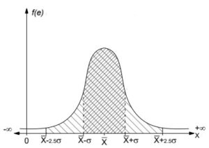
The distribution curve, or Gauss curve, helps identify potential errors by analyzing deviations in the data. It allows us to distinguish between systematic and accidental errors effectively.

This statistical tool enables informed decisions about the quality of the collected data and the implementation of corrections when necessary.

curva de gauus

To achieve precise and reliable results for your projects, it’s essential to work with a specialized topographic survey company like Acero Estudio. Our team leverages cutting-edge technology and adheres to high-quality standards to ensure accurate, error-free measurements.

With our topography services, we will provide you with the precise information about your terrain, giving your engineering or architectural projects a solid and accurate foundation.

Contact us today! We’re here to assist you with all your topography needs.

Setting Out in Topography: Key to Error-Free Construction

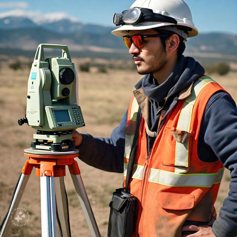
ingeniero topografo

Once a topographic survey has been conducted, companies gain precise information about the land where construction will take place. A topographic setting-out is the process of validating the data from the prior survey to initiate the construction process.

Why is setting-out important?

A setting-out ensures that the structure is correctly positioned, avoiding errors that could lead to additional costs and project delays. While there are usually ways to validate information from a topographic survey, setting-out minimizes the risk of any erroneous values persisting.

How do we carry out our setting-out process?

  1. Preparation: We analyze the technical design and determine the key points to be marked on the site.
  2. Positioning: Reference points are established using tools like total stations, optical levels, or GPS.
  3. Marking: Stakes, lines, and other marks are placed to serve as guides for construction teams.

Applications

  • Construction of buildings, roads, and bridges.
  • Industrial facilities and plants.
  • Urban development projects and public utility networks.

If you’ve conducted topographic surveys and need validation of the data, contact Acero Estudio. With 26 years of experience, we specialize in topographic survey services, ensuring precise construction in the right location. Contact us today!

What Information Should a Topographic Plan Include?

plano topografico

As mentioned in several of our articles, topography is essential for construction and infrastructure projects because it provides a precise understanding of the terrain, including measurements, slopes, and other vital characteristics for comprehensive data.

After conducting a topographic survey, the surveying company will deliver the topographic study (preferably in both physical and digital formats), which should include the following information:

1. Basic Information of the Plan

  • Project identification, location, and date of the plan’s creation.
  • Scale used, clearly indicated to ensure dimensions are understandable and comparable.
  • Coordinates in a standard reference system (such as UTM or WGS84) to accurately locate points on the terrain.

2. Terrain Features

  • Precise representation of terrain elevation, with intervals appropriate to the project’s complexity.
  • Indications of areas with significant slopes that may affect the design or construction.
  • Identification of natural elements such as rivers, ravines, mountains, or depressions.

topographic survey

3. Present Elements

  • Details of roads, buildings, pipelines, electrical poles, etc.
  • Information about wooded areas, cultivated fields, cleared land, water sources, etc.
  • Geodetic markers or topographic benchmarks used as references.

4. Methodology and Tools

  • Confirmation of whether total stations, drones with photogrammetry, LIDAR systems, or high-precision GPS were used.
  • Information about the margin of error to ensure data reliability.

5. Compatibility and Deliverables

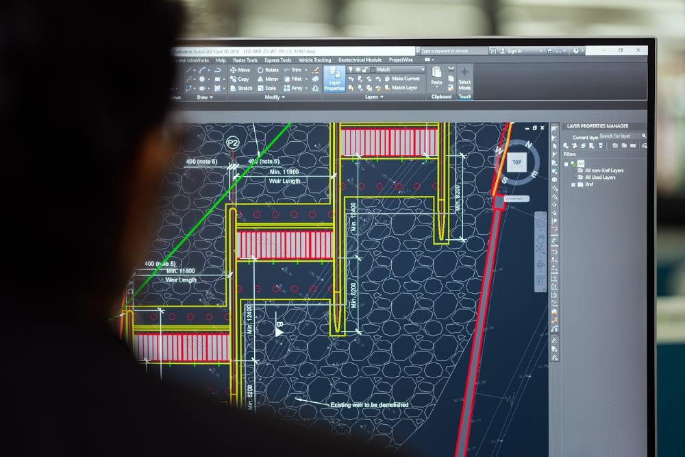
  • Digital files in CAD formats (such as DWG) and GIS formats (such as SHP), along with printed copies if required.
  • Longitudinal and cross-sectional profiles, digital terrain models (DTMs), and orthophotos, if the project requires them.

6. Certifications and Support

  • Guarantee that the work complies with local and international regulations.
  • Signature from specialists, such as a certified surveyor or engineer.

topographist

Advantages of a Topographic Survey with Acero Estudio

Acero Estudio, a company specializing in topographic survey, recommends using surveying to avoid construction risks. Our services help you:

  • Minimize risks in plan design.
  • Avoid flooding risks or improper project placement.

Contact us to discuss how we can support your project development. With 25 years of experience, we are at your service.

Control Points in Topography

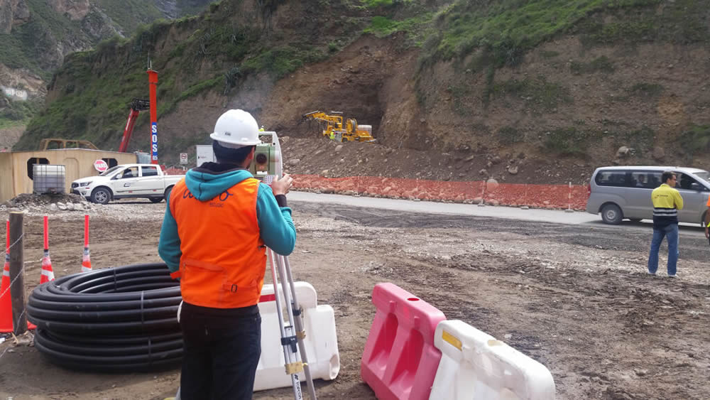
ingeniero calculando el desnivel del terreno en la construcción de la carretera y tunel chacahuaro en lima

Control points in topography are physical (metal or concrete markers) or digital (points within a digital model) geographic references used to ensure accuracy and consistency in topographic surveys. These points are established with known coordinates and serve as a foundation for precise terrain measurement and mapping.

Benefits of Control Points in Topography

The use of control points provides several benefits, such as:

  • Ensuring precision in collected data by correcting potential equipment errors.
  • Guaranteeing consistency between different surveys, facilitating data comparison in long-term projects.
  • Helping optimize time and resources by reducing the need for subsequent corrections, ensuring reliable results from the outset.

Applications of Control Points

Control points are employed in various techniques, including:

  • Drone photogrammetry
  • Topographic leveling
  • Geodetic surveys

puntos de levantamiento topografico

For example, in a road construction project, control points help define precise alignments and elevations, ensuring the design is executed in accordance with the projected plans.

At Acero Estudio, we specialize in topographic survey services such as land surveys and advanced technologies like drone photogrammetry. If you’re looking for precision and efficiency in your projects, contact us. We are ready to provide high-quality solutions tailored to your needs.

What is Leveling in Topography?

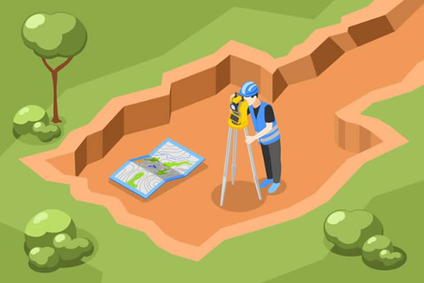
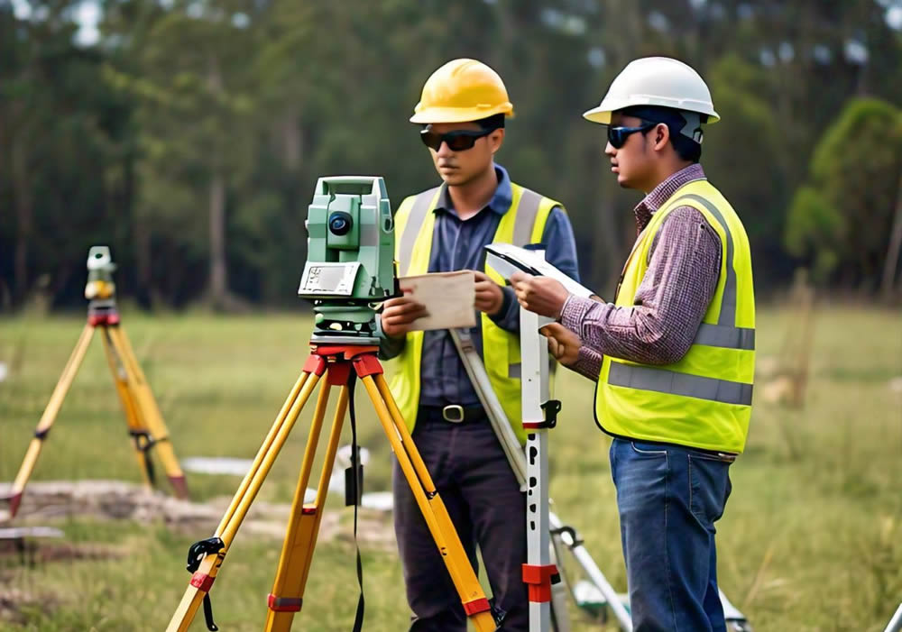
ingeniero realizando un levantamiento topografico

Leveling is a topographic technique used to measure and establish the difference in height between specific points on a terrain. This process makes it possible to understand variations in the surface’s relief, which is essential for accurately representing the topography of an area and preparing the foundation for various types of construction.

Sectors and Types of Construction Where Leveling is Used

  1. Road and Highway Construction: Used for planning and adjusting slopes and route alignments.
  2. Civil Engineering Projects: Essential in projects involving bridges, dams, and tunnels, where precision in elevation is critical.
  3. Buildings and Urban Works: Ensures a flat, stable surface before constructing commercial, residential, and industrial structures.
  4. Hydraulic Works: Key for building canals, sewer systems, and irrigation systems, ensuring the correct direction and flow of water.
  5. Agriculture and Landscaping: Facilitates soil leveling for agricultural projects and garden design, promoting better water distribution and land use.

Advantages of Leveling in Topography

  • Precision in height measurement
  • Optimization of resources and materials in construction
  • Reduction of risks from settlement or inclination of structures
  • Increased safety in civil works
  • Greater accuracy in slope and drainage control

Instruments and Complexity According to Type of Leveling

  1. Geometric Leveling: Requires an optical or digital level, which offers high precision and is relatively easy to handle, though it does require basic technical training.
  2. Trigonometric Leveling: Uses theodolites or total stations, allowing for height calculations on difficult terrains. This method is more complex, as it demands trigonometric calculations and advanced experience.
  3. Barometric Leveling: Carried out with barometers or altimeters, it is less precise than the other methods but useful for extensive or mountainous areas. Its complexity is low, though accuracy depends on atmospheric conditions.

Trust Acero Estudio for Your Topographic Projects

At Acero Estudio, we specialize in topography and surveying services with precision. Our team uses advanced technology and has industry experience, guaranteeing accurate measurements and comprehensive support at every stage of your project. Contact us for professional advice and quality results in your construction and engineering projects!

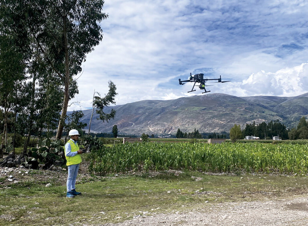
Vista de profesional con el dron para la realización de la topografía del terreno

Applications of Topography in Civil Engineering

aplicaciones de la topografia en ingenieria civil

As we often mention, topographic studies are essential in civil engineering because they provide advanced knowledge of the surfaces where constructions will take place.

In the design and construction of roads, bridges, buildings, dams, and other infrastructure, topography helps us delimit land, conduct geotechnical studies, and manage large-scale infrastructure projects.

Consider that Acero Estudio’s topography survey services can be highly useful in projects such as:

  • Road and bridge design: Topography allows us to obtain precise terrain data, ensuring a proper layout and minimizing risks.
  • Building and dam construction: It facilitates the leveling and correct orientation of structures. In the case of dams and other water management constructions, topography plays a crucial role in preventing flood risks.
  • Land delimitation: Topographic techniques help define boundaries and property, especially in areas with irregular surfaces.
  • Geotechnical studies: Topography is used to analyze soil stability.
  • Infrastructure project management: It contributes to monitoring and controlling progress while also helping to reduce construction risks.
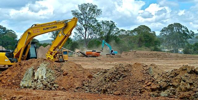
maquinaria preparando terreno para construccion
Machinery preparing the ground for the construction of an infrastructure project.

For precise results in your civil engineering projects, contact Acero Estudio, a company specialized in topographic services and surveys. We also provide solutions for the engineering and architecture sectors, with an expert team ready to assist you. Contact us – we’re at your service!

Differences and Similarities Between Topography and Geodesy

topography survey company

Topography and geodesy are sister disciplines that provide us with advanced knowledge of the surfaces in a given area.

Topography studies relatively small surfaces where precision is required for the construction of industrial plants, factories, houses, hydroelectric plants, etc. Geodesy, on the other hand, carries out these studies over much larger areas, such as the extension of a highway spanning hundreds of kilometers, the laying of a railway line connecting several cities, international airports, electrical grid systems, and more.

As we can see, the purpose of both studies is quite similar, but the scales are fundamentally different. For this reason, each uses distinct techniques and instruments.

Below is a list of the main differences between geodesy and topography:

Aspect Topography Geodesy
Scope and Scale Focuses on small, local areas like construction sites. Covers large areas, including continents and the entire planet.
Earth’s Curvature Not considered in small projects. Considers Earth’s curvature over long distances.
Instruments Total stations, optical levels, drones. GPS, GNSS systems, satellites.
Method Measures distances, angles, and elevations in local areas. Establishes global coordinates and studies Earth’s shape.
Applications Construction projects, land surveying, urban planning. Tectonic studies, global positioning systems (GPS).
Time Scale Used for short-term, specific projects. Used for long-term studies, including geological changes.
Coordinate Systems Uses local coordinate systems for precise locations. Uses global coordinate systems (e.g., WGS84).
Precision High precision in small areas. Precision adjusted for large-scale and global phenomena.

Whether you need a topographic or geodetic survey, Acero Estudio are specialists in topographic surveys at an international level. With over 25 years of experience in Europe and Latin America, we provide specialized technical support for any project.

Contact us today, we are at your service!

The Role of Topographic Surveys in Industrial Project Planning

servicio de levantamiento topografico para proyectos de infraestructura industrial

In industrial construction projects, an accurate topographic survey is essential to mitigate risks such as errors in infrastructure placement, improper land use, and cost overruns during the construction phase. Without an adequate topographic survey, plants, warehouses, and factories may face structural issues, interference with underground services, or non-compliance with regulations that could delay the project and increase costs.

Benefits of Topographic Surveys in Industrial Projects

  • Future expansion planning:
    The survey facilitates planning for future expansions, maximizing the use of available land.
  • Precise calculation of earthworks:
    It allows accurate estimation of the volume of earth to be removed or filled, optimizing resources.
  • Identification of slopes:
    Ensures that the terrain is suitable for the construction of heavy structures, avoiding stability issues.
  • Detection of underground interferences:
    Prevents damage to pipes, cables, and other underground services, minimizing risks during construction.
  • Compliance with local regulations:
    Ensures that the location of structures complies with municipal and environmental regulations.

Our Work at Acero Estudio

At Acero Estudio, we conduct detailed topographic surveys using advanced technology such as drone photogrammetry and LIDAR surveys. A typical survey begins with an inspection of the area and the planning of the equipment to be used. Our experts then collect the necessary topographic data, including elevations and relevant points, to generate precise plans. The process concludes with the delivery of a technical report and recommendations for optimizing the land according to the project’s needs.

If you are planning an industrial project and seek precision and expertise, Acero Estudio is the specialized company providing topographic services to help ensure the success of your project. Contact us for more information!

Differences Between Topographic Levels and Types of Leveling

realizando un levantamiento topografico

Among our clients, we’ve noticed an interest in clarifying the differences between topographic levels (tools) and leveling methodologies (procedures).

Types of Topographic Levels

In the field of topography, using different types of levels is essential for ensuring accuracy in height and distance measurements. Each type of level has its own purpose and characteristics, and its selection depends on the specific needs of the project.

Plane Levels
Plane levels, also known as optical levels, are primarily used to measure the horizontality of a terrain. This type of level requires the operator to manually adjust the instrument to make it horizontal before taking readings. They are ideal for simple leveling projects where it’s necessary to ensure that a surface is level in relation to a horizontal plane. They are widely used in construction and landscaping projects where ensuring the land or structural elements are perfectly level is necessary.

Line Levels
Line levels are more precise instruments that project a horizontal line on the ground, facilitating the alignment of structures across a surface. Unlike plane levels, they don’t require constant adjustments, making them faster and more efficient in repetitive alignment tasks. They are used in infrastructure projects, such as the installation of pipes or the alignment of pillars, where precision in height and alignment is crucial.

Automatic Levels
Automatic levels, also known as self-leveling levels, are the most advanced. They use a compensator that automatically adjusts the instrument to achieve perfect horizontality, eliminating human errors. They are extremely precise and are used in large-scale projects where accuracy is vital. This type of level is very common in civil engineering projects, road construction, and high-precision topographic surveys.

Types of Leveling

Leveling, the process by which the height difference between points on the ground is determined, can be carried out in various ways.

Trigonometric Leveling
Trigonometric leveling is based on trigonometric calculations using angles of elevation or depression and horizontal distances to determine the height of one point relative to another. This method is useful in rugged terrain or when the distances between points are long. It is employed in projects that require measuring height differences in uneven terrain or mountainous areas.

Height Leveling
Also known as geometric leveling, this is the most common method in topography. It consists of the direct measurement of height differences between several points using instruments like the automatic level. It is the most precise method and is used when high accuracy is required. It’s ideal for building construction, roads, and infrastructure projects that require precise height data.

Barometric Leveling
This type of leveling uses atmospheric pressure to estimate the altitude of different points. While it is less accurate than other methods, it is useful for preliminary studies in large areas. It is used in extensive topographic studies where millimetric precision is not required, such as in geographic explorations or environmental surveys.

Simple Leveling
Simple leveling involves measuring the height difference between two points using a handheld level or basic instrument. It is suitable for small projects where it is necessary to quickly determine the slope of the terrain. It is used in the construction of small lots, post installation, or landscaping projects.

Why Choose Acero Estudio as Your Topography Service Provider?

Acero Estudio is a company specialized in topographic surveys with over 10 years of experience in the industry. We use the most advanced technologies, such as drones for photogrammetry, and apply precise leveling methods to guarantee the accuracy of our work in all types of projects. Our team of experts is ready to offer personalized solutions tailored to each client’s needs.

If you’re looking for a reliable company for your next topographic project, contact Acero Estudio. We are ready to provide you with the best service in topographic surveys and drone topography.


Nuestra web está en reestructuración. Agradecemos su comprensión si algún componente del sitio no funciona correctamente. Para contactarnos escríbenos a: info@aceroestudio.com