There are many reasons that make topography and drones a perfect combination.
The applications of drones in topography are many and quite different, but among its most common uses, the supervision of works and facilities stands out from the rest, in which Acero Estudio has a lot of experience.
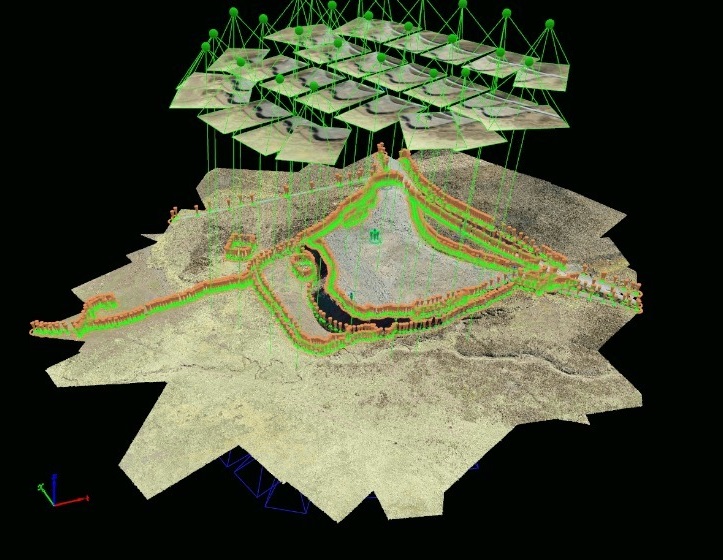
The study of an area for a future action, mainly large public and civil constructions, is crucial in order to examine in detail the environment in which it will be developed. Drones allow to make revisions and visually detect possible conditioning factors in the subsequent execution, in a fast way and with a high level of accuracy.
In addition, drones in this field allow us to obtain high quality images and videos that helps facilitate the presentation and analysis of the progress of the constructions.
