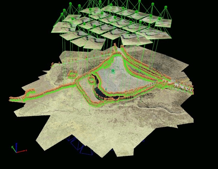
In the current era, marked by technological advancements and a growing demand for efficiency across multiple sectors, the combination of surveying services and drones has emerged as a perfect alliance. This synergistic collaboration between surveying and drone technology has unlocked a wide range of applications and opportunities that are radically transforming the way we approach supervision, construction, and planning projects.
The use of drones in surveying is extremely versatile, and while their applications are varied, they particularly excel in construction and facility monitoring. At Acero Estudio, a company specialized in surveying, we have recognized the potential of this combination and have successfully implemented it in numerous projects.
A critical aspect in the preparation of any project, especially in the realm of large-scale public and civil works, is the meticulous study of the environment where the future action will take place. Precision and comprehensive understanding of terrain conditions are essential to ensure construction success and to avoid potential complications or delays in the process. This is where drones make their triumphant entrance, allowing for quick and precise detailed inspections and visual detection of potential obstacles.
The speed and efficiency of drones in this context are unparalleled. Before the era of drones, collecting topographic data involved lengthy manual procedures and costly ground operations. However, with the deployment of drones equipped with advanced sensors, surveying has become much more accessible and efficient. Drones can fly over extensive areas in a matter of minutes and provide detailed data ranging from terrain topography to the identification of key features such as buildings, roads, or vegetation.
One of the most notable benefits of using drones in surveying is their ability to capture high-quality images and videos. These images and recordings offer a precise visual representation of the current state of a work in progress, greatly facilitating the presentation and analysis of project execution progress. There is no longer a need to rely solely on abstract data or written reports; drones provide a comprehensive and detailed real-time view of the work.
This visual aspect is particularly useful for communication and collaboration in construction projects. Images and videos captured by drones can be easily shared with all stakeholders, from engineers and architects to clients and regulatory authorities. This transparency and clarity in data presentation can help avoid misunderstandings, clarify doubts, and streamline decision-making, thereby contributing to keeping the project within the established schedule and budget.
Furthermore, the use of drones in surveying extends beyond monitoring ongoing works. They are also employed in the initial planning stages of projects, allowing for a detailed assessment of terrain conditions before the first stone is laid. This is essential for identifying potential geographical or environmental challenges that may arise during construction. The ability to anticipate and address these challenges from the outset can prevent costly setbacks and design modifications later in the process.
Another significant advantage of drones in surveying is their ability to conduct periodic inspections and track project progress. Scheduled flight repetitions throughout the project allow for close monitoring of construction evolution and detection of any deviations from the original plan. This real-time tracking capability enables more effective resource management and a quick response to any issues that may arise during construction.
The integration of surveying and drones in the construction industry has proven to be a winning combination. The precision, efficiency, and ability to present detailed visual data offer invaluable value in the planning, monitoring, and execution of construction projects. In summary, the synergy between surveying and drones is paving the way for a more efficient and accurate future in the construction industry, benefiting all parties involved and ultimately the quality of the infrastructures we build.
Contact us to learn more about our surveying services as well as drone photogrammetry. We are at your service.


