How We Accelerate Our Topographic Surveys with 3D Laser Scanning

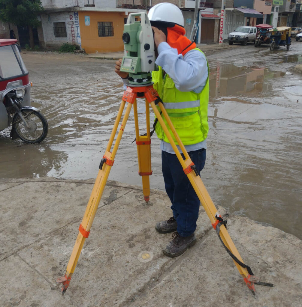
estudio de topografia con laser escaner 3d

Traditional surveying techniques are being enhanced by new technologies like 3D laser scanning. Advances such as this allow us to capture the geometry of terrain or objects with high precision through the emission of laser pulses.

Its operation is based on the principle of active remote sensing, which involves emitting radiation that is then analyzed by various sensors receiving the reflected signals to determine distances. In the construction and architecture sectors, where projects seek to optimize time, this technology improves efficiency, increases accuracy, and provides a fast and detailed alternative to conventional methods.

SPEED WITH PRECISE MEASUREMENTS

Compared to conventional surveying, which relies on equipment like total stations and high-precision GPS while also being prone to human error, 3D laser scanning enables faster surveys with a higher density of data points and minimal interference. While traditional techniques require point-by-point surveying, laser scanning generates clouds of millions of points in minutes, resulting in a highly detailed and precise three-dimensional representation. Additionally, it reduces the likelihood of human errors and minimizes the need to return to the site for additional data collection.

BETTER DATA PROCESSING

When it comes to data processing and its conversion into models, the benefits continue. The results obtained through 3D laser scanning optimize data processing, enabling the creation of dense digital models (more complete point clouds) of the terrain and three-dimensional representations ready for analysis in specialized software in a shorter time.

In other words, the workflow is streamlined—from data collection to processing and model generation. Every step leads to improved efficiency, cost savings, and time reduction, prompting us to rethink work methods and always offer the best techniques to benefit your company.

If you’re looking for innovative solutions in surveying services, Acero Estudio, a leading surveying company in Spain and Peru, is the ideal provider for your project. We specialize in topographic surveys using 3D laser scanning and offer consulting and surface analysis services for the construction and architecture sectors.

Contact us today to provide you with tailored solutions and optimize your projects with cutting-edge technology.

Geomatics and Its Studies: Photogrammetry, Topography, Geodesy, and Cartography

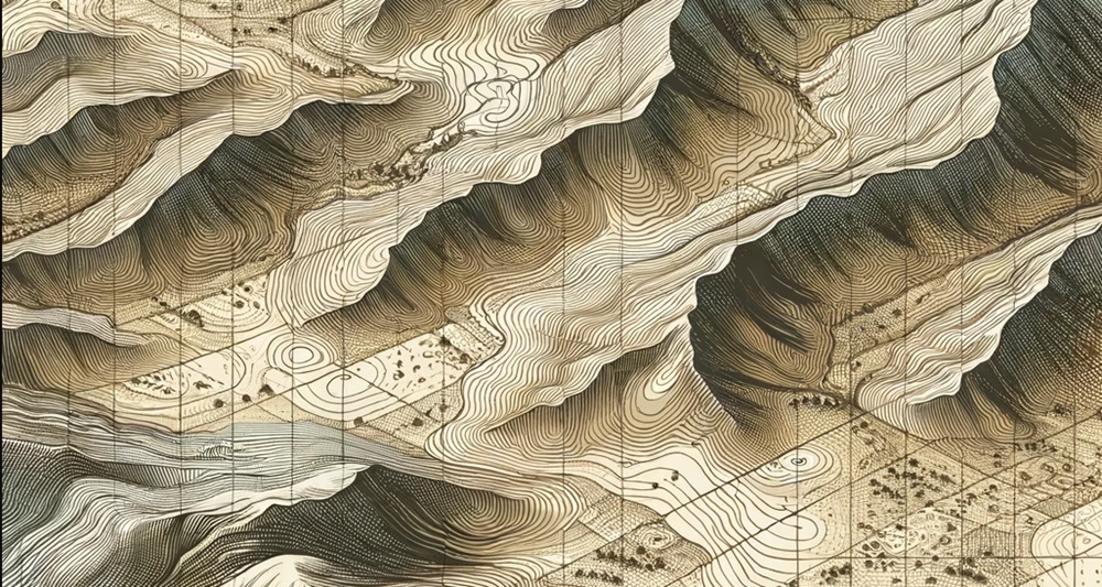
geometic and its studies photogrammetry, topography geodesy an cartography

Geomatics is a broad field of study that encompasses various disciplines dedicated to the study and representation of the Earth’s surface. These disciplines emerged throughout history out of the need to measure and accurately represent the world.

From ancient Egyptian and Greek civilizations, which used rudimentary tools for land measurement, to more recent times when methods were refined with instruments like the theodolite, these disciplines have evolved alongside technological advancements. Today, thanks to digitalization, the use of drones, 3D laser scanners, and satellites, geomatics has reached an unprecedented level of precision and applicability.

Application Fields of Geomatics Disciplines

The study of land, terrain, and its characteristics is applied in various sectors such as civil engineering, construction, mining, urban planning, and environmental management. These studies provide detailed terrain information for infrastructure design, environmental impact assessments, and project optimization. Additionally, technologies such as drones and Geographic Information Systems (GIS) have significantly improved the collection and analysis of spatial data, making decision-making more efficient.

Although all these disciplines are related, each has its specific focus:

  • Photogrammetry is based on capturing images to obtain three-dimensional information about the terrain. In this field, Acero Estudio offers specialized drone photogrammetry services, providing an efficient and highly accurate alternative.

  • Topography measures and precisely represents the characteristics of a land surface in specific areas. If you need topographic surveying services, contact us—you will be amazed by our portfolio of completed topographic projects.

  • Geodesy studies the Earth’s shape and dimensions as a whole, allowing for the creation of geographic coordinate systems.

  • Cartography focuses on the visual representation of geospatial information through maps and plans.

As you can see, we offer services covering the main geomatic studies. If you need assistance in this field, contact Acero Estudio we are your best alternative for high-precision studies, providing innovative solutions with cutting-edge technology.

Contact us to learn how we can optimize your project with our tools and expertise.

Sectors and Applications Where CAD Remains Essential

bim vs cad

While it is true that the BIM methodology has experienced significant growth and momentum within the construction and architecture community, Computer-Aided Design (CAD) remains indispensable in multiple areas where 2D design, technical precision, and compatibility with industrial processes are priorities. Below are the main sectors where CAD continues to be essential, along with its specific applications:

Civil Engineering and Infrastructure Sector

  • Topographic plans, cross-sections, and structural detail drawings are still developed using CAD.

  • CAD remains widely used for the design of roads, bridges, and sewer networks.

  • 2D modeling of foundations, retaining walls, and steel structures is a common practice in this field.

Architecture and Construction

Although BIM now dominates this sector, CAD is still relevant for specific tasks, such as:

  • Development of detailed 2D architectural plans.

  • Creation of construction details, plumbing, and structural installations.

  • Fast editing and modification of plans in the early stages of design.

As you can see, BIM is growing, but CAD remains crucial in industries where 2D precision, manufacturing integration, and compliance with technical regulations are fundamental.

If you need BIM consulting or CAD outsourcing services, Acero Estudio is at your service. Contact us today to learn more about our solutions.

The Use of 3D Laser Scanning in Topographic Surveys

servicio de topografia con escaneo laser

The evolution of measurement technologies is opening new possibilities in terms of efficiency, speed, and accuracy. One of these technologies, which Acero Estudio offers as part of its topographic services, is 3D laser scanning, a highly effective tool that provides significant advantages over traditional methods such as total stations. Its ability to generate detailed terrain models with a density of more than 1,000 points per square meter in a short period (~30 min) makes it an ideal solution for large-scale and highly complex projects.

Greater Accuracy and Speed in Data Collection

Unlike surveys conducted with a total station, which require point-by-point measurements and long periods to cover large areas, 3D laser scanning enables massive data capture with exceptional speed. In projects involving road infrastructure, buildings, or urban surveys, this system generates detailed three-dimensional models, reducing the margin of error and optimizing the planning and execution of works. Additionally, as the size of the study area increases, the difference in execution time between both methods decreases, making laser scanning the preferred choice for large-scale projects.

Applications and Benefits of Laser Scanning in Topography

The 3D laser scanning system has a wide range of applications in engineering and geodesy. Its use is not limited to topographic surveys but has also been implemented in various sectors, such as:

  • Geodetic surveys of linear structures, such as roads, bridges, and tunnels.
  • Surface and terrain modeling, generating high-precision digital models.
  • Infrastructure inspection for deformation detection and structural stability analysis.
  • Archaeological, cultural, and architectural studies, facilitating documentation and heritage conservation.
  • Delineation and monitoring of water bodies, allowing the evaluation of changes in the level and shape of rivers, lakes, or reservoirs.
  • Slope stability analysis and geotechnical risk assessment, crucial in landslide-prone areas.

Thanks to its ability to capture detailed and precise information in record time, 3D laser scanning is expected to completely replace traditional total station measurements in many projects, improving efficiency and reducing operational costs.

Key Differences Between Laser Scanning and Total Stations

While total stations remain a useful method in certain scenarios, 3D laser scanning stands out for offering faster, more detailed, and digitized measurements. The main differences between the two methods include:

Aspect 3D Laser Scanning Total Station
Capture speed High, massive scanning in minutes Slow, requires point-by-point measurements
Data density >1,000 points per m² Individual point measurements
Level of detail High, generates precise 3D models Limited, depends on captured points
Data processing Automated and fast Manual and more labor-intensive
Applications Wide (engineering, archaeology, inspection) Mainly in traditional surveys

Both methods can be used in various fields of engineering and geodesy, but 3D laser scanning is emerging as the future technology for topographic surveys, terrain modeling, and infrastructure monitoring, offering an unparalleled level of detail and efficiency.

If you want to learn more about our topographic surveying, geodesy, or 3D laser scanning services, do not hesitate to contact us.

Reference

Advantages of Laser Scanning Systems for Topographical Surveys in Roads Engineering. The Baltic Journal of Road and Bridge Engineering, 11(2):153-159, June 2016. DOI:10.3846/bjrbe.2016.18. License CC BY.

What Equipment Do We Use in Mining Surveying?

instrumental que usamos en topografia minera

In the mining sector, surveying is a key component throughout the entire production process—from exploration, during extraction, and finally in mine closure—due to the benefits it provides in achieving efficient resource management in the extractive industry.

Thanks to the work of companies like Acero Estudio and its surveying services, mining companies can:

  • Accurately calculate the extracted and processed tonnage.
  • Recalculate proven reserves and optimize processes.
  • Effectively plan the continuity of their operations.
  • Reduce risks and comply with environmental and safety regulations.

What Equipment Do We Use in Mining Surveying?

While traditional tools like levels and total stations are always useful, the mining industry requires modern tools and cutting-edge technology. For this reason, at Acero Estudio, we focus on this sector by employing UAV (Unmanned Aerial Vehicles) or advanced drones equipped with high-resolution sensors. Using these innovative tools allows us to obtain detailed and reliable information in less time and with greater safety.

Drone technology is a key resource in mining surveying, as it significantly improves process efficiency and minimizes risks associated with working in unstable or hard-to-access terrains.

Advantages of Using Drones in Mining Surveying

  • Enhanced Safety: Drones enable surveyors to take measurements in unstable or hard-to-reach areas without exposing themselves to danger.
  • Faster Data Collection: Thanks to their advanced sensors, drones capture topographic information much faster than traditional surveying techniques.
  • Quick 3D Model Generation: The data collected allows for the rapid creation of precise three-dimensional terrain models, facilitating planning and decision-making.

Additionally, UAV drone technology enables us to project roads and new explorations based on the terrain’s characteristics. This is crucial in an industry where a significant portion of investment is dedicated to finding new deposits. Aerial surveying helps optimize access routes, assess project feasibility, and improve exploration logistics.

Finally, topographic information is essential for mine closure operations. Conducting topographic evaluations throughout the entire mining process is vital to prevent leaving areas exposed to landslides or floods. A proper terrain study during the closure phase helps mitigate environmental risks and ensures post-exploitation land stability.

At Acero Estudio, a specialized surveying company, we are committed to innovation and technology in mining surveying, ensuring precise results for our clients. Contact us, and let’s discuss how we can assist you.

Can Earthquakes Affect the Topography of an Area?

how the earthquakes affect topography

One of the most interesting questions we have received from our Peruvian clients in recent times is whether an earthquake can affect the topography of an area. This is an unusual but important question, especially since countries like Peru are located in a high seismic activity zone known as the “Pacific Ring of Fire.”

The answer is a resounding YES. Seismic movements directly impact topography and soil characteristics due to various phenomena that affect the terrain. These include:

Ground Movement and Rupture

Earthquakes can cause movement and displacement of the Earth’s surface due to waves generated by the friction of tectonic plates. These displacements can damage rigid structures such as buildings and bridges.

Formation of Scarps

Scarps are abrupt rock formations that appear to rise from the terrain due to seismic movement. These can form suddenly or along a fault line, serving as visible evidence of crustal deformation. Over millions of years, scarps can evolve into mountain ranges.

Liquefaction

In soils affected by moisture or with the presence of water, a phenomenon known as liquefaction can occur. This causes the ground to lose its consistency, leading to the total collapse of structures.

As you can see, earthquakes have a real impact on the ground and, consequently, on the topography of land, valleys, and mountainous areas. If you want to learn more about topography and how we can help you reduce construction risks in your projects (even in seismic zones), feel free to contact us and inquire about our topographic survey services.

Acero Estudio, as a company specializing in advanced topographic studies, is always at your service.

Integration of BIM with IoT: A New Level in Operations and Maintenance Management

bim and iot fusion to improve management and operativity of buildings

Until now, the most commonly known objective of BIM has been the creation of 3D models, whose benefits in risk reduction and efficiency are well established. However, integrating this methodology with other applications and technologies is opening up new and highly valuable possibilities.

Based on these ideas, this article explores the integration of BIM with the Internet of Things (IoT), an important dimension due to the opportunities it offers for building operation and management.

The Challenge of Building Operation and Management

One of the major challenges in building operation and management today is that these processes have traditionally relied on:

  • Experience and professional judgment
  • Visual information about potential risks or deteriorating structures

With the integration of BIM and IoT, we will move away from assumptions and empirical knowledge and instead focus on real-time data collected by various sensors. These sensors will provide accurate statistical data on:

  • Traffic flow
  • Temperature
  • Structural position (expansion, torsion, or other physical changes)

By combining this data with decentralized cloud-based databases and real-time reporting capabilities, we will be able to anticipate risks, develop energy efficiency strategies, and create plans to improve the movement of people within managed spaces, thanks to BIM.

Although it may still be early to fully grasp the potential of merging these technologies, their evolution is inevitable.

If you are looking to integrate BIM into your construction or building management activities, we invite you to contact Acero Estudio. We are specialists in BIM consulting services in Europe and Latin America. Let us help you develop your plans and turn your ideas into reality.

Key Trends in BIM Consulting

equipo de profesionales conversando sobre un proyecto BIM

With the reduced availability of global credit and cheap money worldwide, both countries and companies are becoming increasingly cautious with their construction and engineering projects. In this context, one of the key tools for achieving efficiency is the BIM methodology, which, as we have seen, offers numerous advantages in reducing errors and maximizing efficiency.

However, this methodology has intertwined with various new techniques, technologies, and ways of thinking that present challenges but, above all, opportunities. Let’s explore the main technologies that are driving significant changes in the BIM methodology.

estructura en bim

Trends in BIM Consulting

  • Implementation of BIM across different construction specialties, including infrastructure construction, industrial construction, and the maintenance of built assets. This highlights the importance of the BIM methodology and, most importantly, its versatility in being efficiently applied across a wide range of fields.
  • Integration of BIM with promising technologies such as the Internet of Things (IoT), augmented reality (AR), virtual reality (VR), and artificial intelligence (AI). These technological complements are making projects more efficient, from planning to management.
    • AR: Before the construction phase, AR applications allow us to stand in front of an empty site and visualize/project a building that does not yet exist.
    • VR: With virtual reality, we can enter the site before construction begins, walk through the environment, and experience its infrastructure—all in digital format but with the realistic 3D experience provided by platforms like Oculus.
    • IoT: A digital twin without real-time data would be incomplete. Thanks to sensor networks, the Internet of Things enables increasingly realistic digital twins that provide valuable information for infrastructure usage and strategic planning.
    • AI: Artificial intelligence plays a crucial role in detecting errors, calculation failures, or other issues that may escape human oversight and could impact the building’s integrity.

Smart Cities with Efficient Urban Planning

This is the ultimate goal of BIM—integrating buildings into interconnected systems, creating efficient cities where each project harmoniously integrates with its surroundings while meeting the specific requirements of the development.

We can affirm that what we consider cutting-edge technology is still evolving. Contact Acero Estudio, a company specializing in BIM Consulting, and we will gladly guide you toward more agile and efficient projects, ensuring that every element (foundation, column, beam, etc.) is placed with minimal risk and the highest certainty in terms of resistance, durability, and construction quality.

We are at your service.

Topography and Its Importance in the Knowledge of Alluvial Basins

estudio de canales aluviales con la topografia

Since it is currently the rainy season along the Latin American coast, this article is highly relevant and well-contextualized for the first three months of the year.

Among the lesser-explored functions of topography is that it enhances the understanding of soils and their stability characteristics. This knowledge is essential for accurately calculating the volumes of material carried by rain during specific periods of rainy years.

The proper evaluation of these phenomena allows us to understand soil behavior in response to water erosivity and its sediment transport capacity, which directly impacts the design and maintenance of natural and artificial channels.

To estimate sediment contribution in basins, the empirical Gavrilovic model (Gavrilovic 1959, 1988; Zemljic 1971) is employed, widely used in hydrology and geotechnical studies. This model enables the calculation of annual sediment production by considering variables such as precipitation erosivity, geological and edaphological characteristics of the terrain, land use, and slope.

Thanks to this methodology, it is possible to obtain a reliable estimate of the amount of sediment transported by waterways during intense rainfall events, contributing to better planning of mitigation and erosion control measures.

These types of studies are fundamental for improving knowledge of alluvial flows, allowing for the reduction of their impact and risks on urban and transportation infrastructure. The accumulation of sediments in channels and reservoirs can cause blockages, reduce storage capacity, and increase the risk of flooding. Therefore, the application of topographic techniques and mathematical modeling is key in designing preventive and corrective solutions for efficient water resource management and the protection of hydraulic structures.

At Acero Estudio, as a topography company, we specialize in topographic survey services and are at your disposal to conduct detailed studies that ensure an adequate understanding of the terrain and its dynamics. Contact us and ensure the reliability of your projects with our team of experts.


What are Workflows in BIM?

mujer trabajando en un modelo bim

Workflows in BIM (Building Information Modeling) are structured processes and procedures that enable the creation, management, and use of 3D digital models in construction projects, where a team is responsible for generating and supervising a model.

Their purpose is to enhance communication among different professionals involved, reduce errors, and improve efficiency in the design, planning, and execution of a project.

Advantages of Using Workflows in BIM

  • Facilitate real-time data integration
  • Improve collaboration among multidisciplinary teams
  • Reduce costs caused by errors or rework
  • Provide better visualization of the project before construction, aiding decision-making
  • Minimize compliance-related issues

There are various types of BIM workflows, tailored to the needs of each project and team. Some focus on the coordination of disciplines (architecture, structures, and installations), while others prioritize data management and integration with other technologies.

Unlike CAD or software development workflows, which focus on producing static files or lines of code, BIM digital models aim to integrate and evolve throughout the project.

To achieve an efficient BIM workflow, it is advisable to have specialized BIM consulting that guides the implementation of standards, tools, and appropriate methodologies. Poor management can lead to modeling errors, incompatibilities, or coordination issues that affect the project’s success.

Acero Estudio, a company specialized in services for the design, architecture, and construction sectors, offers personalized solutions to ensure an optimal workflow aligned with the best practices in the industry. Do not wait, contact us, we are at your service.