
Drones in Infrastructure: State of the Art and Future Perspectives
While it is true that we often see drones as fun tools, in the last [...]
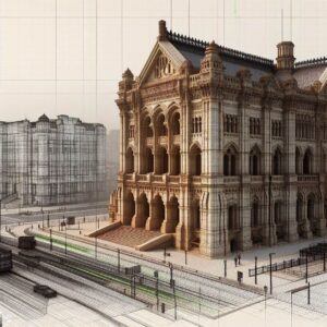
How 3D Laser Scanning Revolutionized Architecture Projects
The continuous advancement of technology has radically transformed the way in which architectural projects are [...]

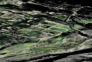
Practical uses of photogrammetry in sustainable ecosystem management
such as reserve parks, forests and jungles. In a world where illegal logging, deforestation and [...]
What software is used in drone photogrammetry?
Drone photogrammetry is a technique that has gained a lot of popularity in various industries [...]
Our 3D Laser Scanning Process using the Faro Focus Laser
When it comes to preserving and analyzing a historic building, the 3D laser scanning process [...]

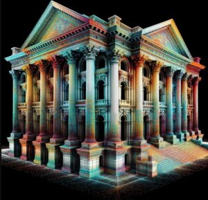
The 3D Laser Scanner: Capturing the world in a point cloud
The 3D laser scanner, one of Acero Estudio’s services, has a remarkable capacity to generate [...]
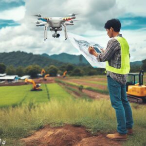
Aerial Photogrammetry: Capturing the World from Above
In this article, we will learn how the process of photogrammetry with drones, also known [...]
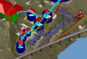
Benefits of Aerial Photogrammetry in Infrastructure Construction
Aerial photogrammetry also known as drone photogrammetry. This technique, which uses aerial and ground images [...]
Photogrammetry with Drones and its advantages for Urban and Rural Digital Restitution
One of the most requested technologies from Acero Estudio is photogrammetry with drones, a set [...]
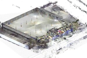
Warehouse refurbishment and 3D laser scanning
With our experience in 3D laser scanning service we provide our client with the necessary [...]
