One of the most requested technologies from Acero Estudio is photogrammetry with drones, a set of methods, software and hardware (with drones) that is not only changing the way civil projects are executed but also speeds up and achieves greater efficiency in construction projects. digital restitution in urban and rural areas.
The representations achieved through photogrammetry enable the creation of accurate digital representations while enabling a number of key benefits for project planning and development in these diversified environments.
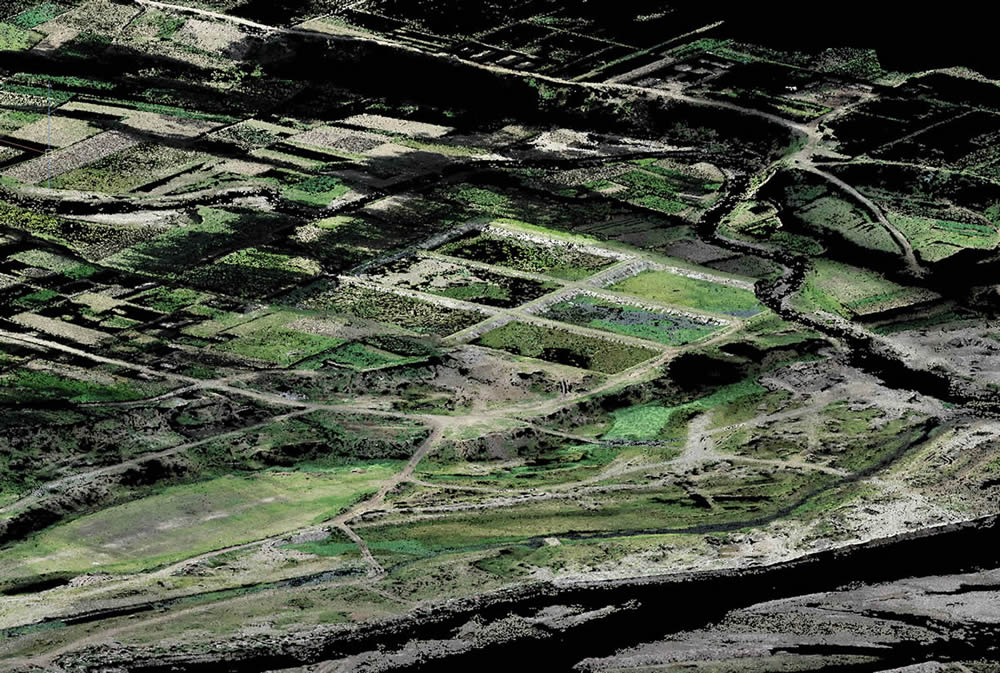
Creating accurate 3D models
Drone photogrammetry offered by Acero Estudio, a company specialized in photogrammetry and BIM, stands out for its ability to generate precise and detailed three-dimensional models of urban and rural areas. This is achieved by capturing multiple aerial images from different angles and altitudes, which are then processed to create a digital model of the terrain. This digital model, often known as an orthophoto or mosaic, serves to achieve a faithful digital representation of the area in question.
Practical Case
A municipality needs to update its urban plan to allow for sustainable growth. Thanks to photogrammetry, an accurate digital representation of the city can be created, including buildings, streets, vegetation and bodies of water. This digital representation will serve as a basis for future analysis and planning.
Efficient Planning
The availability of accurate digital representations is very useful for effective planning in urban and rural environments. Data generated through drone photogrammetry allows planners and designers to make informed decisions about infrastructure siting, natural resource management, and land use planning. This significantly reduces the margin of error, minimizing risks associated with any large project.
Practical Case
In a region prone to flooding, photogrammetry is used to generate various digital representations that are very useful to identify flood-prone areas, allowing corrective and protective measures to be taken in the surrounding areas.
Change Analysis
Drone photogrammetry allows for monitoring changes over time. This is especially valuable in constantly evolving urban and rural environments. Drones can perform regular inspections to capture updated images and detect significant changes to the landscape or infrastructure.
Practical case
A municipality seeks to evaluate the impact of an urban development project and for this drone photogrammetry can be used to track the evolution of the area over several years. This allows them to make data-driven decisions and adjust their planning as necessary.
Access to Remote Areas
In difficult-to-access rural areas, drone photogrammetry becomes an invaluable tool. Drones can reach remote and hard-to-reach places, allowing data capture in mountainous areas, dense forests or rugged terrain. This expands the possibilities of collecting accurate information in environments that were previously inaccessible or expensive to study.
Practical Case
In the preservation of remote natural areas, drones can be used to monitor the health of the ecosystem and detect signs of deforestation or erosion in places that are difficult to access or at risk for people.
If you want to know more about photogrammetry or other services that Acero Estudio offers, do not hesitate to write to us, we are here to support you in your construction or engineering projects in adverse environments.
