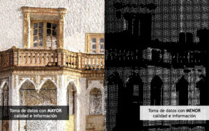
Not all 3D laser scans are created equal
When performing a 3D laser scan, we have to take into account different parameters such [...]
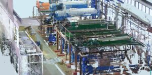
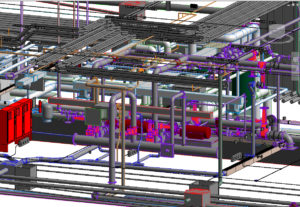
Digital twin
A digital twin is a virtual replica of an infrastructure or building that allows you [...]
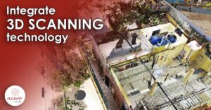
Integrate 3D scanning technology
The size of the global 3D scanning market was valued at over US$5 billion in [...]
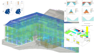
Energy and environment analysis using BIM technology.
Environmentalists have sounded the warning bells, we have no choice but to make our buildings [...]
More flexibility in 3D laser scanning
When capturing the environment using a 3D laser scanner, it often makes sense to combine [...]
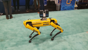
The laser scanner like never seen before
Capturing the environment using a 3D laser scanner sometimes becomes an arduous task due to [...]

The essential support of drones
Drone technology is advancing at exponential rates and is becoming more and more accessible, so [...]

Outsourcing BIM
Take advantage of the knowledge, experience and commitment of a company with more than 20 [...]
Digital transformation is gaining strength in Peru
A couple of years ago, the BIM Peru Plan was proposed in the National Competitiveness [...]

BIM and “Blockchain” combination
The Spanish construction company FCC has completed in Dublin the first project in the world [...]
