
Differences Between Topographic Levels and Types of Leveling

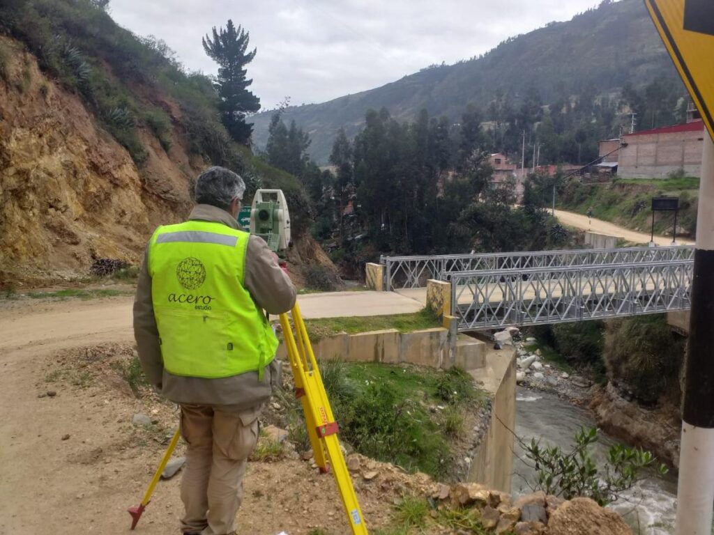
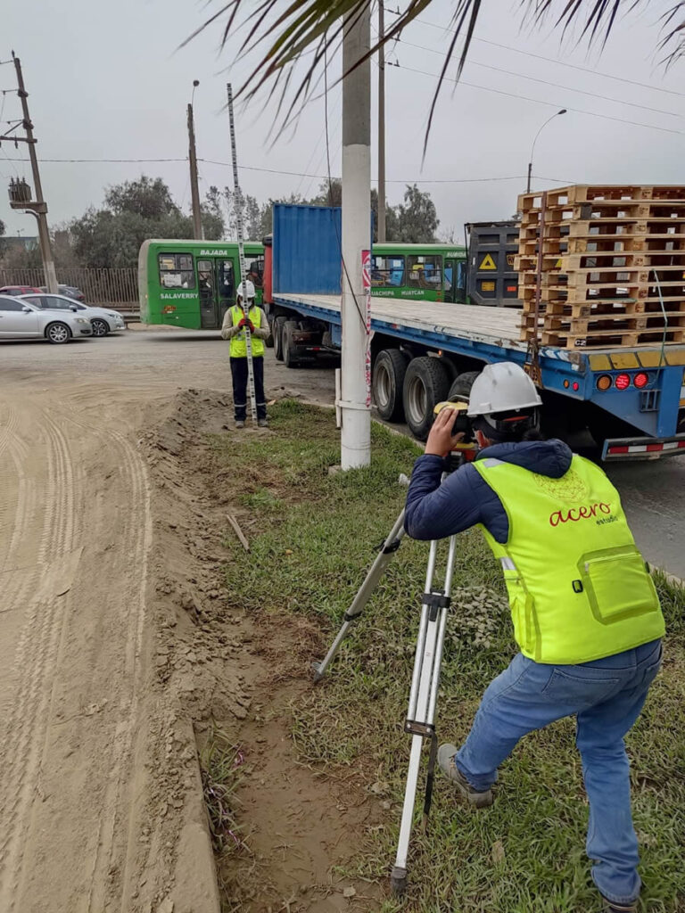
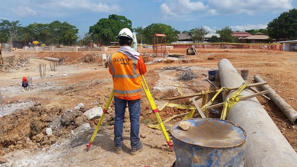
realizando un levantamiento topografico

Among our clients, we’ve noticed an interest in clarifying the differences between topographic levels (tools) and leveling methodologies (procedures).

Types of Topographic Levels

In the field of topography, using different types of levels is essential for ensuring accuracy in height and distance measurements. Each type of level has its own purpose and characteristics, and its selection depends on the specific needs of the project.

Plane Levels
Plane levels, also known as optical levels, are primarily used to measure the horizontality of a terrain. This type of level requires the operator to manually adjust the instrument to make it horizontal before taking readings. They are ideal for simple leveling projects where it’s necessary to ensure that a surface is level in relation to a horizontal plane. They are widely used in construction and landscaping projects where ensuring the land or structural elements are perfectly level is necessary.

Line Levels
Line levels are more precise instruments that project a horizontal line on the ground, facilitating the alignment of structures across a surface. Unlike plane levels, they don’t require constant adjustments, making them faster and more efficient in repetitive alignment tasks. They are used in infrastructure projects, such as the installation of pipes or the alignment of pillars, where precision in height and alignment is crucial.

Automatic Levels
Automatic levels, also known as self-leveling levels, are the most advanced. They use a compensator that automatically adjusts the instrument to achieve perfect horizontality, eliminating human errors. They are extremely precise and are used in large-scale projects where accuracy is vital. This type of level is very common in civil engineering projects, road construction, and high-precision topographic surveys.

Types of Leveling

Leveling, the process by which the height difference between points on the ground is determined, can be carried out in various ways.

Trigonometric Leveling
Trigonometric leveling is based on trigonometric calculations using angles of elevation or depression and horizontal distances to determine the height of one point relative to another. This method is useful in rugged terrain or when the distances between points are long. It is employed in projects that require measuring height differences in uneven terrain or mountainous areas.

Height Leveling
Also known as geometric leveling, this is the most common method in topography. It consists of the direct measurement of height differences between several points using instruments like the automatic level. It is the most precise method and is used when high accuracy is required. It’s ideal for building construction, roads, and infrastructure projects that require precise height data.

Barometric Leveling
This type of leveling uses atmospheric pressure to estimate the altitude of different points. While it is less accurate than other methods, it is useful for preliminary studies in large areas. It is used in extensive topographic studies where millimetric precision is not required, such as in geographic explorations or environmental surveys.

Simple Leveling
Simple leveling involves measuring the height difference between two points using a handheld level or basic instrument. It is suitable for small projects where it is necessary to quickly determine the slope of the terrain. It is used in the construction of small lots, post installation, or landscaping projects.

Why Choose Acero Estudio as Your Topography Service Provider?

Acero Estudio is a company specialized in topographic surveys with over 10 years of experience in the industry. We use the most advanced technologies, such as drones for photogrammetry, and apply precise leveling methods to guarantee the accuracy of our work in all types of projects. Our team of experts is ready to offer personalized solutions tailored to each client’s needs.

If you’re looking for a reliable company for your next topographic project, contact Acero Estudio. We are ready to provide you with the best service in topographic surveys and drone topography.


Is a Topographic Survey Necessary for Building Construction?

levantamiento topografico para construcción de edificios

The answer to this question is YES.

A topographic survey is an essential study for the construction of any building, regardless of its size or location. This study provides architects and engineers with an accurate and detailed view of the area. Through a topographic survey, it is possible to plan actions related to the project, such as earthworks and foundation design. Additionally, a topographic survey can influence the design and construction of the structure. Even in areas that appear flat at first glance, a topographic survey is crucial to ensure that the building’s foundations are correctly placed, preventing future structural issues.

Why Should I Conduct a Topographic Survey in an Apparently Flat Area?

A terrain that seems flat to the naked eye may conceal various irregularities, such as slopes, changes in soil type, or even the presence of underground water bodies. A professional topographic survey helps identify these and other factors, ensuring that the building’s design adapts perfectly to the natural characteristics of the land. Moreover, it ensures proper drainage and soil stability, minimizing the risks of settlements or landslides that could compromise the building’s integrity.

Risks of Constructing a Building Without a Topographic Survey

Building without an adequate topographic survey can lead to a series of serious problems, including:

  • Unevenly settled foundations
  • Inadequate drainage leading to soil erosion issues
  • Errors in the alignment of the building
  • Additional costs due to unforeseen construction errors
  • Environmental impact

What Type of Topography is Recommended for Building Construction?

For the construction of a building, several types of topographic studies are recommended, such as:

  • Topographic survey with planimetry and altimetry
  • Geodetic survey
  • Survey with LIDAR or photogrammetry
  • Soil study

In summary, a topographic survey is a 100% necessary study for any type of construction. It is also advisable to conduct progressive topographic surveys as the construction progresses to avoid errors.

If you need to contact a topography company, we invite you to reach out to Acero Estudio. We have 25 years of specialization in topographic services and surveys in Peru and Spain. We use cutting-edge technology and techniques, including our topography services with drones and drone photogrammetry.

Contact us today – we’re here to help!

What Are the Marks Drawn During a Topographic Survey For?

puntos de levantamiento topografico

As you already know, topographic studies are of great utility to the construction and architecture industry as they provide the basic initial information necessary to undertake any construction or engineering work. With this in mind, it is important to consider that any project must have a serious topographic study before laying the first stone or even before creating a plan.

The Importance of a Topographic Survey Before Architectural Plans

The discipline of architecture involves the projection of elegant and beautiful constructions, but more than that, it consists of creating practical, useful, durable, and functional buildings.

Topography supports architects by providing the most relevant information so these professionals can develop their plans as adequately as possible. Consider, for example, the slope of the land and its importance for the design of sanitary installations. If the topographic plan does not provide this information to the architect, they will not be able to correctly locate bathrooms, drains, cisterns, etc. In this case, the lack of a topographic survey could lead to a series of problems resulting from an improvised plan.

Another paradigm is land with a diagonal slope. In this case, the architectural plan must consider not only the calculations for the front slope but also for the lateral slope, which will be necessary for the execution phase to make the necessary projections in earth movements, material acquisition, and other activities prior to construction.

Purpose of the Marks Made During a Topographic Survey

Now, let’s return to the topic of this article: the importance and purpose of the marks drawn on the ground during a topographic survey. These are reference points that serve both architects and engineers in developing their design and construction plans. These marks can be made from various materials such as wooden stakes, nails, tapes, paint, or chalk on the ground. It is important that they are made with visible and durable materials that allow surveyors and other construction professionals to identify these guide points.

What Relationship Do the Marks Have With Plans and Construction?

They have a direct relationship. The data collected and marked on the site is transferred to detailed plans that faithfully represent the terrain and its characteristics. These plans are essential for architects, engineers, and builders to have an accurate representation and location of the site on which the construction work will begin.

In the construction process, the marks allow workers to know exactly where to place foundations, structures, and reinforcements; they facilitate the alignment and leveling of the constructions and ensure that everything is built according to the design specifications. In other words, it is important to have them to guarantee that structures are built accurately and safely.

If you want to learn more about our topography services, contact Acero Estudio, a consulting company specialized in services for the construction and architecture sector.

Uses and Characteristics of the Total Station in Surveying

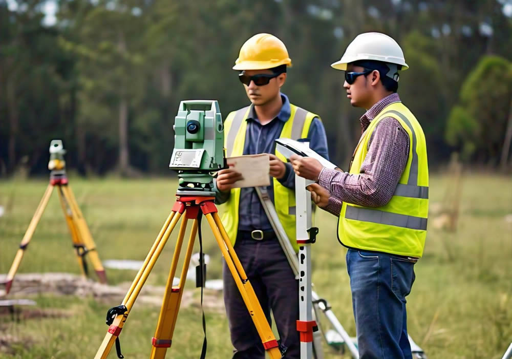
estacion total en la topografía

The total station is an essential tool in surveying due to its versatility and ease in measuring distances and angles. This tool combines the functions of a theodolite and a distance meter, allowing for the precise measurement of horizontal and vertical angles. Below are the main features and uses of this important tool:

Main Functions

Angle Measurement: The total station is capable of measuring horizontal and vertical angles with high precision, essential for the exact delineation of points on the Earth’s surface.

Distance Measurement: Equipped with laser technology, this device can measure distances with an accuracy of up to 1 mm, facilitating the acquisition of exact data.

Coordinate Calculation: Using trigonometry and triangulation, the total station determines the coordinates of specific points, providing values for (x), (y), and (z) (altitude).

Data Storage: This instrument includes internal memory or an electronic notebook to store and process the collected data, improving efficiency and accuracy in fieldwork.

Applications

  • Construction: Fundamental for the planning and execution of construction projects, ensuring that structures are correctly positioned according to designed plans.
  • Cartography: Used in creating detailed maps, providing precise information about the terrain’s topography.
  • Civil Engineering: Essential for the design and construction of infrastructure, ensuring that projects are carried out with precision and according to technical requirements.
  • Topographic Surveys: Crucial for determining the shape and characteristics of the terrain, facilitating informed decision-making in development projects.

Comparison with Other Instruments

Total Station

  • Functions: Combines a theodolite and an electronic distance meter, allowing simultaneous measurement of angles and distances.
  • Uses: Ideal for detailed topographic surveys, construction, and engineering projects.
  • Advantages: High precision, electronic data storage, and the ability to calculate coordinates directly.
  • Disadvantages: More expensive and requires specific training.

Theodolite

  • Functions: Measures horizontal and vertical angles but not distances.
  • Uses: Used in surveying to measure angles in complex terrains.
  • Advantages: Precise in angle measurement, more economical than the total station.
  • Disadvantages: Does not measure distances electronically, which may require additional tools.

Electronic Level

  • Functions: Measures height differences between points using a laser beam or an optical level.
  • Uses: Common in construction for leveling land and structures.
  • Advantages: Easy to use, fast, and precise in height measurement.
  • Disadvantages: Does not measure angles or horizontal distances.

Summary of Differences

  • Total Station: Measures angles and distances electronically, ideal for complex projects.
  • Theodolite: Measures only angles, suitable for tasks that do not require distance measurement.
  • Electronic Level: Measures heights, perfect for leveling in construction.

As noted in this brief compendium of information, the total station stands out as an integral tool in modern surveying, offering precision and efficiency in measuring angles and distances. Its angle measurement, distance measurement, and data storage capabilities also make it useful in construction projects, cartography, civil engineering, and topographic surveys.

Contact us, at Acero Estudio we are specialists in topography surveys and services for the construction and architecture industry.

Types of Leveling in Surveying

servicio topografico de nivelacion geométrica

Leveling is an essential technique in topographyc surveying, as it allows for the precise determination of the relative height between specific points on a given plot of land. This practice is key in the planning and execution of engineering, construction, and cartographic projects, as it provides crucial information about the terrain’s relief. This, in turn, facilitates the design of structures that adapt to the site conditions and optimizes the calculation of necessary earthworks.

Additionally, understanding the slopes of the terrain is fundamental for the architectural development of a project. This knowledge enables the proper design of vital infrastructure, such as sanitary systems, which rely on a minimum slope to ensure the correct flow and evacuation of fluids. In areas with steep inclines, the topographic data obtained through leveling is indispensable for determining whether cut and fill operations are required or if stepped constructions will be used to take advantage of the natural topographic features.

Below, we will explore the different types of leveling used in surveying, each with its characteristics and applications:

Geometric Leveling

Also known as differential leveling, it is one of the most precise and commonly used methods in surveying. This method is based on the use of an optical or automatic level and a leveling rod to measure the difference in height between two points. It is carried out by establishing a horizontal line of sight and reading the elevations at different points.

It is commonly used for:

  • Civil engineering and construction projects
  • Road and railway construction
  • Installation of public utilities

Trigonometric Leveling

This method is based on the use of angles and distances measured with a theodolite. It involves measuring vertical and horizontal angles along with the distance between points of interest to calculate the height difference using trigonometric formulas. This method is especially useful in rugged terrains where geometric leveling can be difficult to implement.

This method is suitable for:

  • Mapping mountainous terrains
  • Geological and mining studies
  • Installation of telecommunications towers and power lines

Barometric Leveling

This method uses atmospheric pressure to determine the elevation of different points. It employs barometers or altimeters to measure air pressure at various locations and then calculates the height difference based on pressure variations. Although less precise than other methods, it is useful for preliminary surveys and in extensive areas where other methods would be impractical. It is commonly used in:

  • Geographic explorations
  • Environmental studies
  • Topographic surveys in remote areas

GPS Leveling

This method uses satellites to determine the elevation of specific points relative to sea level. It employs GPS receivers to capture signals from multiple satellites and calculate the height using complex algorithms. GPS leveling is increasingly popular due to its high precision and ability to cover large areas quickly.

It is optimal for:

  • Digital mapping
  • Topographic surveys in large infrastructure projects
  • Monitoring and managing natural resources

Hydrostatic Leveling

This method uses the principle of communicating vessels to determine height differences. It involves using a tube filled with liquid (usually water) that connects two points. The height of the liquid at both ends of the tube is measured to calculate the height difference between the points. It is a simple and effective technique for short distances and in areas where other methods are impractical. It is especially useful for indoor installations, leveling buildings and structures, and adjusting machinery and equipment, where the simplicity and economy of the method are significant advantages.

In conclusion, the choice of leveling method in surveying depends on several factors, including the required precision, terrain characteristics, the extent of the area to be covered, and available resources. Each method has its own advantages and applications, so it is essential to consult with specialists to determine the most appropriate method for each case.

Contact Acero Estudio and request more information about our topographyc surveying services; we are here to help you realize your projects.

Why We Recommend Our Drone Topography Service

benefits of drone topography

The discipline of topography is constantly evolving; however, it is in recent years with the emergence of drones that this important branch of engineering is undergoing significant changes in the way topographic data is collected and recorded.

In this article, we will explore the advantages of drone topography and compare it with traditional methods.

Speed

Drones equipped with LiDAR (Light Detection and Ranging) sensors and high-resolution cameras can collect topographic data at a much faster and more efficient rate than traditional surveying services. Additionally, the results of a topographic survey conducted using these means are highly accurate.

In road construction projects, where a traditional surveying team might take weeks, drones equipped with LiDAR can complete the work in just a few days, allowing engineers to start the design and architecture phase much more quickly.

Precision

Drone topography is precise and detailed thanks to high-definition sensors and cameras. These data are processed using software such as photogrammetry software, which creates accurate three-dimensional models of the terrain.

An example of the precision and reliability of drones is that, thanks to their multispectral cameras, they can even detect areas with higher or lower humidity to provide maximum information to the project engineers.

Safety

Drone topography allows us to access remote areas, rocky slopes, or areas with dangerous cliffs while maintaining the safety of the human team and allowing us to collect data in difficult or inaccessible terrain.

An example of this is found in the mining industry, where drones fly over dangerous areas, such as steep slopes or recent excavation areas, to conduct detailed inspections without endangering the safety of personnel.

Contact Acero Estudio, inquire about our drone topography service, and let’s kickstart your project with the utmost efficiency and safety.

Factors Influencing the Price of a Topographic Survey

factors-influencing-the-price-of-a-topographic-survey

If you’re looking for a company that provides professional topography services, you’ve come to the right place. At Acero Estudio, we offer professional topography services, and one of the questions we commonly receive is related to pricing. How much does a topographic survey cost, and what factors determine the price?

The answer to this question is that the price can vary considerably depending on several key factors that need to be considered. These factors may include the area to be surveyed, the complexity of the terrain, and the level of detail required by the client.

Area Size

The size of the area to be surveyed is one of the main determinants of the cost of a topographic survey. The larger the area, the more time and resources will be needed to complete the work, which can significantly influence the final price.

It’s also important to consider the complexity, which plays a crucial role in determining the price. There are areas with complicated topographic features, such as steep slopes, dense vegetation, or the presence of bodies of water, which may require special surveying techniques and greater effort from the surveying team, inevitably affecting the project’s cost.

Finally, a high level of detail can also influence the price. Some projects may require a high degree of detail in their topographic map, which requires a greater number of control points, implying more meticulous work from our team and therefore incurring higher costs.

Characteristics to consider when hiring a topographic services company

characteristics-to-consider-when-hiring-a-topographic-services-company

Do you have land ready for construction and need a company specialized in topographic services? Here we provide you with a list of requirements to consider when hiring the specialized provider. Remember that Acero Estudio meets all these requirements, so you can contact us if you need the advice of a company with extensive experience and presence in Europe and America.

Here are the five most important characteristics your topography provider should have:

  1. Proven experience:
    Experience is fundamental in the field of topography. A company with experienced professionals will have the knowledge, resources, and tools to address diverse challenges and offer effective solutions. Experience also entails understanding the most advanced technologies and industry best practices.
  2. Qualified professionals:
    The team of professionals is vital in any project; professionals are the indispensable human capital for developing ideas and turning data into information, so they must be highly qualified and well-trained in the use of topographic equipment and specialized software. The quality of professionals ensures the accuracy and reliability of the collected data, as well as the ability to interpret it correctly to inform decision-making.
  3. Cutting-edge technology:
    Science and technology advance rapidly, so a serious topography company is one that keeps up to date with the latest technologies in instrumentation and topographic software. This includes precise measuring equipment, drones, laser scanners, high-precision global positioning systems (GPS), and 3D modeling software. The use of cutting-edge technology allows for precise and detailed topographic surveys in less time, thus improving efficiency and costs for clients.
  4. Focus on quality and accuracy:
    Accuracy is the reflection of the quality of a topographic study; professionals and technology are important, but only to the extent that they contribute to the precision of the data, which will then be the cornerstone for the construction of a project and decision-making in its favor.
  5. Client communication:
    Each topographic project presents its own unique challenges, and each may have particular characteristics that the surveyor must understand before proceeding with their discipline. For these reasons, the team of the supplying company must have excellent communication strengthened by procedures and protocols that reduce margins of error.

It is worth noting that in addition to having all these characteristics, Acero Estudio also has the ability to adapt to tight deadlines, work in difficult environments, and offer customized solutions to meet the individual demands of each project. Contact us today, and we will start developing your topography projects at the time and place you decide; we are at your service.

The role of topography to achieve sustainable urbanism

ingeniero de acero estudio realizando un estudio topografico

Sustainable urbanism consists of achieving healthy and organized urban growth along with conservation of environmental quality. In this article we will learn how topography plays a fundamental role in providing crucial information for the design and planning of urban environments that are socially, economically and ecologically sustainable.

Let’s learn about the ways in which surveying services contribute to sustainable urbanism:

By identifying natural risk areas

When mapping the topography of a city it is possible to detect areas prone to adverse natural phenomena such as floods, landslides or soil erosion. This allows urban planners to make informed decisions about infrastructure development and housing placement to minimize impact.

Availability of natural resources

In addition to its usefulness in evaluating natural risks, topography provides valuable information about the availability of natural resources and the capacity of the land to support urban development. By knowing the topographic characteristics of a city, it is possible to identify areas with potential for the installation of solar, wind farms or water collection systems. All of this contributes to reducing dependence on fossil fuels, making human settlement and its resource management more sustainable.

Location of recreation areas

Thanks to the development of topography techniques, urban planners can collect important information that helps them locate the best areas for the development of urban infrastructure such as parks, sustainable mobility routes that allow reducing vehicle congestion and greenhouse gas emissions. greenhouse.

It is worth noting that in many of these cases, not only topography is important, but also the combination of this discipline with other areas of study such as architecture and urban planning so that synergies are generated and help in the creation of more sustainable, inclusive and resilient communities. .

Remember that by integrating topographic considerations into the urban planning process, cities can become healthier and more resistant to climate change. Contact Acero Estudio, a leading company in topographic surveys in Peru and Spain; we are at your service.

Is it possible to carry out surveying with drones?

is it possible to carry out surveying with drones

In recent years, drone surveying has gained prominence among surveying services due to its efficiency and accuracy. Various prestigious brands offer drones, equipped with specialized sensors and mapping technology, these tools facilitate the collection of detailed topographic data as well as data that can later be compared with already prepared plans or used to carry out other types of studies. This approach has proven valuable in topographic surveying, providing crucial information on elevations, slopes, and geographic features.

In addition to topographic surveying, drones are capable of generating three-dimensional models of the terrain. This 3D modeling capability not only makes it easier to visualize topography, but also improves analysis and understanding of the geographic environment.

Another notable application is surface change control. By carrying out periodic flights, drones make it possible to monitor alterations in the terrain over time, such as erosion, construction or any relevant modification.

In the field of project planning and design, topographic data obtained from drones is essential. Detailed information streamlines the decision-making process and contributes to efficiency in construction, engineering and agricultural projects.

Additionally, precision agriculture benefits greatly from drone surveying. These devices can perform elevation maps and analyze crop health, providing valuable data to optimize agricultural practices.

The most commonly used sensors in surveying drones include RGB cameras, multispectral cameras, LIDAR (Light Detection and Ranging) and ultrasound sensors.

Drone surveying offers significant advantages, such as reduced time and costs compared to traditional surveying methods. Additionally, the ability to obtain real-time data and flexibility in flight planning make this technology increasingly popular in various fields.

Contact us and request more information about our drone topography and aerial photogrammetry services, we are at your service.

Nuestra web está en reestructuración. Agradecemos su comprensión si algún componente del sitio no funciona correctamente. Para contactarnos escríbenos a: info@aceroestudio.com