Aerial photogrammetry and its advantages to create cadastral information

plano catastral generado mediante fotogrametria con drones

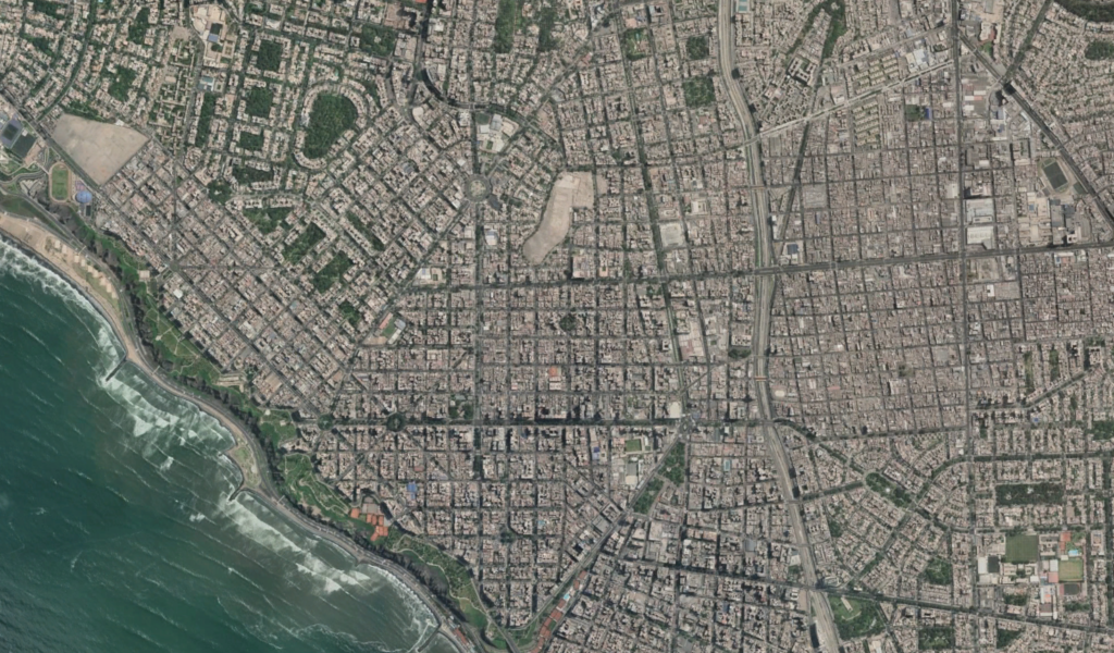
The cadastral information of a territory contains a series of data about the properties, that is: physical characteristics such as areas and delimitations, legal information such as ownership of the land and even an economic valuation of the approximate value of the properties.

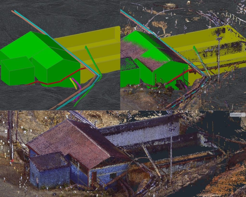
Thanks to photogrammetry it is now possible to create digitized models and records that provide exact information on the physical characteristics of properties and for this initial record to be used to add more data to said model.

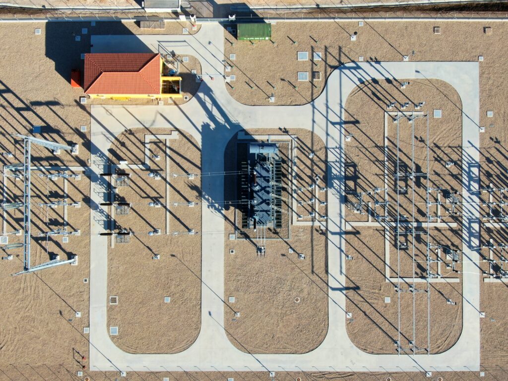
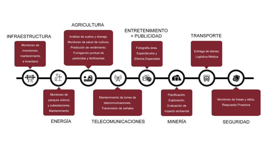
Thanks to our drone fleet, aerial photogrammetry has experienced a considerable improvement in efficiency and what previously could only be done with a small plane or helicopter is now within our reach. Graphic information capture technology, video cameras and other devices are all technological elements that have been improving over time and that today allow us to generate reliable cadastral information.

The Importance of good urban management

As is known, cadastral information is basic for carrying out adequate territorial management and urban planning; In this sense, having this information and using it translates into:

  • Better urban administration.
  • Greater resources and information for future city planning.
  • Greater knowledge of the needs met and not met at the infrastructure level.
  • Projection of number of inhabitants and demographic characteristics.
  • Better management and allocation of public spaces for services: educational, health, etc.
  • Transportation improvement and planning.

It is clear that cadastral management is essential to create a sustainable city, with services equitably provided and functional in terms of transportation. Do not hesitate to request information about our drone photogrammetry service in order to improve the cadastral registry; we are at your service.

Contact Acero Estudio, specialists in photogrammetry with drones and consulting services for architecture and engineering in Spain and Peru.

Drones in Infrastructure: State of the Art and Future Perspectives

dron sobrevolando un puente y realizando vigilancia aérea

While it is true that we often see drones as fun tools, in the last decade their use has amplified our capabilities in various areas. As drone specialists, at Acero Estudio we want to show how this important tool plays a vital role in infrastructure inspection today.

Aerial Photogrammetry: Capturing precise details from above

One of the most significant drone-driven advancements in infrastructure inspection is drone photogrammetry. This technique uses high-resolution cameras mounted on drones to capture detailed images from different angles, allowing the creation of accurate three-dimensional models of existing structures and facilitating the planning of new construction.

Large construction companies use aerial photogrammetry to evaluate the condition of bridges, roads and buildings, identifying possible structural problems early. Additionally, the ability to generate detailed models facilitates informed decision making during the design phase and reduces costs associated with manual inspections.

Monitoring and Surveillance of Works: Guaranteeing Safety and Efficiency

Drones equipped with thermal cameras and advanced sensors can closely monitor construction progress, identify potential safety risks, and provide real-time data to management teams.

Developed countries, such as the United States and China, have integrated drone systems to monitor large-scale construction projects, such as highway expansion and the construction of new facilities. This constant surveillance not only improves workplace safety, but also contributes to overall project efficiency by identifying and addressing issues in a timely manner. In the past, if you wanted to observe a work from the air, it was necessary to hire the service of a helicopter or light plane, but today, thanks to drones, this possibility is within our reach.

Infrastructure and its Impact on the Lives of Populations

Infrastructure plays a fundamental role in the quality of life of populations. From roads and bridges that facilitate transportation to water and energy supply facilities that sustain communities, these structures directly impact the well-being of society.

Large construction companies are using drones to inspect and maintain their critical infrastructure. For example, regular drone inspection of bridges not only ensures their structural integrity, but minimizes closure times and reduces traffic disruptions.

Future Perspectives: Automation and Collaboration with AI

As technology advances, the future prospects for drone infrastructure inspection become even more exciting. The integration of artificial intelligence (AI) will allow drones to analyze data autonomously, identifying patterns and anomalies without human intervention.

Fully automating infrastructure inspection using drones will not only improve efficiency, but also reduce the costs and risks associated with manual work in potentially hazardous environments. This points the way toward a more proactive and predictive approach to critical infrastructure maintenance.

As we move into the future, the collaboration between drone technology and artificial intelligence promises an exciting horizon for global infrastructure development and maintenance.

Advantages of using drones in construction

use of drones in construction sector

Advantages of using drones in construction

The use of drones for construction management has been growing exponentially in recent years. They offer many advantages in terms of tracking, surveillance and location inspection with good, faster and more accurate results.

Below, we present some of the main advantages provided by the use of drones in the construction sector.

Vista de profesional con el dron para la realización de la topografía del terreno
Drones provide various benefits for construction, engineering and architecture

1. Precise mapping

Most of the time, manual data collection and map generation are labor-intensive and time-consuming tasks. Drones can speed up this process by 60-70%. They provide high resolution photos, video capture and data through a LiDAR sensor or through the drone photogrammetry technique.

The LiDAR sensor transmits a laser beam and measures its reflection. Very useful for mapping, especially in topography when there are difficulties in accessing technicians. Construction drone surveying not only simplifies mapping, but also facilitates 3D modeling and analysis.

2. Minimum risk

Drones can replace people in the process of ensuring safety when accessing certain places. By integrating the drone with the monitoring device, real-time information is obtained and problems in certain areas can be instantly identified.

Therefore, the risk of accidents involving people and heavy equipment can be reduced during inspections in areas prone to hazards and risks.

3. Monitoring productivity and responsibility in the field

Drones used in construction make it possible to monitor team productivity. They can also check whether the equipment is installed or not. Therefore, they can easily identify the issue that is causing the project to run slowly. Easy and effective management.

4. Greater effectiveness in Marketing

Photos and videos are the best options to show the project. Until the emergence of drones a few years ago, certain operations could only be carried out with a helicopter to take photos and videos.

The high cost of a helicopter flight has no comparison with the accessibility in economic terms of a drone flight. The costs related to obtaining photos and videos are not parallel to their quality, flexibility, time and safety compared to the drone. These solve the same difficulties effectively.

Thanks to this technology, marketing efforts gain more with high-quality images. You can capture gorgeous projects from different angles in a relatively short time. The company can satisfy stakeholders with progress they can see visually.

Conclusion

The application of drones for construction management provides various benefits regarding safety, costs and time. Drones increase project efficiency with rapid data collection, mapping, and analysis. Furthermore, the information obtained can provide additional advantages if it is integrated with specific computer applications for construction, as it automates management tasks with access to real-time data.

The future of drones in construction will not stop. These benefits are just a few examples. As the technology develops, drones are expected to help construction companies in a wider area.

Also remember that at Acero Estudio we provide various services dedicated to reducing construction risks such as:

Contact us and request a quote for our services, we are here to assist you.

Agriculture from the air

drones used in farming

We have had the opportunity to participate in the Conference “Agriculture from the air: multidisciplinary data and drone spraying” at Barrax Rural Innovation HUB held on June 8 and organized by Acre.

An event that seeks to promote innovation in all its forms, digital transformation and rural agricultural development through the transmission of scientific and empirical information, as well as with field demonstrations of the potential of new market technologies.

The topics discussed generated interesting discussions regarding the opportunities and, sometimes, limitations that current legislation can pose when drones are used to spray agricultural fields. It is inevitable that the technology moves faster than the laws for its application, but it is There is no doubt that the greater the demand, these processes are more agile.

However, there is great potential and fewer drawbacks in collecting and processing accurate aerial data for soil and drainage analysis of crops, through which the health status can be monitored and their yield predicted.

Remember that Acero Estudio, a company specialized in solutions to improve your crops, risk areas and other advantages for agriculture, provides various services dedicated to reducing construction, engineering or architectural risks such as:

Contact us and request a quote for our services, we are here to assist you.

Drones, transversal tools beyond the AEC sector

drone applications

The technological advances of drones make their use multidisciplinary.

Today, its integrated technology has allowed the capture of valuable data through images, videos, thermal information and other data, but today its applications are completely transversal, also allowing the possibility of offering other services, ranging from generating statistical information in time real to being vehicles capable of spraying chemicals on crop fields.

Drones are becoming more accessible every day, however their capacity and applications are progressively increasing. Despite the possible limitations of these tools, it is imminent that carrying out tasks with the use of conventional methods can be expensive, dangerous and sometimes simply impossible when it comes to accessing complex areas in services such as construction monitoring or photogrammetry with drones.

There are sectors where drones have a greater impact, but their presence is increasing in all sectors. Below we detail some of those applications.

Acero Estudio is passionate about innovation. Our team is prepared for great challenges. Finding the “how to do it better” is always our goal, based on curiosity and experience we look for efficient solutions and seek to optimize resources when approaching a project. Ask us about our services and scope, you will be surprised by all the solutions that our fleet of drones can offer.

Remember that Acero Estudio, a company specialized in drones, provides various services dedicated to reducing construction, engineering or architectural risks such as:

Contact us and request a quote for our services, we are here to assist you.

Drones and their transformation of the AEC industry

drone inspección de obras

Companies in the AEC (Architecture, Engineering, Construction) industry are using drones to quickly and accurately collect topographic data.

The architecture, engineering and construction sector has historically been slow to adapt to technology. In fact, according to a report by the McKinsey Global Institute, the construction sector is one of the least digitalized. This is underlined by another report, this one from JBKnowledge, which reveals that almost 60% of construction companies do not invest in new technologies.

Much of the AEC industry is using technologies and processes that no longer adequately serve their needs, either for projects or for associations. However, one area where the construction industry is expanding its use of emerging technology is the use of drones. Estimates by PricewaterhouseCoopers place sources of drone work for infrastructure at a market value of $45.2 billion. Today, an increasing number of disciplines within construction projects – such as designers, surveying companies, environmental consultants, builders and inspectors – use drones in the field to take aerial photography (drone photogrammetry). , volumetric analysis and topographic mapping, among many other things.

The ability of drones to collect real-time data on the jobsite has dramatically increased workflow and efficiency in design and construction. Drones are used most frequently in construction to carry out studies on construction sites, as is the case of our company, Acero Estudio, supervising the progress of the GECAMA wind farm in Cuenca, with the help of this technology. . Drones capture data that surveyors need but typically cannot see, as they have an unobstructed, high-altitude view of the construction site.

This also helps make the construction site safer, as drones can inspect difficult or dangerous terrain, keeping human surveyors out of harm’s way and helping construction workers avoid dangerous areas. For all these reasons, drones are replacing traditional methods of terrain surveillance and greatly reducing the time and manual work required.

It is an irony that the AEC sector is one of the slowest to adopt new technologies and yet one of those that could benefit the most from them. However, this sector has more readily adopted the use of drones, which can save large design and construction projects a lot of time and money.

Learn more about Acero Estudio

Take into account that Acero Estudio provides various services dedicated to reducing construction risks such as:

Contact us and request a quote for our services, we are here to assist you.

Conceptual study for the improvement of pedestrian accessibility in metropolitan station

estudio conceptual para restitucion accesibilidad metropolitano de lima

The Acero Estudio team in Peru carried out the geodesy work, drone flight and restitution of the area planned for Pedestrian Accessibility to and from the Metropolitan Stations, Lima.

Given the current global pandemic situation due to COVID-19, these tasks were all carried out under preventive measures and medical examinations.

To better understand the work carried out by our team in the project area, they began with the placement of Geodetic Points (one at each station) linked to the IGN coordinate system. Their measurement using dual-frequency differential GPS. Next, the necessary support points were located for the subsequent restoration of the drone flight. These support points were marked with an X-shaped template and paint, and measured with GPS in RTK mode.

The drone flight of the 33 stations was carried out at an appropriate height taking into account the height of the existing buildings and elements. For this, a DJI Phantom 4 Pro drone with a 20 Mpx camera was used. Once the photogrammetric images were obtained, they were processed and the point cloud and orthophoto of each station was created. With the orthophoto and the point cloud, the MDT was processed and subsequently the restitution of the environment of each station.

We thank our client CPS for all the trust placed in our team and the work of coordinating and directing the work carried out.

Remember that at Acero Estudio we are specialists in photogrammetry services with drones and LIDAR, both services performed with drones and very useful for engineering or architectural projects.

Take into account that Acero Estudio provides services dedicated to reducing construction risks such as:

Contact us and request a quote for our services, we are here to assist you.

Supervision of progress of works with drones

The monitoring and inspection of works with drones is being implemented as a valuable tool to document the evolution in the execution of works through drone flights.

Companies involved in the control and supervision of works are increasingly opting for aerial supervision with drones during the construction process, mainly to carry out four types of work:

  • Execution progress control
  • Checking the geometry
  • Obtaining corporate and/or advertising videos
  • Detailed images of unique elements.

Our monitoring, inspection and aerial supervision services for works with drones, both outdoors and indoors, allow complete tracking of the work. Among the main advantages of this technology, the following stand out:

  • It helps to know the rhythm of execution
  • Increases and improves the quality and quantity of graphic documentation in different phases of construction
  • Minimizes costs, acquiring greater information in less time
  • Improves safety by reducing accessibility difficulties, avoiding risks to the human team that carries out the inspection

At Acero Estudio we have a team of drones and experienced pilots, trained to develop any type of project, which allows us to guarantee the optimal result of the contracted work, as well as offer all the experience accumulated in the sector in each of the works. in which we participate. Through the acquisition of data, we carry out a precise study of the area and its needs, in accordance with the current UAS Regulations in Spain applied by the State Aviation Safety Agency (AESA).

We already have several projects carried out in this area, among which it is worth highlighting the supervision of the GECAMA wind farm (Castilla-La Mancha Wind Generation) in Cuenca, specifically in the municipalities of Atalaya del Cañete, Cañada Juncosa, Honrubia and Tébar, where the Application of this technology is providing a large number of benefits for different collaborators.

Hiring a drone service is an excellent investment for companies in any industry. This technology is used throughout the entire execution of the project, from feasibility and bidding to transfer and maintenance, so the opportunity to apply it whenever possible in any type of work should not be missed.

We thank GECAMA, TYPSA and Enlight for the trust placed in our team to carry out this activity.

Remember that drones are also important tools for drone photogrammetry services and lidar services.

Contact us for more information about our drone services.

Learn more about Acero Estudio

Take into account that Acero Estudio provides various services dedicated to reducing construction risks such as:

Contact us and request a quote for our services, we are here to assist you.

Geodesy, drone flight and laser scanning: Minera Volcan, Cerro De Pasco

geodesia para minera volcan en peru

Technical File for the Expansion of the Neutralization Plant, Minera Volcan, Cerro De Pasco

The Acero Estudio team in Peru carried out geodesy, drone flight and 3D laser scanning of the area planned for the expansion of the Volcan Mining Neutralization Plant in Cerro de Pasco.

These tasks were carried out under all preventive measures and medical examinations due to the existing COVID-19 pandemic.

Once all the requirements requested by Volcan were exceeded, the Acero Estudio team in Peru traveled from Lima to the work area.

Work in the project area began with the placement of Geodetic Points linked to the mining company’s coordinate system and their measurement using dual-frequency differential GPS.

Next, the necessary support points were located for the subsequent restoration of the drone flight. These support points were marked with lime and measured with GPS in RTK mode.

The drone flight of about 12 Ha was carried out at low altitude (60 m) to obtain greater definition of the terrain and existing elements such as buildings, pipes, etc. For this, a DJI Phantom 4 Pro drone with a 20 Mpx camera was used.

After the drone flight, laser scanning was carried out of the specific areas where the expansion of the neutralization plant will be carried out.

241 scans were performed using the FARO 3D S120 scanner with which all essential information was collected, measurements, high quality and dynamic range (HDR) image volumes and millions of 3D points obtained in seconds, with a full capture range of 360 degrees, where the resolution, quality of the points and light intake were adjusted to adequately adapt to the capture of the scene from multiple points of view, different lighting conditions, installations and distances to the facades.

In the office, a record of the scans was obtained and 3D modeling of the main facilities that were the object of the project was carried out.

We thank our client SUEZ for the trust placed in our team and the work of coordinating and directing the work carried out.

Learn more about Acero Estudio

Take into account that Acero Estudio provides various services dedicated to reducing construction risks such as:

Contact us and request a quote for our services, we are here to assist you.

Aerial surveying is getting smarter

Drone

Surveyors and GIS professionals have very high standards when it comes to their tools and their craft. Therefore, it is not surprising that many are turning to drones when requesting a surveying, mapping and 3D modeling service. Drones achieve results that meet surveying accuracy standards and, compared to traditional surveying techniques, dramatically reduce the time, cost and effort required.

Drone surveying is more complicated than taking a few photos from above. This requires several steps, from the preparation of ground control points, through mission planning, to the processing of the images that are captured with the topography software.

Within drone surveying, one technique that has been successful in 3D modeling is the use of oblique drone photogrammetry, in which images are captured with multiple lenses that are mounted together in an array with fixed axis angles. The resulting images reveal details that are sometimes lost when capturing only vertical photographs.

Using this cutting-edge technology, surveyors have the ultimate surveying solution at their disposal, in terms of precision and efficiency. Thanks to the intelligent oblique capture feature, surveyors can now capture and create 3D models of their targets more effectively than ever.

Oblique photography has many advantages. While a vertical angle can help show the location of features such as buildings, streets or open spaces, oblique aerial photos are better at giving a perspective of the appearance of features rising from the ground such as buildings, topography, foliage, etc. in relation to the ground and the horizon.

Other advantages are:

  • Reveals details that might have been obstructed in the vertical view.
  • Facilitates accurate determination of feature elevation.
  • Captures much more relative height data.
  • The position and relative height information obtained from each data set can be compared, contrasted and pooled to obtain relative height information between elements in the target area, producing a map of both position and height data, which It can be represented as a 3D map of the studied area.

However, there are also disadvantages. Due to the number of lenses, the equipment can be very heavy and expensive. A heavier payload means shorter flight times and more time spent changing the drone’s batteries, especially on large-scale surveying missions. On the other hand, if you try to do oblique photogrammetry or 3D modeling with a single camera, many flights are needed, which takes significantly more time.

With the continued increase in the use of drones in surveying and construction, there is a constant need to make their use easier and more economical, in terms of time and cost. Aerial surveying has become smarter and oblique shooting is one such innovation that covers both aspects.

Contact Acero Estudio, a company specialized in aerial photogrammetry; we are at your service.