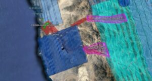
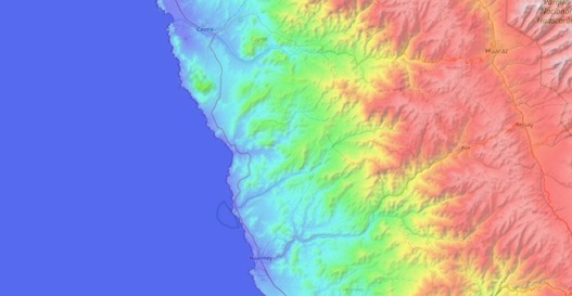
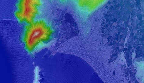
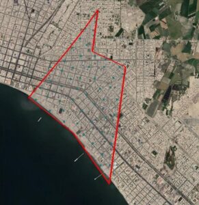
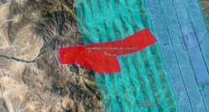
Casma and Huarmey topographic studies.

We are advancing at a good pace in the Topography works for the project:

“Riverside defenses of the Casma and Huarmey rivers”.

Acero Estudio LATAM, in Peru, provides field and cabinet services for the development of this project included in the Comprehensive Plan for Reconstruction with Changes (PIRCC) to restore all the physical infrastructure damaged and destroyed by the El Niño Coastal Phenomenon in 13 regions of the country: Áncash, Arequipa, Ayacucho, Cajamarca, Huancavelica, Ica, Junín, La Libertad, Lambayeque, Lima, Loreto, Piura and Tumbes.

Our participation in this project consists of the topographical survey and preparation of the digital terrain model of the area in which the actions of this project are carried out in the preparation of topographic plans and records and the generation of volumetric reports on earthworks and civil works. . We also participate in meetings to reconcile the distance measurements of haulage routes and the volume of production of various materials.

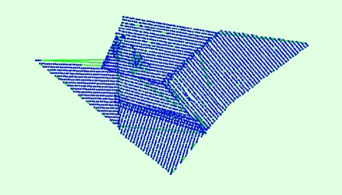
Specific topographic surveys have been carried out to represent the terrain and the various existing elements contained in the digital model at different scales, such as bridges, intakes and other structures using different technologies, total station, GPS, drones, Lidar, echo sounder and level.

Among others, we use PIX4Dmatic software, state-of-the-art photogrammetry software for terrestrial, large-scale and corridor mapping.

We thank TYPSA for the trust placed in our team.
 

https://rioscasmayhuarmey.com.pe/proyecto.html

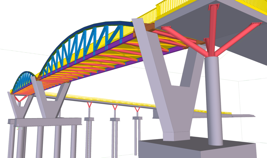
Tekla Structures flexibility, precision and efficiency

Tekla software offers high value solutions in the engineering industry focused on structural design, manufacturing and assembly, which guarantee the constructability of projects and the creation of highly detailed models.

The applied technology allows contractors to manage risk and plan the construction process accurately by creating safer structural models, where the analysis of their data allows informed decisions to be made at all stages of the project and minimizes uncertainties. .

Currently, efficient collaboration and communication between stakeholders, as well as interoperability between the different design and calculation software in the industry, are crucial for the success of any project, especially if it is framed in BIM work methodologies. .

Tekla software is a specific response to an area of ​​the industry that demands highly developed structural information models, handling data with greater accuracy and more precise calculations.

Acero Estudio has extensive experience in the use of this tool as a result of the practice and continuous training of our staff.

Lacramarca topographic studies.

We are advancing at a good pace in the works of the Topography Study for the project:

“Riverside defenses of the Lacramarca river”.

From Acero Estudio LATAM, in Peru, we provide field and cabinet services for the development of this project included in the Comprehensive Plan for Reconstruction with Changes (PIRCC) to restore all the physical infrastructure damaged and destroyed by the El Niño Costero Phenomenon in 13 regions of the country: Áncash, Arequipa, Ayacucho, Cajamarca, Huancavelica, Ica, Junín, La Libertad, Lambayeque, Lima, Loreto, Piura and Tumbes.

Our participation in this project consists of the topographical survey and preparation of the digital terrain model of the area in which the actions of this project are carried out in the preparation of topographical plans and records, as well as generating the volumetric reports on earthworks and civil works. . We also participate in meetings to reconcile the distance measurements of haulage routes and the volume of production of various materials.

Specific topographic surveys have been carried out to represent the terrain and the various existing elements contained in the digital model at different scales, such as bridges, intakes and other structures using different technologies, total station, GPS, drones, Lidar, echo sounder and level.

Among others, we use PIX4Dmatic software, state-of-the-art photogrammetry software for terrestrial, large-scale and corridor mapping.

We thank ARTIFICIAL for the trust placed in our team.


Types of projects suitable for 3D scanning

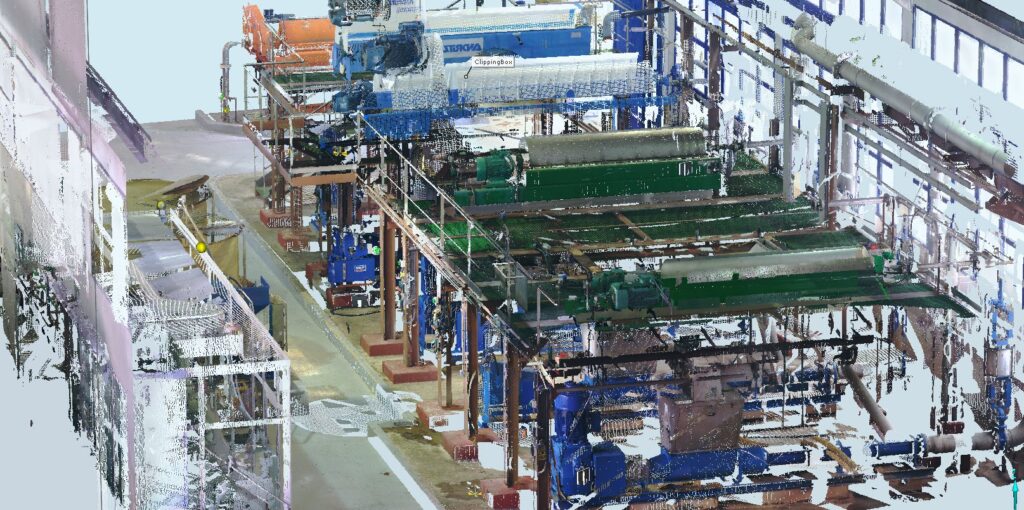
This means of data capture is transforming work methods and simplifying all processes as it offers great advantages derived from its use. At Acero Estudio we are specialized in scanning and modeling buildings, railway lines and industrial plants among other.

This technology is useful in all kinds of scenarios. In any environment it is a valid tool, although a priori it is not considered the tool to use.

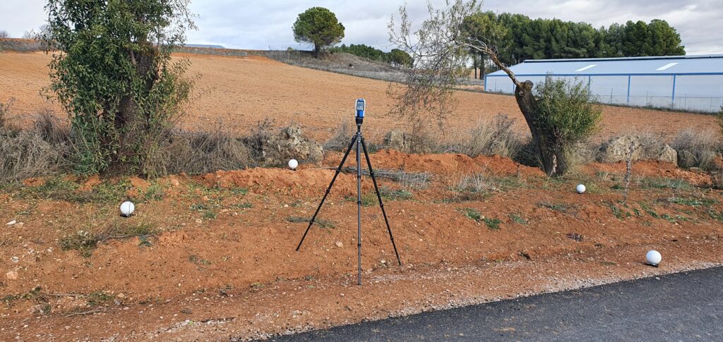
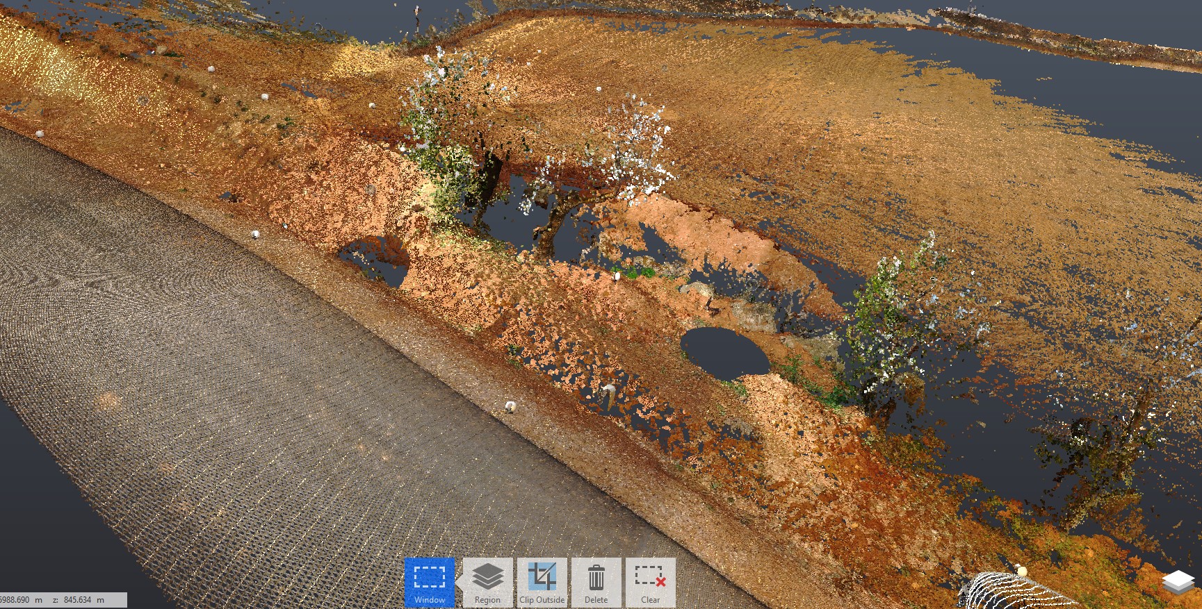
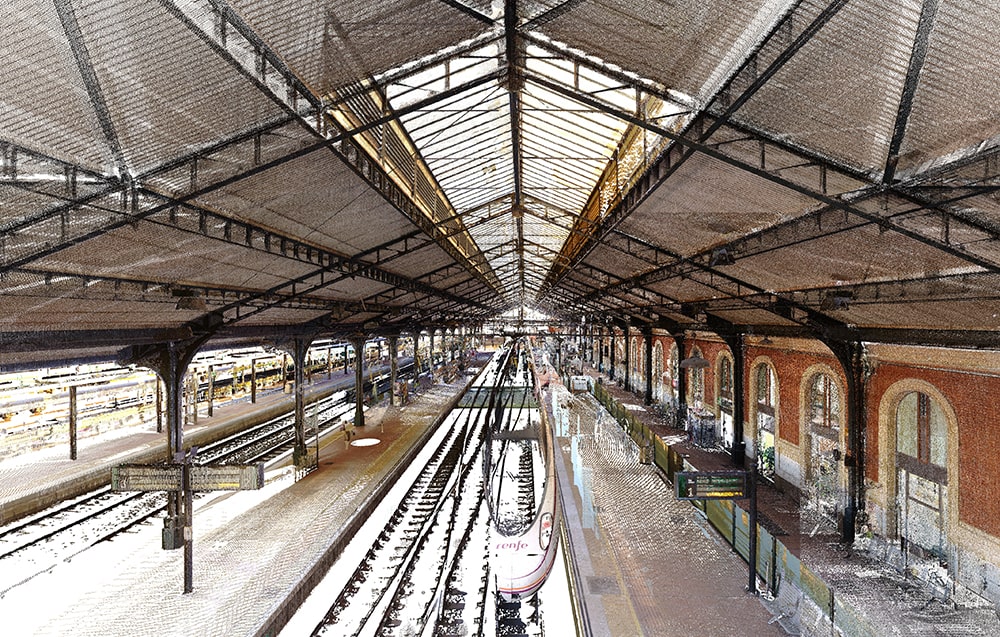
Today we show you a 3D laser scan of several plots in a rustic setting. With the help of spheres, which we have already told you about in another article, the complete scenario of the area to be studied was captured.

We leave you a photo so you can see the final result.

Image quality in drones

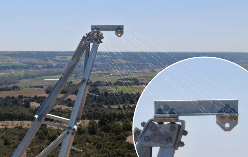
The effectiveness of drones in taking images is indisputable, for example, in wind farm inspections they have a great advantage since they reduce time and costs, and prevent operators from having to access their high-rise facilities.

But today we want to talk to you about the quality of the cameras that drones incorporate, capturing images at height has taken a giant step forward thanks to the use of these small devices.

When purchasing a drone, you must take into account the camera you are going to choose in the event that you opt for one with an integrated camera or one in which you can install your own camera and we must not forget that image stabilization is one of the key aspects for a correct recording or photography.

At Acero Estudio we have a fleet of Drones with 24-48 mm Optical Zoom, 48 MP Super Resolution photos, FHD Video with 4× Zoom to offer you the best service on the market since we have professionals with extensive experience in the audiovisual sector. We not only offer data collection but also the making of subsequent videos with all the post-production work that needs to be incorporated.

With all the photos and videos, and thanks to the zoom of the high-quality cameras that our drones have, they will be able to detect defects and damage at the moment, allowing solutions as soon as possible.

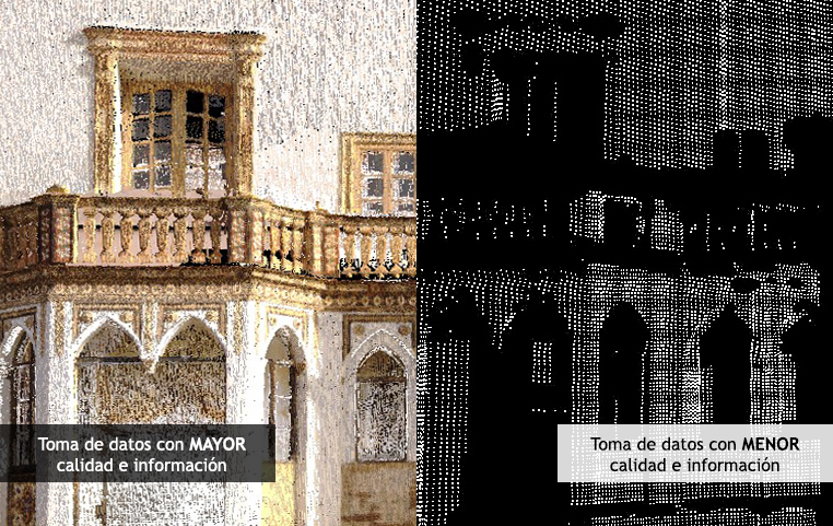
Not all 3D laser scans are created equal

When performing a 3D laser scan, we have to take into account different parameters such as the density of points and the precision that this technology gives us. We always recommend scanning the right way for each project.

From our experience, we recommend analyzing the need for the result and its future use to determine the characteristics to use in the data collection process from the beginning.

Sometimes the cost is a very determining factor and the order is made without knowing in advance the characteristics of the process and the result obtained. This influences the optimization of the result, being able to obtain a product with requirements lower than expected.

Fortunately, to date, we have not seen ourselves in that situation since we try to be, above all, professionals and advise the client regarding the requirements of each job, but we have witnessed the completion of some jobs that, after a of data by another provider, does not offer the necessary information for scanning buildings, structures, facilities, works or other types of scenarios where the information obtained is insufficient for the subsequent process due to lack of precision and information density.

That is when we reflected and came to the conclusion that although the cost of our offer could be higher than other providers, in reality we were not offering the same.

Always bet on quality!

Digital twin

A digital twin is a virtual replica of an infrastructure or building that allows you to simulate its behavior and predict needs in real time.

The union of the physical and virtual worlds through digital twins enables an exhaustive analysis of the information, something that, combined with ‘big data’ solutions, the Internet of Things and artificial intelligence, allows rigorous control of the systems to avoid problems, prevent downtimes and plan future scenarios through simulations.

When a company builds a digital replica of its infrastructures, the environments in which it operates, and the systems that produce them, it can predict virtually everything that will happen in the physical world. For technicians, digital twins are very useful because, by having a detailed history of the previous model, they can correct errors and create new, more reliable versions.

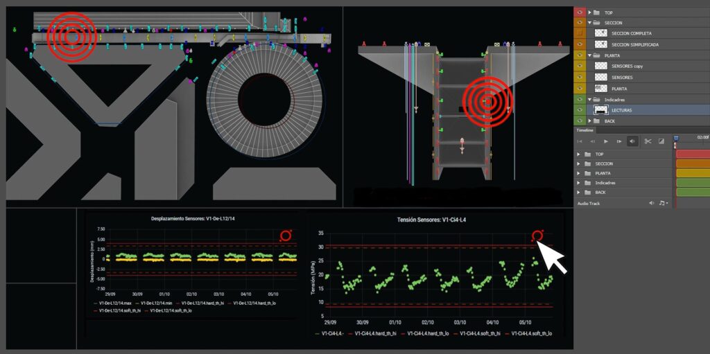
At Acero Estudio we integrate this technology into our services so that your company gets the most out of it. We offer 3D scanning of the current facilities, the creation of the BIM model from this data and the creation of the digital twin integrating, among other elements, sensors and specific programming to obtain real-time data from the asset and reproduce it in the digital model. so that it can be viewed by all the agents involved according to their competencies.

This digital twin is a single database that, in addition to sharing this information in real time with those responsible for operations, allows the different agents to collaborate and make automatic or generated alerts for a specific case. Through this tool generated by Acero Estudio, the agents involved can also carry out analyzes and predict the behavior of the asset, generating very valuable information for future decision-making regarding this asset.

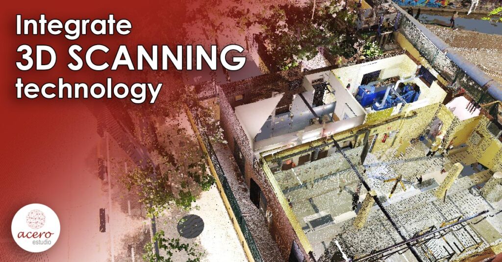
Integrate 3D scanning technology

3D Scanning

The size of the global 3D scanning market was valued at over US$5 billion in 2020, and was predicted to grow 8.4% annually through 2025 according to Grand View Research.

Behind this growth, we can deduce that the rate of adoption has been increasing. A growing number of companies have realized the benefits of investing in 3D scanning technologies, whether to improve product development and design, for quality control applications, reverse engineering, prototyping, and more.

But the really important thing is how to integrate this technology into your business.

It all starts with the design, making sketches and models, which will then be shaped using a CAD model to build the first prototype. This is where 3D scanning technology comes into play. However, it is important to ask yourself when should a company think about integrating 3D scanning into its activity, since it is not always the best idea a priori.

It is important for companies to incorporate 3D scanners from the design stage to provide technical support throughout the product lifecycle.

The application is completely transversal, in almost all types of productive business and industry this technology has a place.

3D laser scanners can play an important role in product development and design, quality control, trial batch production, and intelligent manufacturing. Once the function that is going to be given to the technology and the type of applications to which it is going to be used is clear, it is necessary to take into account a series of important points such as: stability, efficiency, speed, precision of scanning and profitability.

3D Scanning example

This technology is applied in almost all sectors that we can imagine

3D digital models are critical front-end data requirements.

It is essential that, when investing in a new technology, we take into account the most common mistakes that can prevent them from being made in the future. Perhaps, two typical errors are usually the measurement time and the cost of a 3D scan. Novice users of this technology think that when scanning a 3D object, this geometry can be easily modified. This reverse engineering process is not an immediate process and requires some experience to obtain a quality scan.

Early understanding and use of 3D scanning technology will bring great value and benefits. It’s a really cool thing to “love and like 3D scanning technology.”

We are Aceroestudio: Laser 3D Scanning experts

Our multidisciplinary team is composed of internationally renowned professionals with proven professional track record. For many years we have been participating in large projects in the 5 continents: subway lines, airports, dams, energy, building, installations, civil works, etc.

All this profesional background let us to address each project and each client with a wide variety of solutions getting a high level of loyalty and recurrence.

>> SEE WHAT WE CAN DO FOR YOUR COMPANY

Contact us if you need more information

Drop files here or
Max. file size: 16 MB.
    Aceptación(Required)

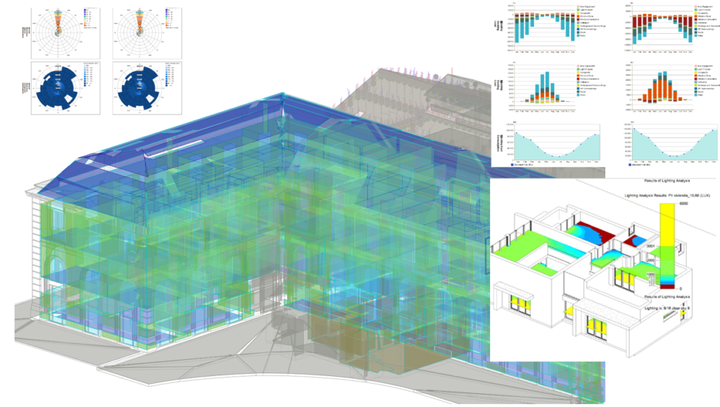
    Energy and environment analysis using BIM technology.

    Environmentalists have sounded the warning bells, we have no choice but to make our buildings energy efficient and environmentally friendly.

    The biggest advantage of using BIM is that it takes into account your day-to-day experience to help you change habits, thus allowing you to make the necessary adjustments to improve the efficiency of buildings.

    Companies that offer BIM services can play a vital role in helping architects create energy efficient buildings with a low carbon footprint.

    More efficient facilities management

    BIM encompasses the entire lifespan of an asset unlike other traditional building systems.

    This means that BIM modeling service providers support building owner/operators at all times and help them manage their facilities more efficiently.

    Benefits of energy performance analysis by BIM

    Evaluate the performance of the proposed structure
    Companies that provide BIM services employ a process that uses consistent and coordinated information to help all stakeholders (architects, engineers, contractors, and building owners) preview the projected construction once it has been executed.

    Improvement of the energy efficiency of the structure

    BIM technology provides building owners with energy efficiency suggestions and an overall model for the building’s conceptual energy use. This helps improve efficiency in new designs as well as renovation and modernization projects.

    Importance of doing energy analysis:

    Studies have shown that energy analysis using BIM models can help you save nearly twenty-five percent on energy use in new buildings.

    The potential for energy savings is even greater for retrofit or renovation projects, as these existing buildings never had an energy analysis system.

    You can use these whole building energy analyzes to accurately calculate the maximum possible reductions in energy consumption for a proposed/existing structure.

    More flexibility in 3D laser scanning

    When capturing the environment using a 3D laser scanner, it often makes sense to combine terrestrial laser scanners with handheld 3D scanners, for example to capture all the important details in the tightest or most intricate areas. However, when using different systems, there is a downside to this as there is a lot of equipment to carry and often limited space at the scan site to place target marks.

    This is why we want to share with you a very interesting tool when it comes to carrying out any type of scanning, the spheres. This set of spheres consists of six units with a diameter of 145 mm and offers us a great solution when making our scans.

    The use of these spheres helps us to register and align small areas, as well as to combine the measurement results of different types of scanners. In turn, thanks to the small size of the case in which they are transported, the set of spheres requires little storage space and can be carried comfortably, considerably facilitating the development of your scan.

    At Acero Estudio we take advantage of all the advantages that this tool brings and the results are unbeatable.