Agriculture from the air

drones used in farming

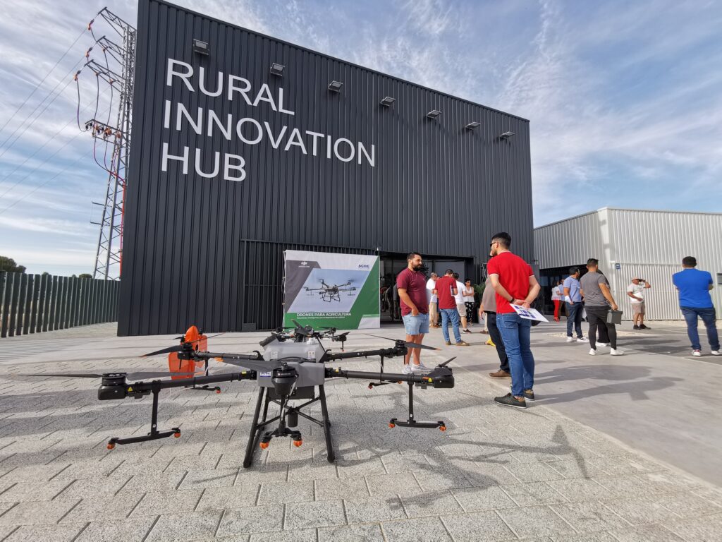
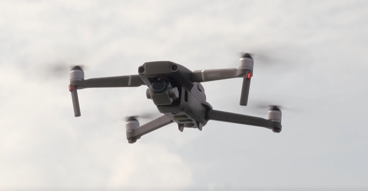
We have had the opportunity to participate in the Conference “Agriculture from the air: multidisciplinary data and drone spraying” at Barrax Rural Innovation HUB held on June 8 and organized by Acre.

An event that seeks to promote innovation in all its forms, digital transformation and rural agricultural development through the transmission of scientific and empirical information, as well as with field demonstrations of the potential of new market technologies.

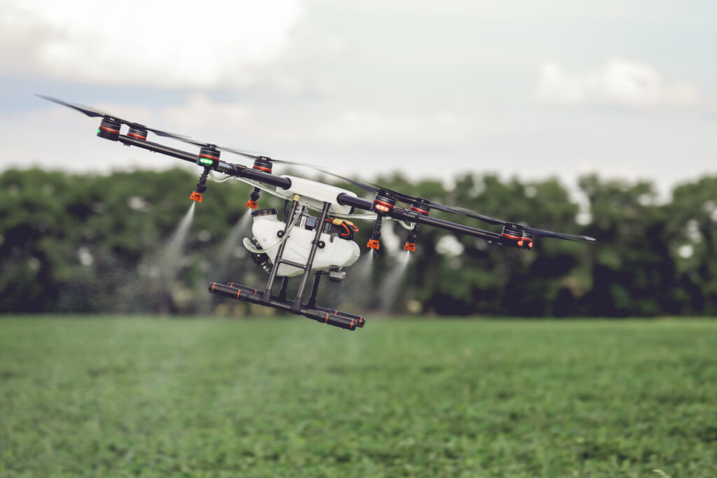
The topics discussed generated interesting discussions regarding the opportunities and, sometimes, limitations that current legislation can pose when drones are used to spray agricultural fields. It is inevitable that the technology moves faster than the laws for its application, but it is There is no doubt that the greater the demand, these processes are more agile.

However, there is great potential and fewer drawbacks in collecting and processing accurate aerial data for soil and drainage analysis of crops, through which the health status can be monitored and their yield predicted.

Remember that Acero Estudio, a company specialized in solutions to improve your crops, risk areas and other advantages for agriculture, provides various services dedicated to reducing construction, engineering or architectural risks such as:

Contact us and request a quote for our services, we are here to assist you.

Drones, transversal tools beyond the AEC sector

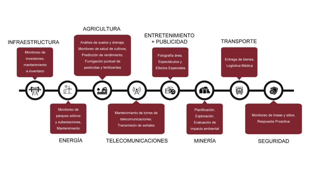
drone applications

The technological advances of drones make their use multidisciplinary.

Today, its integrated technology has allowed the capture of valuable data through images, videos, thermal information and other data, but today its applications are completely transversal, also allowing the possibility of offering other services, ranging from generating statistical information in time real to being vehicles capable of spraying chemicals on crop fields.

Drones are becoming more accessible every day, however their capacity and applications are progressively increasing. Despite the possible limitations of these tools, it is imminent that carrying out tasks with the use of conventional methods can be expensive, dangerous and sometimes simply impossible when it comes to accessing complex areas in services such as construction monitoring or photogrammetry with drones.

There are sectors where drones have a greater impact, but their presence is increasing in all sectors. Below we detail some of those applications.

Acero Estudio is passionate about innovation. Our team is prepared for great challenges. Finding the “how to do it better” is always our goal, based on curiosity and experience we look for efficient solutions and seek to optimize resources when approaching a project. Ask us about our services and scope, you will be surprised by all the solutions that our fleet of drones can offer.

Remember that Acero Estudio, a company specialized in drones, provides various services dedicated to reducing construction, engineering or architectural risks such as:

Contact us and request a quote for our services, we are here to assist you.

Conceptual study for the improvement of pedestrian accessibility in metropolitan station

estudio conceptual para restitucion accesibilidad metropolitano de lima

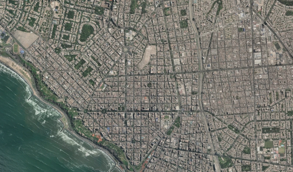
The Acero Estudio team in Peru carried out the geodesy work, drone flight and restitution of the area planned for Pedestrian Accessibility to and from the Metropolitan Stations, Lima.

Given the current global pandemic situation due to COVID-19, these tasks were all carried out under preventive measures and medical examinations.

To better understand the work carried out by our team in the project area, they began with the placement of Geodetic Points (one at each station) linked to the IGN coordinate system. Their measurement using dual-frequency differential GPS. Next, the necessary support points were located for the subsequent restoration of the drone flight. These support points were marked with an X-shaped template and paint, and measured with GPS in RTK mode.

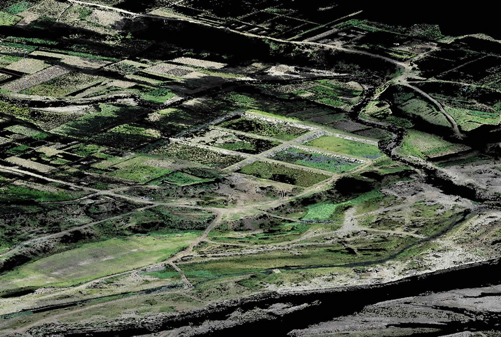
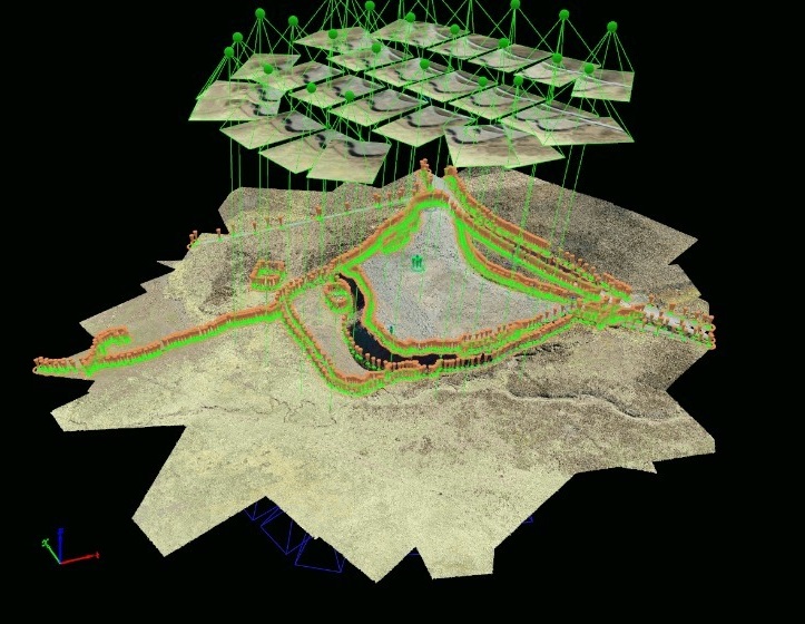
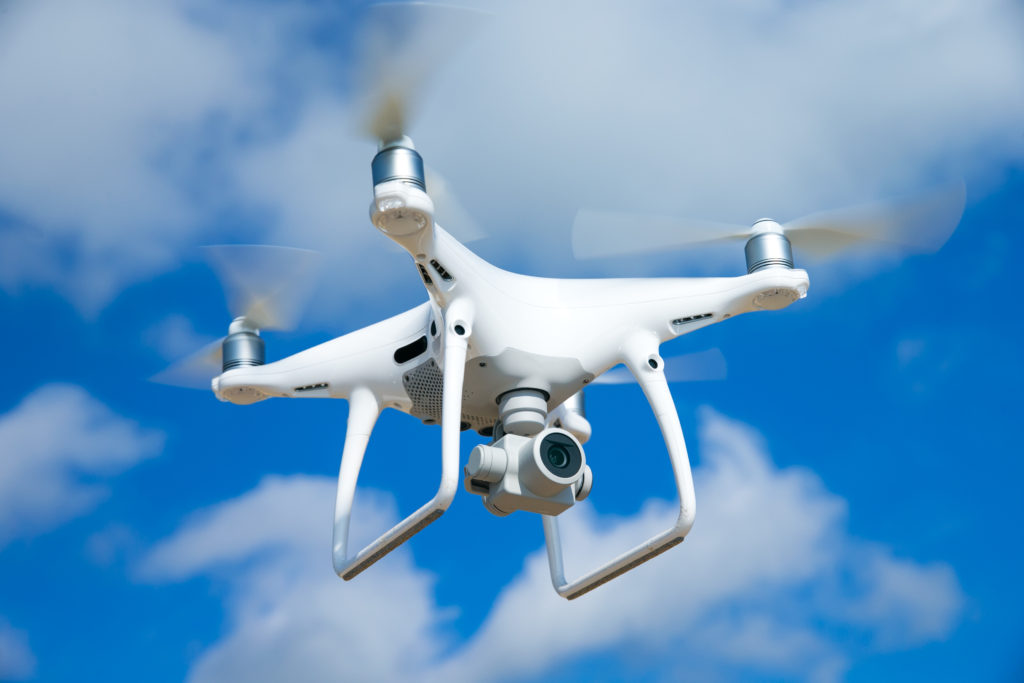
The drone flight of the 33 stations was carried out at an appropriate height taking into account the height of the existing buildings and elements. For this, a DJI Phantom 4 Pro drone with a 20 Mpx camera was used. Once the photogrammetric images were obtained, they were processed and the point cloud and orthophoto of each station was created. With the orthophoto and the point cloud, the MDT was processed and subsequently the restitution of the environment of each station.

We thank our client CPS for all the trust placed in our team and the work of coordinating and directing the work carried out.

Remember that at Acero Estudio we are specialists in photogrammetry services with drones and LIDAR, both services performed with drones and very useful for engineering or architectural projects.

Take into account that Acero Estudio provides services dedicated to reducing construction risks such as:

Contact us and request a quote for our services, we are here to assist you.

The drone, our great ally in aerial photogrammetry

dron

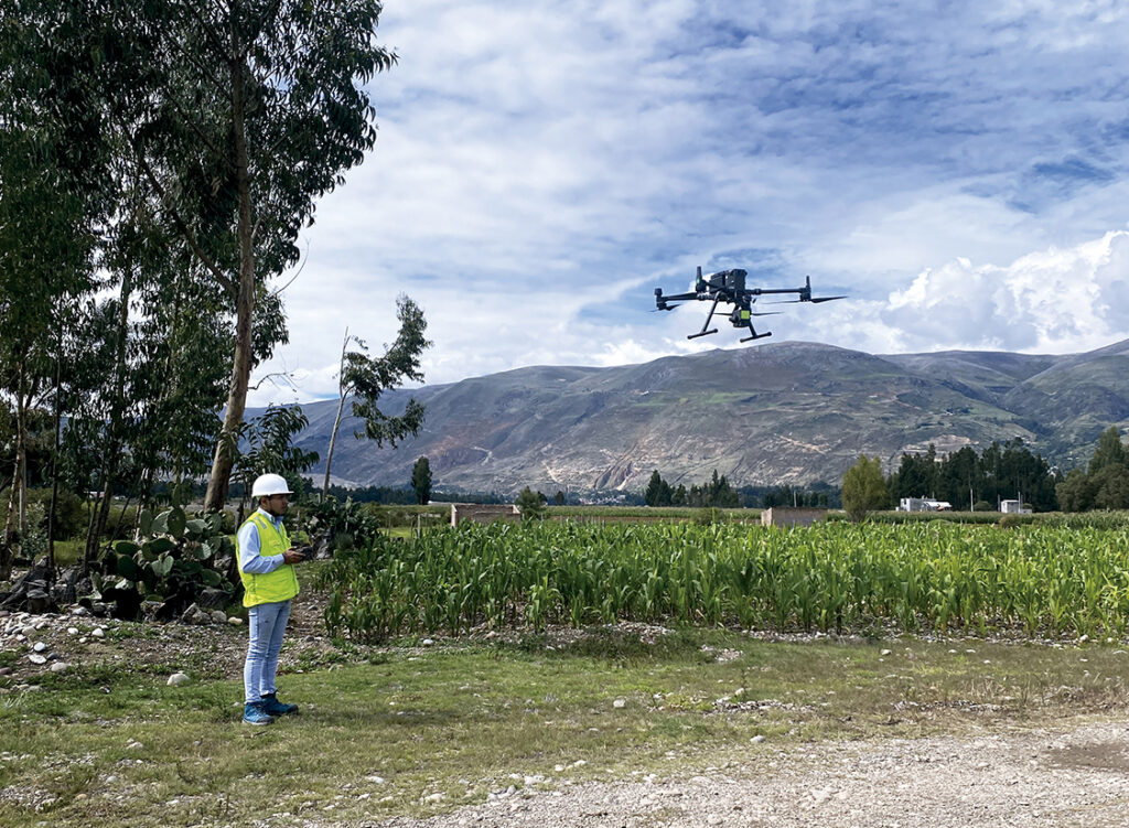
The photogrammetric flight with a drone is one of the most used techniques currently in inspections and monitoring of works and at Acero Estudio we offer this type of service

Thanks to photogrammetric drone flight, we convert two-dimensional data into three-dimensional information, since it allows us to calculate the dimensions and positions of objects in space from measurements made on aerial photographs.

Our drone fleet is equipped with GPS technology and follow programmed flight routes, performing very precise and stable flights, ideal for achieving optimal results and great advantages. The use of these has increased the possibilities of exploitation of images, allowing the automatic generation of height models, ortho images and stereo-images as well as the creation and visualization of three-dimensional models.

Furthermore, with the use of this technology, a faster and more personalized service is achieved for each project. Photogrammetry with drones has made it possible to speed up processes, reduce costs, reduce operational risks and provide high-quality images.

For the restitution of 3D images with drones to be accurate, in addition to great knowledge of the terrain, we need correct flight planning, since this is where we find the main difficulty of the mission. The drone flight must be stable and constant to obtain elements of the front, rear and side images, that is, the photographs captured must have a high amount of overlap between images, approximately 80% in each photograph.

As we can see, drones have become our great ally in this sector. It is vitally important that the flight is carried out by professional experts such as those at Acero Estudio, specialists in photogrammetry, to obtain the best results! Contact us to resolve any questions or to collaborate with us and take a look at Drones to learn more.

Learn more about Acero Estudio services:

Take into account that Acero Estudio provides various services dedicated to reducing construction risks such as:

Contact us and request a quote for our services, we are here to assist you.

Topography and Drones, A Perfect Combination

retocada

In the current era, marked by technological advancements and a growing demand for efficiency across multiple sectors, the combination of surveying services and drones has emerged as a perfect alliance. This synergistic collaboration between surveying and drone technology has unlocked a wide range of applications and opportunities that are radically transforming the way we approach supervision, construction, and planning projects.

The use of drones in surveying is extremely versatile, and while their applications are varied, they particularly excel in construction and facility monitoring. At Acero Estudio, a company specialized in surveying, we have recognized the potential of this combination and have successfully implemented it in numerous projects.

A critical aspect in the preparation of any project, especially in the realm of large-scale public and civil works, is the meticulous study of the environment where the future action will take place. Precision and comprehensive understanding of terrain conditions are essential to ensure construction success and to avoid potential complications or delays in the process. This is where drones make their triumphant entrance, allowing for quick and precise detailed inspections and visual detection of potential obstacles.

The speed and efficiency of drones in this context are unparalleled. Before the era of drones, collecting topographic data involved lengthy manual procedures and costly ground operations. However, with the deployment of drones equipped with advanced sensors, surveying has become much more accessible and efficient. Drones can fly over extensive areas in a matter of minutes and provide detailed data ranging from terrain topography to the identification of key features such as buildings, roads, or vegetation.

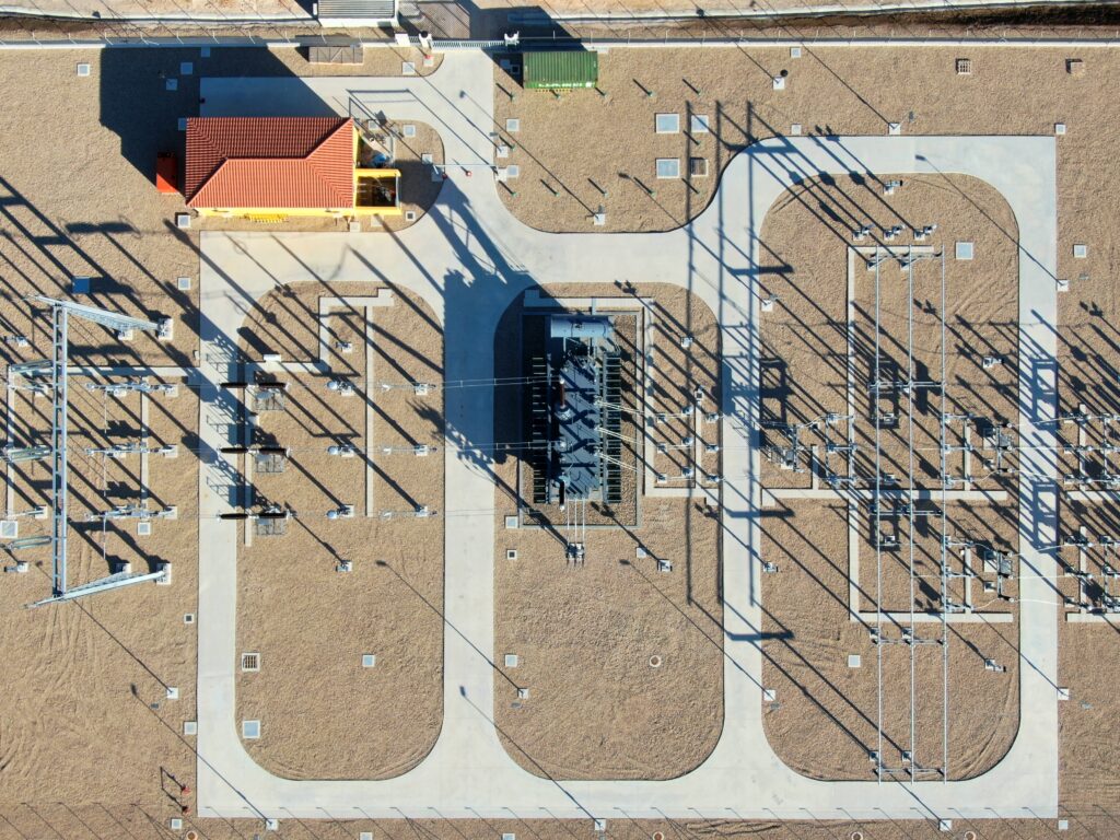
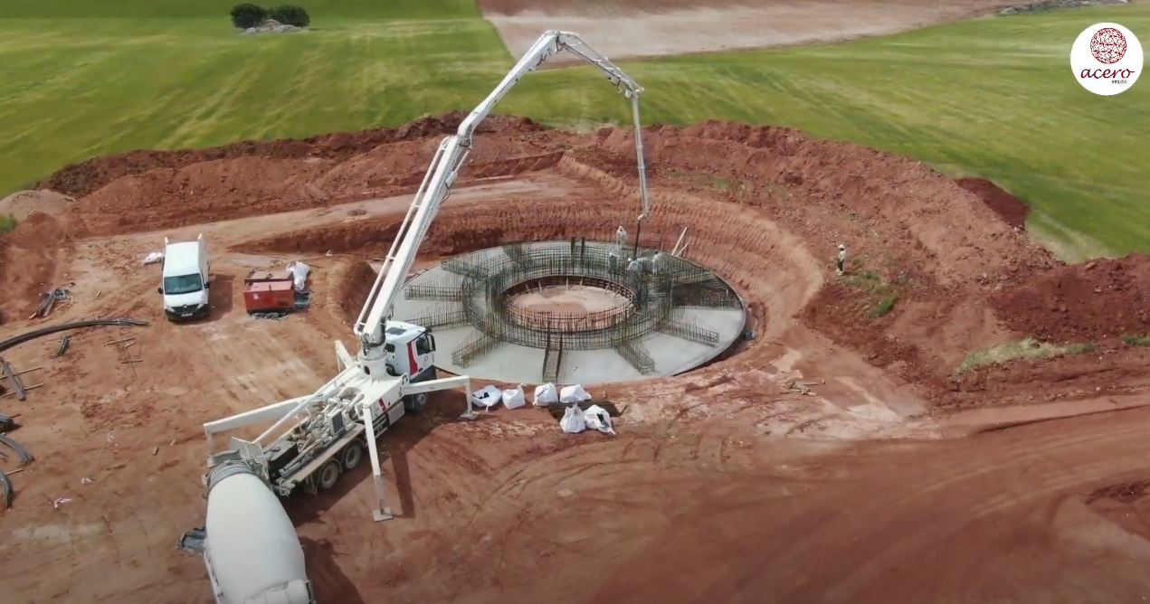
One of the most notable benefits of using drones in surveying is their ability to capture high-quality images and videos. These images and recordings offer a precise visual representation of the current state of a work in progress, greatly facilitating the presentation and analysis of project execution progress. There is no longer a need to rely solely on abstract data or written reports; drones provide a comprehensive and detailed real-time view of the work.

This visual aspect is particularly useful for communication and collaboration in construction projects. Images and videos captured by drones can be easily shared with all stakeholders, from engineers and architects to clients and regulatory authorities. This transparency and clarity in data presentation can help avoid misunderstandings, clarify doubts, and streamline decision-making, thereby contributing to keeping the project within the established schedule and budget.

Furthermore, the use of drones in surveying extends beyond monitoring ongoing works. They are also employed in the initial planning stages of projects, allowing for a detailed assessment of terrain conditions before the first stone is laid. This is essential for identifying potential geographical or environmental challenges that may arise during construction. The ability to anticipate and address these challenges from the outset can prevent costly setbacks and design modifications later in the process.

Another significant advantage of drones in surveying is their ability to conduct periodic inspections and track project progress. Scheduled flight repetitions throughout the project allow for close monitoring of construction evolution and detection of any deviations from the original plan. This real-time tracking capability enables more effective resource management and a quick response to any issues that may arise during construction.

The integration of surveying and drones in the construction industry has proven to be a winning combination. The precision, efficiency, and ability to present detailed visual data offer invaluable value in the planning, monitoring, and execution of construction projects. In summary, the synergy between surveying and drones is paving the way for a more efficient and accurate future in the construction industry, benefiting all parties involved and ultimately the quality of the infrastructures we build.

Contact us to learn more about our surveying services as well as drone photogrammetry. We are at your service.

Aerial surveying is getting smarter

Drone

Surveyors and GIS professionals have very high standards when it comes to their tools and their craft. Therefore, it is not surprising that many are turning to drones when requesting a surveying, mapping and 3D modeling service. Drones achieve results that meet surveying accuracy standards and, compared to traditional surveying techniques, dramatically reduce the time, cost and effort required.

Drone surveying is more complicated than taking a few photos from above. This requires several steps, from the preparation of ground control points, through mission planning, to the processing of the images that are captured with the topography software.

Within drone surveying, one technique that has been successful in 3D modeling is the use of oblique drone photogrammetry, in which images are captured with multiple lenses that are mounted together in an array with fixed axis angles. The resulting images reveal details that are sometimes lost when capturing only vertical photographs.

Using this cutting-edge technology, surveyors have the ultimate surveying solution at their disposal, in terms of precision and efficiency. Thanks to the intelligent oblique capture feature, surveyors can now capture and create 3D models of their targets more effectively than ever.

Oblique photography has many advantages. While a vertical angle can help show the location of features such as buildings, streets or open spaces, oblique aerial photos are better at giving a perspective of the appearance of features rising from the ground such as buildings, topography, foliage, etc. in relation to the ground and the horizon.

Other advantages are:

  • Reveals details that might have been obstructed in the vertical view.
  • Facilitates accurate determination of feature elevation.
  • Captures much more relative height data.
  • The position and relative height information obtained from each data set can be compared, contrasted and pooled to obtain relative height information between elements in the target area, producing a map of both position and height data, which It can be represented as a 3D map of the studied area.

However, there are also disadvantages. Due to the number of lenses, the equipment can be very heavy and expensive. A heavier payload means shorter flight times and more time spent changing the drone’s batteries, especially on large-scale surveying missions. On the other hand, if you try to do oblique photogrammetry or 3D modeling with a single camera, many flights are needed, which takes significantly more time.

With the continued increase in the use of drones in surveying and construction, there is a constant need to make their use easier and more economical, in terms of time and cost. Aerial surveying has become smarter and oblique shooting is one such innovation that covers both aspects.

Contact Acero Estudio, a company specialized in aerial photogrammetry; we are at your service.